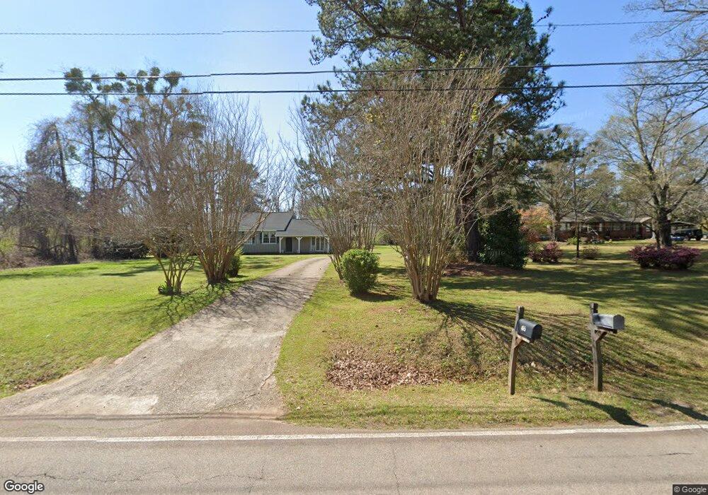
465 Youngs Mill Rd Lagrange, GA 30241
Estimated Value: $211,000 - $257,000
3
Beds
2
Baths
2,176
Sq Ft
$112/Sq Ft
Est. Value
About This Home
This home is located at 465 Youngs Mill Rd, Lagrange, GA 30241 and is currently estimated at $242,981, approximately $111 per square foot. 465 Youngs Mill Rd is a home located in Troup County with nearby schools including Franklin Forest Elementary School, Hollis Hand Elementary School, and Ethel W. Kight Elementary School.
Ownership History
Date
Name
Owned For
Owner Type
Purchase Details
Closed on
Aug 6, 2014
Sold by
Yarbrough Ronnie Steve
Bought by
Yarbrough Jackie Katter
Current Estimated Value
Purchase Details
Closed on
Dec 6, 1985
Sold by
Montgomery Cynitha Y and Montgomery Robert
Bought by
Yarbrough Ronnie S and Yarbrough Jackie K
Purchase Details
Closed on
Feb 5, 1982
Sold by
Smith William A and Smith Betty H
Bought by
Montgomery Cynitha Y and Montgomery Robert
Purchase Details
Closed on
Aug 24, 1979
Sold by
Smith William A Int
Bought by
Smith William A and Smith Betty H
Purchase Details
Closed on
Jan 1, 1972
Sold by
Fling Daniel Earl and Fling Emmett
Bought by
Smith William A Int
Purchase Details
Closed on
Jan 1, 1941
Sold by
Phillips Cosby S and Phillips Vivian C
Bought by
Fling Daniel Earl and Fling Emmett
Create a Home Valuation Report for This Property
The Home Valuation Report is an in-depth analysis detailing your home's value as well as a comparison with similar homes in the area
Purchase History
| Date | Buyer | Sale Price | Title Company |
|---|---|---|---|
| Yarbrough Jackie Katter | -- | -- | |
| Yarbrough Ronnie S | $85,000 | -- | |
| Montgomery Cynitha Y | $75,000 | -- | |
| Smith William A | -- | -- | |
| Smith William A Int | $17,000 | -- | |
| Fling Daniel Earl | -- | -- |
Source: Public Records
Tax History
| Year | Tax Paid | Tax Assessment Tax Assessment Total Assessment is a certain percentage of the fair market value that is determined by local assessors to be the total taxable value of land and additions on the property. | Land | Improvement |
|---|---|---|---|---|
| 2025 | $2,072 | $75,960 | $8,040 | $67,920 |
| 2024 | $1,898 | $69,600 | $8,040 | $61,560 |
| 2023 | $1,711 | $62,720 | $8,040 | $54,680 |
| 2022 | $1,678 | $60,120 | $8,040 | $52,080 |
| 2021 | $1,218 | $40,380 | $8,040 | $32,340 |
| 2020 | $1,218 | $40,380 | $8,040 | $32,340 |
| 2019 | $1,153 | $38,220 | $7,860 | $30,360 |
| 2018 | $1,153 | $38,220 | $7,860 | $30,360 |
| 2017 | $1,153 | $38,220 | $7,860 | $30,360 |
| 2016 | $1,138 | $37,739 | $7,860 | $29,879 |
| 2015 | $1,140 | $37,739 | $7,860 | $29,879 |
| 2014 | $1,035 | $36,166 | $7,860 | $28,306 |
| 2013 | -- | $38,025 | $7,860 | $30,165 |
Source: Public Records
Map
Nearby Homes
- 509 Youngs Mill Rd
- 793 Celebration Blvd
- 105 Ridgefield Dr
- 112 Celebration Blvd
- 107 N Barnard Ave
- 101 Sarah Ln
- 110 Lenox Cir
- 0 N Barnard Ave
- 227 River Meadow Dr
- 412 Sweetwood Ct Unit A36
- 210 Hearthstone Dr
- 129 Celebration Blvd
- 109 Sarah Ln
- 115 Clara Jean Ct
- 304 Bridgette Blvd
- 517 Tradition Place
- 124 Woodridge Cir
- 519 Tradition Place
- 212 Cleveland Dr
- 204 Cleveland Dr
- 485 Youngs Mill Rd
- 482 Youngs Mill Rd
- 499 Youngs Mill Rd
- 0 Hammet Rd
- 32 Hammett Rd
- 0 Hammett Rd Unit 8257462
- 0 Hammett Rd Unit 3007352
- 0 Hammett Rd Unit TR 1 3241324
- 0 Hammett Rd Unit 7109595
- 0 Hammett Rd Unit 24 7612192
- 0 Hammett Rd Unit 8502783
- 10 Hammett Rd
- 420 Youngs Mill Rd
- 523 Youngs Mill Rd
- 412 Youngs Mill Rd
- 60 Hammett Rd
- 334 N Barnard Ave
- 389 Youngs Mill Rd
- 539 Youngs Mill Rd
- 241 N Barnard Ave
Your Personal Tour Guide
Ask me questions while you tour the home.