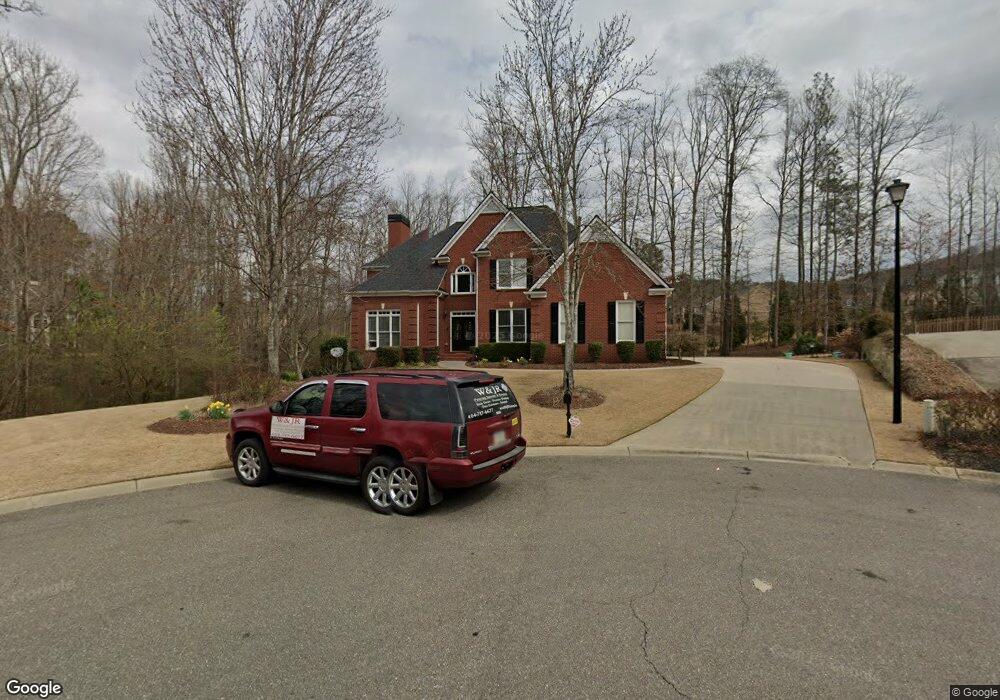
4650 Ashworth Dr Cumming, GA 30040
Estimated Value: $737,000 - $809,000
4
Beds
4
Baths
2,924
Sq Ft
$265/Sq Ft
Est. Value
About This Home
This home is located at 4650 Ashworth Dr, Cumming, GA 30040 and is currently estimated at $774,837, approximately $264 per square foot. 4650 Ashworth Dr is a home located in Forsyth County with nearby schools including Kelly Mill Elementary School, West Forsyth High School, and Milton Montessori School.
Ownership History
Date
Name
Owned For
Owner Type
Purchase Details
Closed on
Apr 8, 2004
Sold by
Sharp Resid Bldrs & Devels Llc
Bought by
Graves Kimberly A and Graves Timothy
Current Estimated Value
Home Financials for this Owner
Home Financials are based on the most recent Mortgage that was taken out on this home.
Original Mortgage
$327,500
Outstanding Balance
$145,690
Interest Rate
4.88%
Mortgage Type
New Conventional
Estimated Equity
$629,147
Create a Home Valuation Report for This Property
The Home Valuation Report is an in-depth analysis detailing your home's value as well as a comparison with similar homes in the area
Home Values in the Area
Average Home Value in this Area
Purchase History
| Date | Buyer | Sale Price | Title Company |
|---|---|---|---|
| Graves Kimberly A | $337,800 | -- |
Source: Public Records
Mortgage History
| Date | Status | Borrower | Loan Amount |
|---|---|---|---|
| Open | Graves Kimberly A | $327,500 |
Source: Public Records
Tax History Compared to Growth
Tax History
| Year | Tax Paid | Tax Assessment Tax Assessment Total Assessment is a certain percentage of the fair market value that is determined by local assessors to be the total taxable value of land and additions on the property. | Land | Improvement |
|---|---|---|---|---|
| 2025 | $5,474 | $300,036 | $60,000 | $240,036 |
| 2024 | $5,474 | $273,984 | $60,000 | $213,984 |
| 2023 | $5,181 | $275,560 | $52,000 | $223,560 |
| 2022 | $5,080 | $179,236 | $34,000 | $145,236 |
| 2021 | $4,415 | $179,236 | $34,000 | $145,236 |
| 2020 | $4,424 | $179,660 | $34,000 | $145,660 |
| 2019 | $4,237 | $170,284 | $34,000 | $136,284 |
| 2018 | $4,169 | $165,984 | $32,000 | $133,984 |
| 2017 | $4,046 | $159,380 | $32,000 | $127,380 |
| 2016 | $3,858 | $150,500 | $26,800 | $123,700 |
| 2015 | $3,865 | $150,500 | $26,800 | $123,700 |
| 2014 | $3,449 | $139,768 | $26,800 | $112,968 |
Source: Public Records
Map
Nearby Homes
- 2910 Bishopstone Way
- 2805 Bishopstone Way
- 2330 Cheatham Creek Ct
- 3560 Rosewicke Dr
- 2735 Kimblewick Ct
- 2620 Laurel Gate Ln
- 2550 Crimson Downs Dr
- 3607 Old Towne Ln
- 2470 Bridle Bridge Trail
- 2425 Barley Crest Pass
- 2405 Boxwalking Ct
- 2520 Barley Downs Cir
- 3826 Stagecoach Ln
- 3725 Downing Dr
- 5130 Laurel Park Ln
- 5315 Keepsake Ct
- 5330 Keepsake Ct
- 4640 Ashworth Dr
- 4660 Ashworth Dr
- 4630 Ashworth Dr
- 4655 Ashworth Dr
- 4645 Ashworth Dr
- 4620 Ashworth Dr
- 4635 Ashworth Dr
- 4580 Park Brooke Ct
- 2125 Kingsey Ct
- 4590 Park Brooke Ct
- 2120 Kingsey Ct
- 4625 Ashworth Dr
- 2375 Saddlebrook Trace
- 2365 Saddle Brook Trace
- 2115 Kingsey Ct
- 2115 Kingsey Ct Unit 44
- 0 Park Brooke Ct
- 4615 Ashworth Dr
- 2340 Saddle Brook Trace
- 2340 Saddlebrook Trace