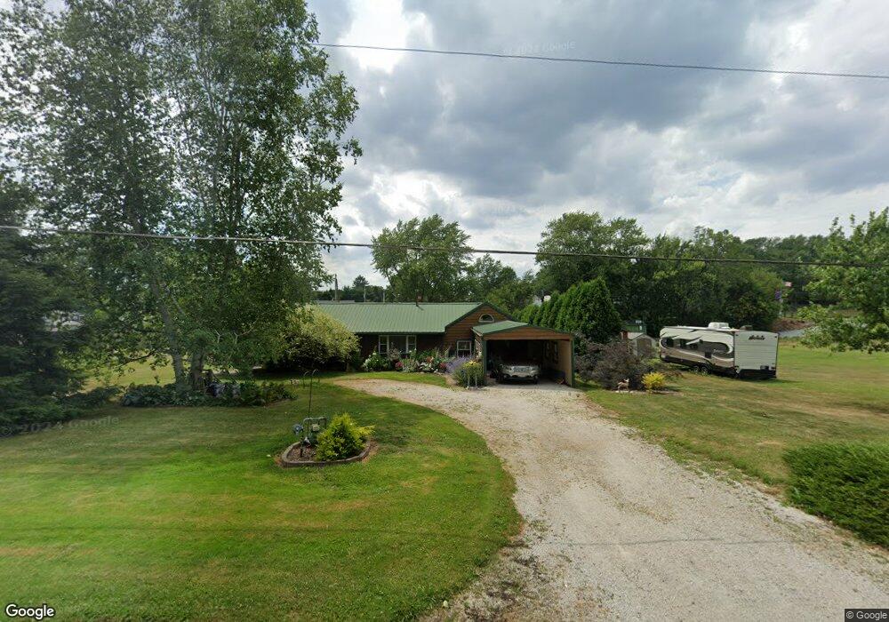
4651 Meese Rd Louisville, OH 44641
Estimated Value: $146,546 - $196,000
2
Beds
2
Baths
1,144
Sq Ft
$148/Sq Ft
Est. Value
About This Home
This home is located at 4651 Meese Rd, Louisville, OH 44641 and is currently estimated at $169,137, approximately $147 per square foot. 4651 Meese Rd is a home located in Stark County with nearby schools including Louisville High School and St. Thomas Aquinas High School & Middle School.
Ownership History
Date
Name
Owned For
Owner Type
Purchase Details
Closed on
Aug 21, 2014
Sold by
Swartzentruber Viivan S
Bought by
Metzger Joseph O and Metzger Patricia L
Current Estimated Value
Purchase Details
Closed on
Aug 10, 2000
Sold by
Swartzentruber Patricia L and Swartzentruber Patricia L
Bought by
Metzger Joseph O and Metzger Patricia L
Create a Home Valuation Report for This Property
The Home Valuation Report is an in-depth analysis detailing your home's value as well as a comparison with similar homes in the area
Home Values in the Area
Average Home Value in this Area
Purchase History
| Date | Buyer | Sale Price | Title Company |
|---|---|---|---|
| Metzger Joseph O | -- | None Available | |
| Metzger Joseph O | -- | -- |
Source: Public Records
Tax History Compared to Growth
Tax History
| Year | Tax Paid | Tax Assessment Tax Assessment Total Assessment is a certain percentage of the fair market value that is determined by local assessors to be the total taxable value of land and additions on the property. | Land | Improvement |
|---|---|---|---|---|
| 2025 | -- | $33,360 | $14,490 | $18,870 |
| 2024 | -- | $33,360 | $14,490 | $18,870 |
| 2023 | $1,412 | $28,990 | $10,260 | $18,730 |
| 2022 | $1,417 | $28,990 | $10,260 | $18,730 |
| 2021 | $1,421 | $28,990 | $10,260 | $18,730 |
| 2020 | $1,207 | $26,010 | $9,240 | $16,770 |
| 2019 | $1,212 | $26,010 | $9,240 | $16,770 |
| 2018 | $1,163 | $26,010 | $9,240 | $16,770 |
| 2017 | $1,190 | $24,450 | $8,650 | $15,800 |
| 2016 | $1,118 | $23,500 | $8,650 | $14,850 |
| 2015 | $1,121 | $23,500 | $8,650 | $14,850 |
| 2014 | $1,084 | $20,800 | $6,830 | $13,970 |
Source: Public Records
Map
Nearby Homes
- 2015 E Main St
- 1812 E Broad St
- 1413 Washington Blvd
- 0 Michigan Blvd
- 2110 Edmar St
- 308 Superior St
- 520 S Silver St
- 728 E Broad St
- 5495 Meese Rd NE
- 910 Crosswyck Cir
- 325 Lincoln Ave
- 8896 Rue Helena St
- 210 E Gorgas St
- 3390 Meese Rd NE
- 204 E Broad St
- 107 E Broad St
- 316 E Reno Dr
- 428 Honeycrisp Dr NE
- 3047 Mcintosh Dr NE
- 432 Honeycrisp Dr NE
- 4625 Meese Rd
- 4625 Meese Rd NE
- 4626 Meese Rd
- 8812 Louisville St NE
- 4672 Meese Rd
- 118 Brookfield St
- 126 Brookfield St
- 4601 Meese Rd
- 8812 Louisville St
- 134 Brookfield St
- 2120 E Main St
- 136 Brookfield St
- 2110 E Main St
- 4574 Meese Rd
- 4575 Meese Rd
- 150 Brookfield St
- 8874 Louisville St
- 4566 Meese Rd NE
- 158 Brookfield St
- 129 Brookfield Ave