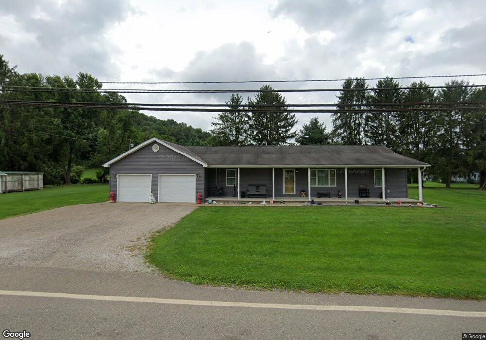
46511 State Route 248 Long Bottom, OH 45743
Estimated Value: $197,000 - $247,000
3
Beds
1
Bath
1,536
Sq Ft
$144/Sq Ft
Est. Value
About This Home
This home is located at 46511 State Route 248, Long Bottom, OH 45743 and is currently estimated at $221,042, approximately $143 per square foot. 46511 State Route 248 is a home with nearby schools including Eastern Elementary School and Eastern High School.
Ownership History
Date
Name
Owned For
Owner Type
Purchase Details
Closed on
Aug 8, 2025
Sold by
Ridenour John L and Ridenour Melanie B
Bought by
Hall Morgan Gwen and Pope Mark A
Current Estimated Value
Home Financials for this Owner
Home Financials are based on the most recent Mortgage that was taken out on this home.
Original Mortgage
$7,000
Outstanding Balance
$7,000
Interest Rate
6.72%
Mortgage Type
New Conventional
Estimated Equity
$214,042
Purchase Details
Closed on
Aug 30, 1999
Bought by
Ridenour Melanie B Ridenour John L
Create a Home Valuation Report for This Property
The Home Valuation Report is an in-depth analysis detailing your home's value as well as a comparison with similar homes in the area
Home Values in the Area
Average Home Value in this Area
Purchase History
| Date | Buyer | Sale Price | Title Company |
|---|---|---|---|
| Hall Morgan Gwen | $200,000 | Bestitle Agency | |
| Ridenour Melanie B Ridenour John L | $15,000 | -- |
Source: Public Records
Mortgage History
| Date | Status | Borrower | Loan Amount |
|---|---|---|---|
| Open | Hall Morgan Gwen | $7,000 | |
| Open | Hall Morgan Gwen | $196,377 |
Source: Public Records
Tax History Compared to Growth
Tax History
| Year | Tax Paid | Tax Assessment Tax Assessment Total Assessment is a certain percentage of the fair market value that is determined by local assessors to be the total taxable value of land and additions on the property. | Land | Improvement |
|---|---|---|---|---|
| 2024 | $1,556 | $48,450 | $5,160 | $43,290 |
| 2023 | $1,556 | $48,450 | $5,160 | $43,290 |
| 2022 | $1,569 | $48,450 | $5,160 | $43,290 |
| 2021 | $1,649 | $48,930 | $5,160 | $43,770 |
| 2020 | $1,649 | $48,930 | $5,160 | $43,770 |
| 2019 | $1,660 | $48,930 | $5,160 | $43,770 |
| 2018 | $1,438 | $43,250 | $3,450 | $39,800 |
| 2017 | $1,438 | $43,250 | $3,450 | $39,800 |
| 2016 | $1,475 | $43,250 | $3,450 | $39,800 |
| 2014 | $1,199 | $36,620 | $2,740 | $33,880 |
| 2013 | $1,199 | $36,620 | $2,740 | $33,880 |
Source: Public Records
Map
Nearby Homes
- 48175 Scout Camp Rd
- 37227 Bashan Rd
- 37080 Skinner Rd
- 43970 Cook Rd
- 43240 Smith-Goeglein
- 43219 Smith Goeglein Dr
- 35975 Flatwoods Rd
- 0 Cook
- 34618 Bashan Rd
- 0 Rocksprings Rd
- 40601 E Shade Rd
- 0 Mount Olive Rd Unit 20799198
- 37355 Rocksprings Rd
- 39834 State Route 7
- 0 Bigley Ridge Rd
- 47065 Morning Star Rd
- 0 Morning Star Rd
- 0 Wills Hill Rd
- 32658 Rose Hill Rd
- 41601 Foxhill Rd
- 46537 State Route 248
- 36340 Allen St
- 36310 Allen St
- 46516 State Route 248
- 46545 State Route 248
- 46540 State Route 248
- 248 Sr
- 36320 New Hope Rd
- 46343 Tr 112 Scout Camp Rd Rd
- 46331 Scout Camp Rd
- 112 E Scout Camp Rd
- 46382 Scout Camp Rd
- 46599 State Route 248
- 46599 Ohio 248
- 46608 State Route 248
- 36222 Allen St
- 36384 New Hope Rd
- 46387 Tr 112 Scout Camp Rd Rd
- 46612 State Route 248
- 36180 Allen St