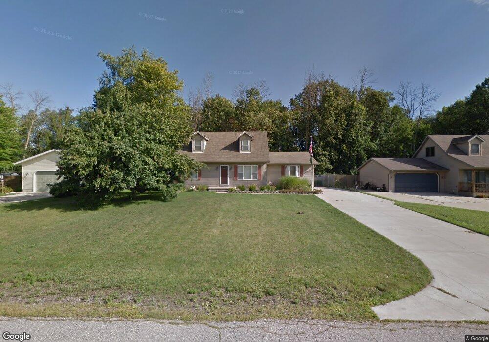
4652 Cloverdale Ln Kimball, MI 48074
Estimated Value: $260,000 - $292,215
3
Beds
2
Baths
1,947
Sq Ft
$142/Sq Ft
Est. Value
About This Home
This home is located at 4652 Cloverdale Ln, Kimball, MI 48074 and is currently estimated at $275,804, approximately $141 per square foot. 4652 Cloverdale Ln is a home located in St. Clair County with nearby schools including Kimball Elementary School, Central Middle School, and Port Huron High School.
Ownership History
Date
Name
Owned For
Owner Type
Purchase Details
Closed on
Feb 22, 2008
Sold by
Walker Bradford A and Walker Sandra E
Bought by
Karkanen William M
Current Estimated Value
Home Financials for this Owner
Home Financials are based on the most recent Mortgage that was taken out on this home.
Original Mortgage
$152,250
Outstanding Balance
$93,238
Interest Rate
5.51%
Mortgage Type
FHA
Estimated Equity
$182,566
Create a Home Valuation Report for This Property
The Home Valuation Report is an in-depth analysis detailing your home's value as well as a comparison with similar homes in the area
Home Values in the Area
Average Home Value in this Area
Purchase History
| Date | Buyer | Sale Price | Title Company |
|---|---|---|---|
| Karkanen William M | $155,000 | Stewart Title Agency Of Mi |
Source: Public Records
Mortgage History
| Date | Status | Borrower | Loan Amount |
|---|---|---|---|
| Open | Karkanen William M | $152,250 |
Source: Public Records
Tax History Compared to Growth
Tax History
| Year | Tax Paid | Tax Assessment Tax Assessment Total Assessment is a certain percentage of the fair market value that is determined by local assessors to be the total taxable value of land and additions on the property. | Land | Improvement |
|---|---|---|---|---|
| 2025 | $2,038 | $122,200 | $0 | $0 |
| 2024 | $1,035 | $124,900 | $0 | $0 |
| 2023 | $948 | $119,000 | $0 | $0 |
| 2022 | $1,842 | $110,200 | $0 | $0 |
| 2021 | $1,677 | $105,200 | $0 | $0 |
| 2020 | $1,677 | $87,000 | $0 | $87,000 |
| 2019 | $1,652 | $79,000 | $0 | $0 |
| 2018 | $1,607 | $75,100 | $0 | $0 |
| 2017 | $1,571 | $76,000 | $0 | $0 |
| 2016 | $758 | $76,000 | $0 | $0 |
| 2015 | -- | $69,200 | $9,400 | $59,800 |
| 2014 | -- | $53,300 | $9,400 | $43,900 |
| 2013 | -- | $59,000 | $0 | $0 |
Source: Public Records
Map
Nearby Homes
- 4632 Cloverdale Ln
- 4595 Griswold Rd
- 1405 Range Rd
- 00 Range Rd
- V/L Allen
- 0000 Range Rd
- 1701 Allen Rd
- 1979 Allen Rd
- 1604 Allen Rd
- 00 Howard Rd
- 0 Wall Rd Unit 50185999
- 0 Allen Rd Unit 20250008597
- 0 Allen Rd Unit 20250008612
- 174 Meadow Ln
- 104 Oldbrook Ln
- 1091 Allen Rd
- 0 Ravenswood Rd Unit 20251017048
- 0000 Ravenswood Rd
- 0 Lapeer Rd Unit 50137357
- 153 Meadow Ln
- 4640 Cloverdale Ln
- 4662 Cloverdale Ln
- 4674 Cloverdale Ln
- 4651 Cloverdale Ln
- 4641 Cloverdale Ln
- 4661 Cloverdale Ln
- 4680 Cloverdale Ln
- 4622 Cloverdale Ln
- 4631 Cloverdale Ln
- 4671 Cloverdale Ln
- 4690 Cloverdale Ln
- 4621 Cloverdale Ln
- 4681 Cloverdale Ln
- 4672 Wildwood Ln
- 4671 Davidson Rd
- 4685 Davidson Rd
- 4695 Davidson Rd
- 4677 Davidson Rd
- 4620 Cloverdale Ln
- 4642 Wildwood Ln