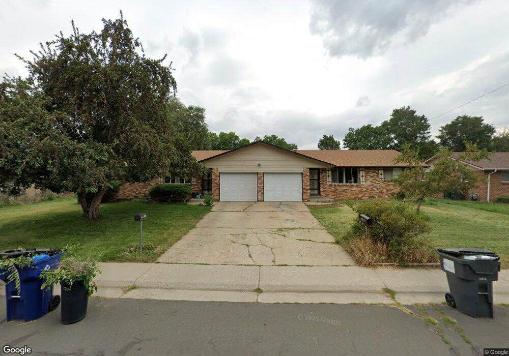
4655 Hoyt St Wheat Ridge, CO 80033
Kipling NeighborhoodEstimated Value: $576,000 - $720,000
4
Beds
2
Baths
1,928
Sq Ft
$334/Sq Ft
Est. Value
About This Home
This home is located at 4655 Hoyt St, Wheat Ridge, CO 80033 and is currently estimated at $643,429, approximately $333 per square foot. 4655 Hoyt St is a home located in Jefferson County with nearby schools including Peak Expeditionary - Pennington, Everitt Middle School, and Wheat Ridge High School.
Ownership History
Date
Name
Owned For
Owner Type
Purchase Details
Closed on
Jul 19, 2005
Sold by
Monge Lou and Monge Ermalinda
Bought by
Piro Pauline M
Current Estimated Value
Home Financials for this Owner
Home Financials are based on the most recent Mortgage that was taken out on this home.
Original Mortgage
$188,300
Outstanding Balance
$97,977
Interest Rate
5.61%
Mortgage Type
Fannie Mae Freddie Mac
Estimated Equity
$545,452
Purchase Details
Closed on
Jun 25, 2003
Sold by
Croom Janice K
Bought by
Monge Lou and Monge Ermalinda
Home Financials for this Owner
Home Financials are based on the most recent Mortgage that was taken out on this home.
Original Mortgage
$203,000
Interest Rate
4.37%
Mortgage Type
Purchase Money Mortgage
Purchase Details
Closed on
Aug 6, 1997
Sold by
Croom Bobby G
Bought by
Croom Janice K and Croom Bobby G
Create a Home Valuation Report for This Property
The Home Valuation Report is an in-depth analysis detailing your home's value as well as a comparison with similar homes in the area
Home Values in the Area
Average Home Value in this Area
Purchase History
| Date | Buyer | Sale Price | Title Company |
|---|---|---|---|
| Piro Pauline M | $269,000 | Security Title | |
| Monge Lou | $271,000 | Land Title | |
| Croom Janice K | -- | -- |
Source: Public Records
Mortgage History
| Date | Status | Borrower | Loan Amount |
|---|---|---|---|
| Open | Piro Pauline M | $188,300 | |
| Previous Owner | Monge Lou | $203,000 |
Source: Public Records
Tax History Compared to Growth
Tax History
| Year | Tax Paid | Tax Assessment Tax Assessment Total Assessment is a certain percentage of the fair market value that is determined by local assessors to be the total taxable value of land and additions on the property. | Land | Improvement |
|---|---|---|---|---|
| 2024 | $3,466 | $37,389 | $18,841 | $18,548 |
| 2023 | $3,466 | $37,389 | $18,841 | $18,548 |
| 2022 | $2,705 | $29,034 | $12,007 | $17,027 |
| 2021 | $2,805 | $30,528 | $12,625 | $17,903 |
| 2020 | $2,643 | $28,829 | $10,871 | $17,958 |
| 2019 | $2,607 | $28,829 | $10,871 | $17,958 |
| 2018 | $2,469 | $26,539 | $7,764 | $18,775 |
| 2017 | $2,248 | $26,539 | $7,764 | $18,775 |
| 2016 | $2,140 | $23,658 | $8,407 | $15,251 |
| 2015 | $1,809 | $23,658 | $8,407 | $15,251 |
| 2014 | $1,809 | $18,807 | $6,190 | $12,617 |
Source: Public Records
Map
Nearby Homes
- 4643 Independence St Unit 9
- 4737 Flower St Unit 4737
- 4658 Flower St Unit 4658
- 9380 W 49th Ave Unit 101
- 8976 W 46th Place Unit 8976
- 4931 Garrison St Unit 204G
- 4563 Everett St
- 5021 Garrison St Unit 103A
- 5041 Garrison St Unit 204C
- 4201 Garland St
- 10251 W 44th Ave Unit 6-106
- 8945 W 49th Ave
- 8748 W 46th Ave
- 4744 Dudley St
- 4950 Estes Ct
- 4752 Dover St
- 9870 W 41st Ave
- 8530 W 46th Ave
- 8553 W 48th Place
- 10095 W 41st Ave
- 4665 Hoyt St
- 4585 Hoyt St
- 4640 Independence St
- 4600 Independence St
- 4570 Hoyt St
- 4568 Hoyt St
- 4675 Hoyt St
- 4588 Hoyt St
- 4565 Hoyt St
- 4677 Hoyt St Unit 4677
- 4540 Hoyt St
- 4690 Independence St
- 4674 Hoyt St
- 4590 Independence St
- 4685 Hoyt St
- 4545 Hoyt St
- 4520 Hoyt St
- 4565 Holland St
- 4684 Hoyt St
- 4615 Independence St