Estimated Value: $227,000 - $436,000
--
Bed
--
Bath
--
Sq Ft
0.62
Acres
About This Home
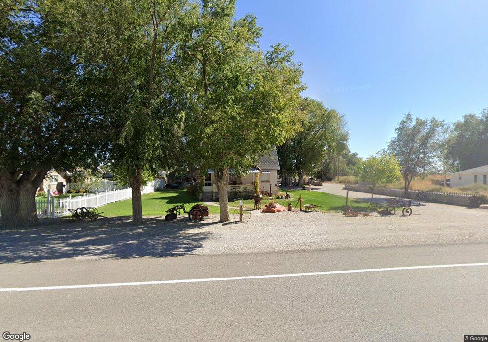
This home is located at 4655 S 4000 W, Delta, UT 84624 and is currently estimated at $318,008. 4655 S 4000 W is a home.
Ownership History
Date
Name
Owned For
Owner Type
Purchase Details
Closed on
Jan 29, 2014
Sold by
Mooney Michael R and Mooney Teresa D
Bought by
The Mooney Family Trust and Mooney Teresa D
Current Estimated Value
Purchase Details
Closed on
Oct 20, 2006
Sold by
Jensen Max
Bought by
Mooney Michael R and Mooney Teresa D
Home Financials for this Owner
Home Financials are based on the most recent Mortgage that was taken out on this home.
Original Mortgage
$53,600
Interest Rate
6.36%
Create a Home Valuation Report for This Property
The Home Valuation Report is an in-depth analysis detailing your home's value as well as a comparison with similar homes in the area
Home Values in the Area
Average Home Value in this Area
Purchase History
| Date | Buyer | Sale Price | Title Company |
|---|---|---|---|
| The Mooney Family Trust | -- | -- | |
| Mooney Michael R | -- | -- |
Source: Public Records
Mortgage History
| Date | Status | Borrower | Loan Amount |
|---|---|---|---|
| Previous Owner | Mooney Michael R | $53,600 |
Source: Public Records
Tax History Compared to Growth
Tax History
| Year | Tax Paid | Tax Assessment Tax Assessment Total Assessment is a certain percentage of the fair market value that is determined by local assessors to be the total taxable value of land and additions on the property. | Land | Improvement |
|---|---|---|---|---|
| 2025 | $1,334 | $164,419 | $19,250 | $145,169 |
| 2024 | $1,334 | $142,013 | $15,125 | $126,888 |
| 2023 | $1,649 | $142,013 | $15,125 | $126,888 |
| 2022 | $1,045 | $92,151 | $13,750 | $78,401 |
| 2021 | $800 | $67,894 | $12,100 | $55,794 |
| 2020 | $771 | $66,211 | $12,100 | $54,111 |
| 2019 | $722 | $62,604 | $12,100 | $50,504 |
| 2018 | $488 | $43,421 | $12,100 | $31,321 |
| 2017 | $455 | $38,629 | $8,800 | $29,829 |
| 2016 | $434 | $38,629 | $8,800 | $29,829 |
| 2015 | $435 | $38,629 | $8,800 | $29,829 |
| 2014 | -- | $38,629 | $8,800 | $29,829 |
| 2013 | -- | $38,972 | $8,800 | $30,172 |
Source: Public Records
Map
Nearby Homes
- 3885 W 4500 S
- 3770 S 4000 Rd W
- 6500 S 3000 West Rd
- 3480 S 4000 W
- 470 S 2750 W Unit 6
- 460 S 2750 W Unit 7
- 490 S 2750 W Unit 5
- 465 S 2750 W Unit 4
- 6177 S 3000 Rd W
- 0 Tbd 3000 Rd S Unit LotWP001
- 8000 S Highway 257
- 6500 W 2000 S
- 17000 W 2500 Rd S
- 16700 W 2500 South Rd
- 16800 W 2500 South Rd
- 289 W Center St S
- 168 N 100 Rd W
- 1040 W Center St
- 0 Tbd 6500 Rd S Unit LotWP001 21115450
- 700 Acres