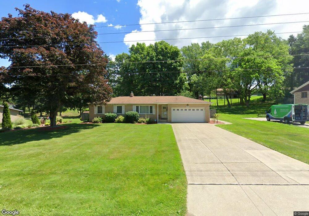
4657 Mars Rd Uniontown, OH 44685
Estimated Value: $235,000 - $274,000
3
Beds
2
Baths
1,384
Sq Ft
$184/Sq Ft
Est. Value
About This Home
This home is located at 4657 Mars Rd, Uniontown, OH 44685 and is currently estimated at $254,416, approximately $183 per square foot. 4657 Mars Rd is a home located in Summit County with nearby schools including Greenwood Elementary School, Green Intermediate Elementary School, and Green Primary School.
Ownership History
Date
Name
Owned For
Owner Type
Purchase Details
Closed on
Apr 25, 2001
Sold by
Meadows Connie L
Bought by
Mccready Richard L and Boyle Mccready Sandra E
Current Estimated Value
Home Financials for this Owner
Home Financials are based on the most recent Mortgage that was taken out on this home.
Original Mortgage
$61,000
Interest Rate
7.03%
Purchase Details
Closed on
Aug 14, 1997
Sold by
Davis Howard D
Bought by
Meadows Connie L
Home Financials for this Owner
Home Financials are based on the most recent Mortgage that was taken out on this home.
Original Mortgage
$88,000
Interest Rate
7.71%
Mortgage Type
New Conventional
Create a Home Valuation Report for This Property
The Home Valuation Report is an in-depth analysis detailing your home's value as well as a comparison with similar homes in the area
Purchase History
| Date | Buyer | Sale Price | Title Company |
|---|---|---|---|
| Mccready Richard L | $135,000 | Northeast Title Agency Inc | |
| Meadows Connie L | $118,000 | -- |
Source: Public Records
Mortgage History
| Date | Status | Borrower | Loan Amount |
|---|---|---|---|
| Closed | Mccready Richard L | $61,000 | |
| Closed | Meadows Connie L | $88,000 |
Source: Public Records
Tax History
| Year | Tax Paid | Tax Assessment Tax Assessment Total Assessment is a certain percentage of the fair market value that is determined by local assessors to be the total taxable value of land and additions on the property. | Land | Improvement |
|---|---|---|---|---|
| 2024 | $2,777 | $68,489 | $13,024 | $55,465 |
| 2023 | $2,777 | $68,489 | $13,024 | $55,465 |
| 2022 | $2,291 | $52,682 | $10,017 | $42,665 |
| 2021 | $2,147 | $52,682 | $10,017 | $42,665 |
| 2020 | $2,106 | $52,690 | $10,020 | $42,670 |
| 2019 | $1,986 | $47,580 | $10,020 | $37,560 |
| 2018 | $2,030 | $47,580 | $10,020 | $37,560 |
| 2017 | $1,748 | $47,580 | $10,020 | $37,560 |
| 2016 | $1,740 | $40,140 | $10,020 | $30,120 |
| 2015 | $1,748 | $40,140 | $10,020 | $30,120 |
| 2014 | $1,737 | $40,140 | $10,020 | $30,120 |
| 2013 | $1,584 | $37,130 | $10,020 | $27,110 |
Source: Public Records
Map
Nearby Homes
- 4542 Camelot Cir Unit 4546
- 4529-4533 Camelot Cir
- 4710 Pinecrest Dr
- 4 Shrakes Hotel Dr
- 6 Shrakes Hotel Dr
- 3 Shrakes Hotel Dr
- 5 Shrakes Hotel Dr
- 7 Shrakes Hotel Dr
- S/L 14,15 Shakes Hotel Dr
- lot 8 Whyem Dr
- 0 Kenway Blvd Unit 5162986
- 4298 S Main St Unit 4302
- 3680 Kenway Blvd
- 3672 Kenway Blvd
- 3630 Great Windsor Ln
- 3624 Great Windsor Ln
- 3859 Greenfield Rd
- 3618 Great Windsor Ln
- 3612 Great Windsor Ln
- 3639 Great Windsor Ln