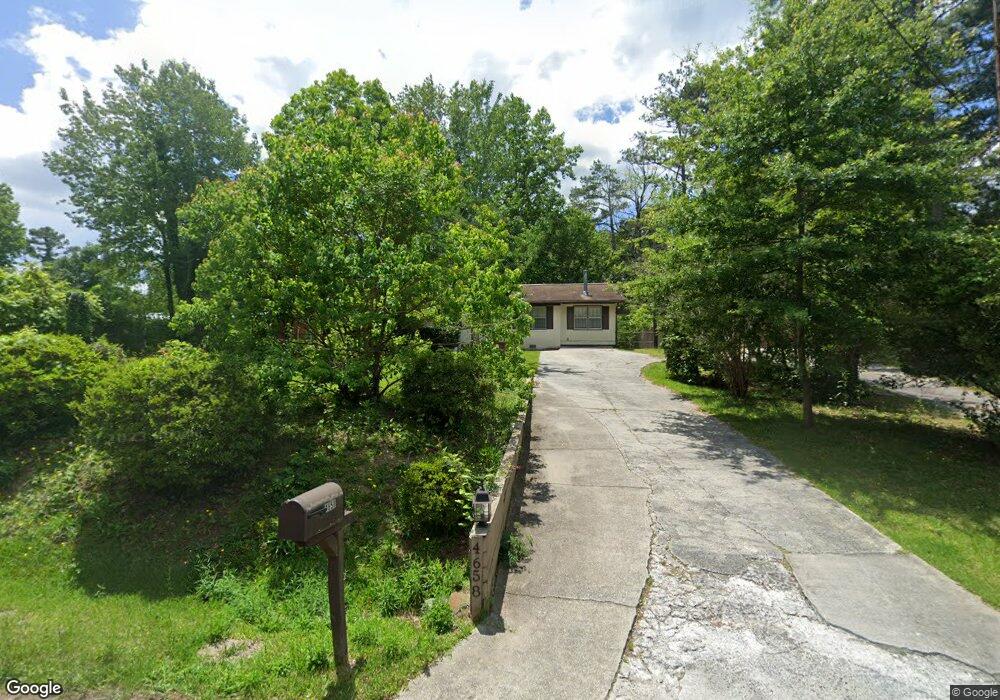
4658 Brooklawn St Macon, GA 31210
Estimated Value: $92,000 - $135,000
3
Beds
2
Baths
1,272
Sq Ft
$92/Sq Ft
Est. Value
About This Home
This home is located at 4658 Brooklawn St, Macon, GA 31210 and is currently estimated at $116,847, approximately $91 per square foot. 4658 Brooklawn St is a home located in Bibb County with nearby schools including Carter Elementary School, Howard Middle School, and Howard High School.
Ownership History
Date
Name
Owned For
Owner Type
Purchase Details
Closed on
May 6, 2021
Sold by
Reed Isabelle P
Bought by
Spivey Adrian
Current Estimated Value
Home Financials for this Owner
Home Financials are based on the most recent Mortgage that was taken out on this home.
Original Mortgage
$29,456
Outstanding Balance
$26,581
Interest Rate
3.1%
Mortgage Type
FHA
Estimated Equity
$90,266
Purchase Details
Closed on
Apr 21, 1998
Sold by
Reed Isabelle P and Hammett Felicia A
Bought by
Hammett Felicia A and Hammett Reed I
Create a Home Valuation Report for This Property
The Home Valuation Report is an in-depth analysis detailing your home's value as well as a comparison with similar homes in the area
Home Values in the Area
Average Home Value in this Area
Purchase History
| Date | Buyer | Sale Price | Title Company |
|---|---|---|---|
| Spivey Adrian | $30,000 | None Available | |
| Hammett Felicia A | -- | -- |
Source: Public Records
Mortgage History
| Date | Status | Borrower | Loan Amount |
|---|---|---|---|
| Open | Spivey Adrian | $29,456 |
Source: Public Records
Tax History Compared to Growth
Tax History
| Year | Tax Paid | Tax Assessment Tax Assessment Total Assessment is a certain percentage of the fair market value that is determined by local assessors to be the total taxable value of land and additions on the property. | Land | Improvement |
|---|---|---|---|---|
| 2025 | $777 | $31,601 | $2,584 | $29,017 |
| 2024 | $803 | $31,601 | $2,584 | $29,017 |
| 2023 | $1,039 | $35,078 | $2,584 | $32,494 |
| 2022 | $1,171 | $33,821 | $4,530 | $29,291 |
| 2021 | $1,034 | $27,212 | $4,530 | $22,682 |
| 2020 | $1,057 | $27,212 | $4,530 | $22,682 |
| 2019 | $1,065 | $27,212 | $4,530 | $22,682 |
| 2018 | $1,811 | $27,212 | $4,530 | $22,682 |
| 2017 | $1,020 | $27,212 | $4,530 | $22,682 |
| 2016 | $966 | $27,212 | $4,530 | $22,682 |
| 2015 | $1,438 | $29,372 | $4,530 | $24,842 |
| 2014 | $1,654 | $29,372 | $4,530 | $24,842 |
Source: Public Records
Map
Nearby Homes
- 4532 Ayers Rd
- 4571 Shadow Lawn Dr
- 4508 Bon Ayer Cir
- 4373 Barrington Place
- 3949 Bernice Ave
- 4403 Azalea Dr
- 4433 Azalea Dr
- 1402 Barrington Place
- 1406 Barrington Place
- 534 Ivy Brook Way
- 117 Legare Ct
- 776 Ivy Brook Way
- 162 Parkwood Ave
- 621 Ivy Brook Way
- 631 Ivy Brook Way
- 740 Ivy Brook Way
- 3848 Berkley Dr
- 4652 Brooklawn St
- 4666 Brooklawn St
- 4672 Brooklawn St
- 4640 Brooklawn St
- 4659 Brooklawn St
- 4653 Brooklawn St
- 102 Westchester Park
- 4643 Lakewood Ave
- 4683 Brooklawn St
- 4665 Brooklawn Place
- 4642 Lakewood Ave
- 760 Saint Andrews Dr
- 4635 Lakewood Ave
- 770 Saint Andrews Dr
- 770 St Andrews Dr
- 102 Merion Park
- 4629 Brooklawn St
- 758 Saint Andrews Dr
- 4638 Lakewood Ave
- 4694 Brooklawn St