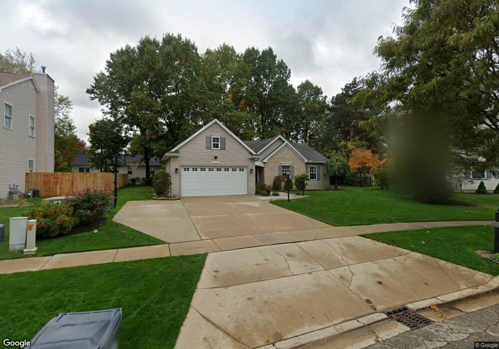
4659 Connolly Ln Portage, MI 49024
Estimated Value: $334,000 - $396,000
3
Beds
3
Baths
2,110
Sq Ft
$173/Sq Ft
Est. Value
About This Home
This home is located at 4659 Connolly Ln, Portage, MI 49024 and is currently estimated at $365,489, approximately $173 per square foot. 4659 Connolly Ln is a home located in Kalamazoo County with nearby schools including 12th Street Elementary School, Portage West Middle School, and Portage Central High School.
Ownership History
Date
Name
Owned For
Owner Type
Purchase Details
Closed on
Feb 23, 2007
Sold by
Bly Bryan M and Bly Amber M
Bought by
Sturgis Kevin A and Sturgis Toni M
Current Estimated Value
Home Financials for this Owner
Home Financials are based on the most recent Mortgage that was taken out on this home.
Original Mortgage
$164,000
Outstanding Balance
$98,828
Interest Rate
6.27%
Mortgage Type
Purchase Money Mortgage
Estimated Equity
$266,661
Create a Home Valuation Report for This Property
The Home Valuation Report is an in-depth analysis detailing your home's value as well as a comparison with similar homes in the area
Home Values in the Area
Average Home Value in this Area
Purchase History
| Date | Buyer | Sale Price | Title Company |
|---|---|---|---|
| Sturgis Kevin A | $205,000 | Chicago Title |
Source: Public Records
Mortgage History
| Date | Status | Borrower | Loan Amount |
|---|---|---|---|
| Open | Sturgis Kevin A | $164,000 |
Source: Public Records
Tax History Compared to Growth
Tax History
| Year | Tax Paid | Tax Assessment Tax Assessment Total Assessment is a certain percentage of the fair market value that is determined by local assessors to be the total taxable value of land and additions on the property. | Land | Improvement |
|---|---|---|---|---|
| 2025 | $5,218 | $192,400 | $0 | $0 |
| 2024 | $4,594 | $182,400 | $0 | $0 |
| 2023 | $4,379 | $149,300 | $0 | $0 |
| 2022 | $4,731 | $143,400 | $0 | $0 |
| 2021 | $4,573 | $139,700 | $0 | $0 |
| 2020 | $4,399 | $127,500 | $0 | $0 |
| 2019 | $396 | $124,200 | $0 | $0 |
| 2018 | $0 | $112,600 | $0 | $0 |
| 2017 | $0 | $108,200 | $0 | $0 |
| 2016 | -- | $102,800 | $0 | $0 |
| 2015 | -- | $96,100 | $0 | $0 |
| 2014 | -- | $90,600 | $0 | $0 |
Source: Public Records
Map
Nearby Homes
- 4788 Norfolk Cir
- 6794 Brickleton Ct
- 5189 Queen Victoria Ln
- 5464 Cypress Bay Dr
- 3737 Bellflower Dr
- 6787 Tiger Lily Dr Unit 55
- 3638 Bellflower Dr
- 7296 Annandale Dr
- 6971 Annandale Dr
- 6782 Southwind St Unit 68
- 3653 Tartan Cir
- 7175 Hopkinton Dr
- 7873 Shepherds Glen Ct
- 5103 Brinson Ln
- 5207 Brinson Ln
- 7236 Hampstead Ln Unit 18
- 5122 Brinson Ln
- 5102 Brinson Ln
- 7566 Cobblewood Dr
- 5661 Attleberry Ave
- 4633 Connolly Ln
- 4679 Connolly Ln
- 4660 Geneva Ave
- 4634 Geneva Ave
- 7251 Bertland Dr
- 4611 Connolly Ln
- 7199 Venice Dr
- 7200 Venice Dr
- 4610 Geneva Ave
- 7241 Bertland Dr
- 7200 Provence Dr
- 7185 Venice Dr
- 4651 Geneva Ave
- 4741 Roland Cir
- 4687 Geneva Ave
- 7186 Provence Dr
- 4621 Geneva Ave
- 7231 Bertland Dr
- 7178 Venice Dr
- 4709 Roland Cir