Estimated Value: $305,965 - $317,000
3
Beds
2
Baths
2,121
Sq Ft
$147/Sq Ft
Est. Value
About This Home
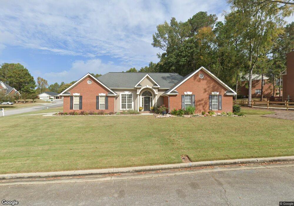
This home is located at 4659 Leeward Dr, Evans, GA 30809 and is currently estimated at $311,491, approximately $146 per square foot. 4659 Leeward Dr is a home located in Columbia County with nearby schools including Evans Elementary School, Evans Middle School, and Evans High School.
Ownership History
Date
Name
Owned For
Owner Type
Purchase Details
Closed on
Aug 23, 2021
Sold by
Crumpton Alvin Briggs
Bought by
Crumpton Alvin Briggs and Crumpton Valerie T
Current Estimated Value
Home Financials for this Owner
Home Financials are based on the most recent Mortgage that was taken out on this home.
Original Mortgage
$248,900
Outstanding Balance
$225,642
Interest Rate
2.7%
Mortgage Type
New Conventional
Estimated Equity
$85,849
Purchase Details
Closed on
Oct 6, 2017
Sold by
Simpson Bobby D
Bought by
Simpson Bobby D and Simpson Amber L
Home Financials for this Owner
Home Financials are based on the most recent Mortgage that was taken out on this home.
Original Mortgage
$160,000
Interest Rate
3.78%
Mortgage Type
New Conventional
Create a Home Valuation Report for This Property
The Home Valuation Report is an in-depth analysis detailing your home's value as well as a comparison with similar homes in the area
Home Values in the Area
Average Home Value in this Area
Purchase History
| Date | Buyer | Sale Price | Title Company |
|---|---|---|---|
| Crumpton Alvin Briggs | -- | -- | |
| Crumpton Alvin Briggs | $262,000 | -- | |
| Simpson Bobby D | -- | -- | |
| Simpson Bobby D | $200,000 | -- |
Source: Public Records
Mortgage History
| Date | Status | Borrower | Loan Amount |
|---|---|---|---|
| Open | Crumpton Alvin Briggs | $248,900 | |
| Closed | Crumpton Alvin Briggs | $248,900 | |
| Previous Owner | Simpson Bobby D | $160,000 |
Source: Public Records
Tax History
| Year | Tax Paid | Tax Assessment Tax Assessment Total Assessment is a certain percentage of the fair market value that is determined by local assessors to be the total taxable value of land and additions on the property. | Land | Improvement |
|---|---|---|---|---|
| 2025 | $3,057 | $127,717 | $20,604 | $107,113 |
| 2024 | $3,365 | $134,288 | $22,204 | $112,084 |
| 2023 | $3,365 | $109,429 | $18,904 | $90,525 |
| 2022 | $2,725 | $104,562 | $19,304 | $85,258 |
| 2021 | $2,380 | $85,397 | $14,804 | $70,593 |
| 2020 | $2,294 | $80,497 | $14,604 | $65,893 |
| 2019 | $2,149 | $75,295 | $14,504 | $60,791 |
| 2018 | $2,237 | $78,198 | $14,104 | $64,094 |
| 2017 | $2,146 | $76,574 | $13,904 | $62,670 |
| 2016 | $2,010 | $74,391 | $13,980 | $60,411 |
| 2015 | $1,953 | $72,126 | $11,880 | $60,246 |
| 2014 | $1,928 | $70,339 | $11,880 | $58,459 |
Source: Public Records
Map
Nearby Homes
- 599 Windward Ct
- 604 Kimberley Place
- 4712 Walnut Hill Dr
- 642 Kimberley Place
- 4622 Brittany Dr
- 665 Steeplechase Way
- 4560 Mulberry Creek Dr
- 305 Sumac Trail
- 3542 Hilltop Trail
- 3527 Hilltop Trail
- 3538 Hilltop Trail
- 703 Low Meadow Dr
- 4614 Stoneridge Ct
- 726 Whitney Shoals Rd
- 881 Audubon Way
- 814 Audubon Way
- 648 River Oaks Ln
- 5068 Hereford Farm Rd
- 4653 Washington Rd
- 1 Woodbridge Way
- 553 Leeward Ct
- 4657 Leeward Dr
- 4658 Leeward Dr
- 557 Crossgate Ct
- 555 Leeward Ct
- 4660 Leeward Dr
- 4662 Leeward Dr
- 4665 Leeward Dr
- 552 Leeward Ct
- 4664 Leeward Dr
- 4656 Leeward Dr
- 559 Crossgate Ct
- 557 Leeward Ct
- 4666 Leeward Dr
- 554 Leeward Ct
- 4654 Leeward Dr
- 4669 Leeward Dr
- 558 Leeward Ct
- 558 Crossgate Ct
- 556 Leeward Ct
Your Personal Tour Guide
Ask me questions while you tour the home.