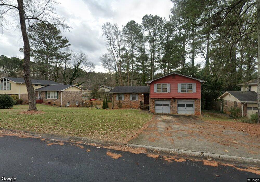
4659 Wendover Dr Unit 1 Stone Mountain, GA 30083
Estimated Value: $243,000 - $272,000
4
Beds
3
Baths
2,166
Sq Ft
$120/Sq Ft
Est. Value
About This Home
This home is located at 4659 Wendover Dr Unit 1, Stone Mountain, GA 30083 and is currently estimated at $259,985, approximately $120 per square foot. 4659 Wendover Dr Unit 1 is a home located in DeKalb County with nearby schools including Woodridge Elementary School, Miller Grove Middle School, and Miller Grove High School.
Ownership History
Date
Name
Owned For
Owner Type
Purchase Details
Closed on
Jul 1, 2013
Sold by
Gslsvac Ga Llc
Bought by
Means Antone
Current Estimated Value
Home Financials for this Owner
Home Financials are based on the most recent Mortgage that was taken out on this home.
Original Mortgage
$38,000
Outstanding Balance
$27,389
Interest Rate
3.79%
Mortgage Type
New Conventional
Estimated Equity
$246,087
Purchase Details
Closed on
Jan 2, 2013
Sold by
Foney Carl L
Bought by
Gslsvac Ga Llc
Purchase Details
Closed on
Apr 4, 2005
Sold by
Gordon Marlene C
Bought by
Foney Carl L
Home Financials for this Owner
Home Financials are based on the most recent Mortgage that was taken out on this home.
Original Mortgage
$150,000
Interest Rate
5.74%
Mortgage Type
New Conventional
Create a Home Valuation Report for This Property
The Home Valuation Report is an in-depth analysis detailing your home's value as well as a comparison with similar homes in the area
Home Values in the Area
Average Home Value in this Area
Purchase History
| Date | Buyer | Sale Price | Title Company |
|---|---|---|---|
| Means Antone | $48,000 | -- | |
| Gslsvac Ga Llc | -- | -- | |
| Foney Carl L | $150,000 | -- |
Source: Public Records
Mortgage History
| Date | Status | Borrower | Loan Amount |
|---|---|---|---|
| Open | Means Antone | $38,000 | |
| Previous Owner | Foney Carl L | $150,000 |
Source: Public Records
Tax History Compared to Growth
Tax History
| Year | Tax Paid | Tax Assessment Tax Assessment Total Assessment is a certain percentage of the fair market value that is determined by local assessors to be the total taxable value of land and additions on the property. | Land | Improvement |
|---|---|---|---|---|
| 2025 | $5,134 | $107,800 | $12,000 | $95,800 |
| 2024 | $5,474 | $115,600 | $12,000 | $103,600 |
| 2023 | $5,474 | $106,800 | $6,760 | $100,040 |
| 2022 | $4,140 | $87,200 | $6,760 | $80,440 |
| 2021 | $3,145 | $64,520 | $6,760 | $57,760 |
| 2020 | $3,229 | $66,440 | $6,760 | $59,680 |
| 2019 | $3,064 | $62,680 | $6,760 | $55,920 |
| 2018 | $2,102 | $51,120 | $6,760 | $44,360 |
| 2017 | $2,279 | $44,600 | $6,760 | $37,840 |
| 2016 | $1,801 | $33,680 | $6,760 | $26,920 |
| 2014 | $1,182 | $19,184 | $5,224 | $13,960 |
Source: Public Records
Map
Nearby Homes
- 4641 Wendover Dr Unit 1
- 4605 Mercer Rd
- 1491 S Hairston Rd
- 4734 White Oak Trail
- 1512 S Hairston Rd
- 1337 S Hairston Rd
- 1323 S Hairston Rd
- 1513 Spruce Ridge Way
- 4594 Bexley Dr
- 4504 Cedar Ridge Trail
- 1215 Sheppard Place
- 1374 To Lani Farm Rd
- 1363 To Lani Farm Rd
- 4640 Elm Ridge Ct
- 1219 To Lani Dr
- 4831 Oak Path
- 1439 Walnut Ridge Way Unit 2
- 4448 Cedar Ridge Trail
- 4442 Cedar Ridge Trail
- 4564 Cypress Ridge Ct Unit 4
- 4653 Wendover Dr Unit 1
- 4665 Wendover Dr
- 4674 Weyburn Ln
- 4666 Weyburn Ln Unit 1
- 4647 Wendover Dr
- 4673 Wendover Dr
- 4682 Weyburn Ln
- 1438 Wendover Ct Unit 1
- 4658 Weyburn Ln Unit 1
- 1439 Wendover Ct
- 4640 Wendover Dr
- 1446 Wendover Ct
- 4650 Weyburn Ln
- 1447 Wendover Ct
- 4670 Wendover Dr
- 1451 Grafton Ct Unit 1
- 4635 Wendover Dr Unit 1
- 4675 Weyburn Ln
- 4683 Weyburn Ln Unit 1
- 4705 Mercer Rd