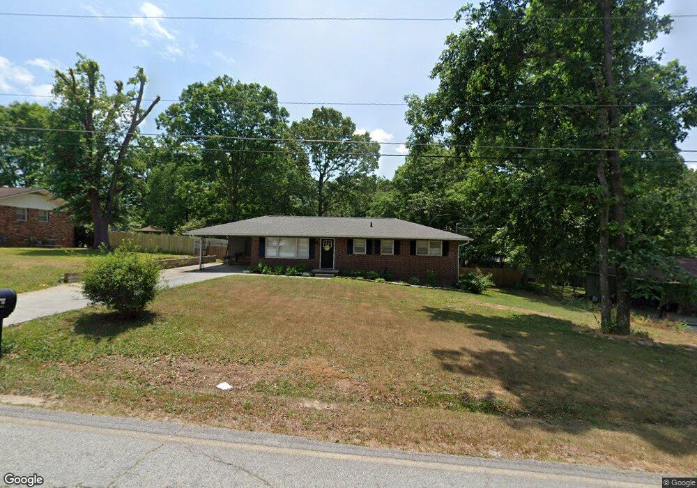
466 Andrews Rd Toccoa, GA 30577
Estimated Value: $211,683 - $240,000
3
Beds
2
Baths
1,475
Sq Ft
$155/Sq Ft
Est. Value
About This Home
This home is located at 466 Andrews Rd, Toccoa, GA 30577 and is currently estimated at $229,171, approximately $155 per square foot. 466 Andrews Rd is a home located in Stephens County with nearby schools including Stephens County High School.
Ownership History
Date
Name
Owned For
Owner Type
Purchase Details
Closed on
Nov 16, 2020
Sold by
Orr Stephen
Bought by
Chupp Hanna
Current Estimated Value
Home Financials for this Owner
Home Financials are based on the most recent Mortgage that was taken out on this home.
Original Mortgage
$147,150
Outstanding Balance
$128,297
Interest Rate
2.8%
Mortgage Type
New Conventional
Estimated Equity
$100,874
Purchase Details
Closed on
Jul 5, 2018
Sold by
Allen George
Bought by
Orr Stephen and Orr Andrea A
Home Financials for this Owner
Home Financials are based on the most recent Mortgage that was taken out on this home.
Original Mortgage
$69,190
Interest Rate
4.25%
Mortgage Type
FHA
Purchase Details
Closed on
Sep 1, 2016
Sold by
George
Bought by
Allen George and Allen Gail
Create a Home Valuation Report for This Property
The Home Valuation Report is an in-depth analysis detailing your home's value as well as a comparison with similar homes in the area
Purchase History
We collect this data history from publicly available records. To have your information removed, we recommend requesting removal directly through your county’s website.
| Date | Buyer | Sale Price | Title Company |
|---|---|---|---|
| Chupp Hanna | $154,900 | -- | |
| Orr Stephen | $80,000 | -- | |
| Allen George | -- | -- | |
| Allen George | $27,500 | -- |
Source: Public Records
Mortgage History
We collect this data history from publicly available records. To have your information removed, we recommend requesting removal directly through your county’s website.
| Date | Status | Borrower | Loan Amount |
|---|---|---|---|
| Open | Chupp Hanna | $147,150 | |
| Previous Owner | Orr Stephen | $69,190 |
Source: Public Records
Tax History
| Year | Tax Paid | Tax Assessment Tax Assessment Total Assessment is a certain percentage of the fair market value that is determined by local assessors to be the total taxable value of land and additions on the property. | Land | Improvement |
|---|---|---|---|---|
| 2025 | $2,120 | $70,410 | $2,268 | $68,142 |
| 2024 | $1,838 | $53,270 | $2,268 | $51,002 |
| 2023 | $1,682 | $49,233 | $2,268 | $46,965 |
| 2022 | $1,312 | $46,081 | $2,268 | $43,813 |
| 2021 | $1,265 | $42,440 | $2,268 | $40,172 |
| 2020 | $937 | $29,656 | $2,268 | $27,388 |
| 2019 | $940 | $29,656 | $2,268 | $27,388 |
| 2018 | $804 | $25,343 | $2,268 | $23,075 |
| 2017 | $816 | $25,343 | $2,268 | $23,075 |
| 2016 | -- | $25,343 | $2,268 | $23,074 |
| 2015 | -- | $25,157 | $2,268 | $22,889 |
| 2014 | -- | $25,158 | $2,268 | $22,889 |
| 2013 | -- | $25,406 | $2,268 | $23,138 |
Source: Public Records
Map
Nearby Homes
- 1226 Skyline Dr
- 198 Pebble Creek Dr
- 475 Hilltop Way
- 158 Pebble Creek Dr
- 820 Collier Rd
- 926 Skyline Dr
- 208 Cherry St
- 683 Collier Rd
- 1795 Skyline Dr
- 207 Poplar Trail
- 39 Meadowbrook Dr
- 103 Old Liberty Hill Rd
- 606 Rose Ln
- 642 Skyline Dr
- .59 ACRE Addington Ct
- 1288 Rose Ln
- 156 White Pine Rd
- 31 Addington Ct
- 0 Valley Dr Unit 7751789
- 0 Valley Dr Unit 10701357
- 488 Andrews Rd
- 448 Andrews Rd
- 469 Andrews Rd
- 311 Andrews Rd
- 430 Andrews Rd
- 451 Andrews Rd
- 487 Andrews Rd
- 516 Andrews Rd
- 431 Andrews Rd
- 408 Andrews Rd
- 517 Andrews Rd
- 30 Andrews Place
- 686 Hilltop Way
- 413 Andrews Rd
- 536 Andrews Rd
- 0 Anderson Rd Unit 7626611
- 535 Andrews Rd
- 689 Hilltop Way
- 654 Hilltop Way
- 554 Andrews Rd
Your Personal Tour Guide
Ask me questions while you tour the home.