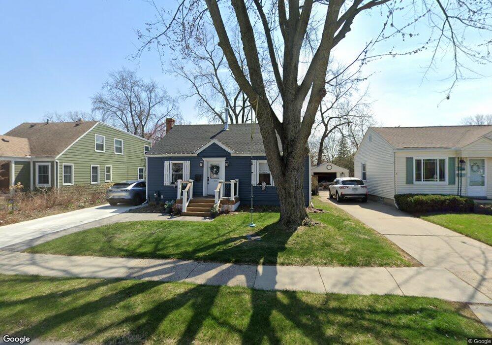
466 E Baker Ave Clawson, MI 48017
Estimated Value: $225,764 - $305,000
3
Beds
2
Baths
1,006
Sq Ft
$264/Sq Ft
Est. Value
About This Home
This home is located at 466 E Baker Ave, Clawson, MI 48017 and is currently estimated at $265,191, approximately $263 per square foot. 466 E Baker Ave is a home located in Oakland County with nearby schools including Clawson Middle School, Clawson High School, and Guardian Angels School.
Ownership History
Date
Name
Owned For
Owner Type
Purchase Details
Closed on
Mar 13, 2009
Sold by
Eichbrecht Gregory and Eichbrecht Kathy
Bought by
Glander Daniel
Current Estimated Value
Purchase Details
Closed on
Mar 3, 2003
Sold by
Wellman Shelline and Wellman Douglas D
Bought by
Erchbrecht Gregory
Purchase Details
Closed on
Oct 28, 1997
Sold by
Witt Lillian H
Bought by
Wellman Douglas D
Home Financials for this Owner
Home Financials are based on the most recent Mortgage that was taken out on this home.
Original Mortgage
$82,873
Interest Rate
7.42%
Create a Home Valuation Report for This Property
The Home Valuation Report is an in-depth analysis detailing your home's value as well as a comparison with similar homes in the area
Home Values in the Area
Average Home Value in this Area
Purchase History
| Date | Buyer | Sale Price | Title Company |
|---|---|---|---|
| Glander Daniel | $86,000 | Devon Title Agency | |
| Erchbrecht Gregory | $152,000 | Lawyers Title Insurance Corp | |
| Wellman Douglas D | $83,000 | -- |
Source: Public Records
Mortgage History
| Date | Status | Borrower | Loan Amount |
|---|---|---|---|
| Previous Owner | Wellman Douglas D | $82,873 |
Source: Public Records
Tax History
| Year | Tax Paid | Tax Assessment Tax Assessment Total Assessment is a certain percentage of the fair market value that is determined by local assessors to be the total taxable value of land and additions on the property. | Land | Improvement |
|---|---|---|---|---|
| 2025 | $2,225 | $108,100 | $0 | $0 |
| 2024 | $2,126 | $103,880 | $0 | $0 |
| 2023 | $2,038 | $94,480 | $0 | $0 |
| 2022 | $2,055 | $85,210 | $0 | $0 |
| 2021 | $2,014 | $79,080 | $0 | $0 |
| 2020 | $1,950 | $76,280 | $0 | $0 |
| 2019 | $2,016 | $72,330 | $0 | $0 |
| 2018 | $2,001 | $67,170 | $0 | $0 |
| 2017 | $1,956 | $56,150 | $0 | $0 |
| 2016 | $1,991 | $52,280 | $0 | $0 |
| 2015 | -- | $47,820 | $0 | $0 |
| 2014 | -- | $41,450 | $0 | $0 |
| 2011 | -- | $37,710 | $0 | $0 |
Source: Public Records
Map
Nearby Homes
- 550 Roth Blvd
- 609 E Baker Ave
- 917 Kenwood St
- 911 Kenwood St
- 909 Kenwood St
- 918 Kenwood St
- 57 W Elmwood Ave
- 45 E Tacoma St
- 114 Knollwood Blvd
- 101 Jefferson Ave
- 44 W Tacoma St
- 150 Wilson Ave
- 1121 Ottawa Ave
- 124 Leroy Ave
- 1101 Donald Ave
- 135 Gerald Ave
- 428 Bauman Ave
- 1205 Donald Ave
- 503 W Elmwood Ave
- 138 Chopin St
- 476 E Baker Ave
- 456 E Baker Ave
- 486 E Baker Ave
- 444 E Baker Ave
- 475 Roth Blvd
- 465 Roth Blvd
- 455 Roth Blvd
- 496 E Baker Ave
- 487 Roth Blvd
- 469 E Baker Ave
- 497 Roth Blvd
- 508 E Baker Ave
- 445 Roth Blvd
- 434 E Baker Ave
- 477 E Baker Ave
- 451 E Baker Ave
- 507 Roth Blvd
- 487 E Baker Ave
- 435 Roth Blvd
- 516 E Baker Ave
Your Personal Tour Guide
Ask me questions while you tour the home.