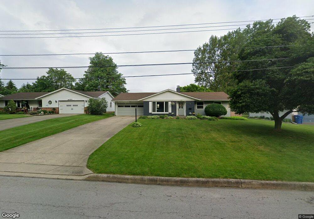
466 High Meadow Rd Amherst, OH 44001
Estimated Value: $166,000 - $244,844
3
Beds
2
Baths
1,568
Sq Ft
$140/Sq Ft
Est. Value
About This Home
This home is located at 466 High Meadow Rd, Amherst, OH 44001 and is currently estimated at $219,461, approximately $139 per square foot. 466 High Meadow Rd is a home located in Lorain County with nearby schools including Powers Elementary School, Walter G. Nord Middle School, and Amherst Junior High School.
Ownership History
Date
Name
Owned For
Owner Type
Purchase Details
Closed on
Oct 15, 2002
Sold by
Smaldino Samuel J
Bought by
Green Edward L and Green Janell L
Current Estimated Value
Home Financials for this Owner
Home Financials are based on the most recent Mortgage that was taken out on this home.
Original Mortgage
$110,500
Outstanding Balance
$46,597
Interest Rate
6.24%
Estimated Equity
$172,864
Purchase Details
Closed on
Sep 28, 1998
Sold by
Jesko James A and Jesko Sue Ann
Bought by
Smaldino Samuel J
Home Financials for this Owner
Home Financials are based on the most recent Mortgage that was taken out on this home.
Original Mortgage
$118,750
Interest Rate
6.98%
Create a Home Valuation Report for This Property
The Home Valuation Report is an in-depth analysis detailing your home's value as well as a comparison with similar homes in the area
Home Values in the Area
Average Home Value in this Area
Purchase History
| Date | Buyer | Sale Price | Title Company |
|---|---|---|---|
| Green Edward L | $33,500 | Easton Title Services | |
| Smaldino Samuel J | $125,000 | Lorain County Title Co Inc |
Source: Public Records
Mortgage History
| Date | Status | Borrower | Loan Amount |
|---|---|---|---|
| Open | Green Edward L | $110,500 | |
| Closed | Smaldino Samuel J | $118,750 |
Source: Public Records
Tax History Compared to Growth
Tax History
| Year | Tax Paid | Tax Assessment Tax Assessment Total Assessment is a certain percentage of the fair market value that is determined by local assessors to be the total taxable value of land and additions on the property. | Land | Improvement |
|---|---|---|---|---|
| 2024 | $3,054 | $75,646 | $18,851 | $56,795 |
| 2023 | $2,692 | $56,179 | $12,212 | $43,967 |
| 2022 | $2,580 | $56,179 | $12,212 | $43,967 |
| 2021 | $2,587 | $56,179 | $12,212 | $43,967 |
| 2020 | $2,385 | $45,970 | $9,990 | $35,980 |
| 2019 | $2,337 | $45,970 | $9,990 | $35,980 |
| 2018 | $2,383 | $45,970 | $9,990 | $35,980 |
| 2017 | $2,416 | $44,380 | $9,300 | $35,080 |
| 2016 | $2,436 | $44,380 | $9,300 | $35,080 |
| 2015 | $2,422 | $44,380 | $9,300 | $35,080 |
| 2014 | $2,540 | $46,320 | $9,700 | $36,620 |
| 2013 | $2,548 | $46,320 | $9,700 | $36,620 |
Source: Public Records
Map
Nearby Homes
- 1273 Spruce Tree Ln
- Pine w/ Full Basement Plan at Quarry Creek
- Poplar Plan at Quarry Creek
- 60 Flamingo Ave
- 41 Flamingo Ave
- 8 Riviera Ave
- 127 Tropicana Ave
- 117 Caesars Cir
- 351 Rockridge Dr
- 922 Sharondale Dr
- 135 Ridgeland Dr
- 707 Greenlawn Dr
- 6394 Balsam Dr
- 105 N Woodhill Dr
- 726 Sunrise Dr
- 825 Cleveland Ave
- 1819 Gloucester Dr
- 0 Cooper Foster Park Rd Unit 5129838
- 117 Fall Lake Ln
- 45305 N Ridge Rd
- 460 High Meadow Rd
- 472 High Meadow Rd
- 478 High Meadow Rd
- 454 High Meadow Rd
- 463 High Meadow Rd
- 471 High Meadow Rd
- 315 N Leavitt Rd
- 401 N Leavitt Rd
- 484 High Meadow Rd
- 448 High Meadow Rd
- 477 High Meadow Rd
- 1241 Old Oak Rd
- 445 High Meadow Rd
- 483 High Meadow Rd
- 490 High Meadow Rd
- 442 High Meadow Rd
- 470 Lullaby Cir
- 1240 Old Oak Rd
- 476 Lullaby Cir
- 1247 Old Oak Rd