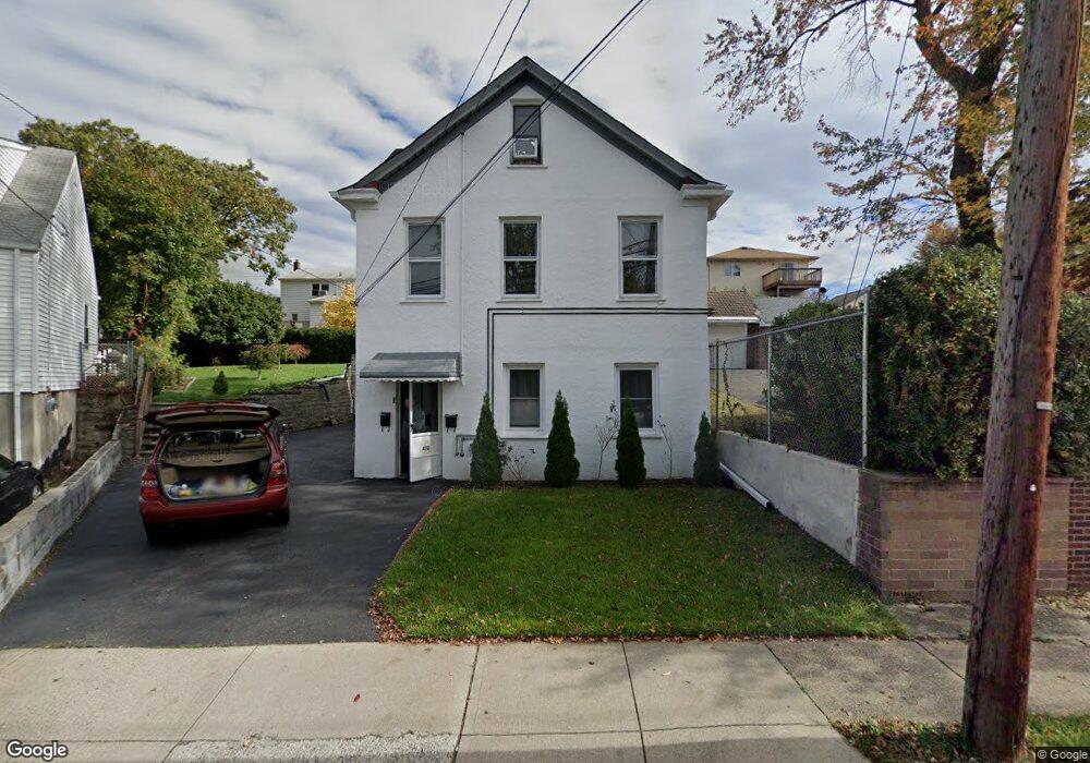
466 Macarthur Ave Unit 1 Garfield, NJ 07026
Estimated Value: $538,000 - $671,000
2
Beds
1
Bath
1,632
Sq Ft
$375/Sq Ft
Est. Value
About This Home
This home is located at 466 Macarthur Ave Unit 1, Garfield, NJ 07026 and is currently estimated at $611,308, approximately $374 per square foot. 466 Macarthur Ave Unit 1 is a home located in Bergen County with nearby schools including Garfield High School and Bergen Arts and Sciences Charter School.
Ownership History
Date
Name
Owned For
Owner Type
Purchase Details
Closed on
Oct 6, 2016
Sold by
Zangara Rosaria and Zangara Sally
Bought by
Ruiz Leobardo and Ruiz Norma
Current Estimated Value
Home Financials for this Owner
Home Financials are based on the most recent Mortgage that was taken out on this home.
Original Mortgage
$303,805
Outstanding Balance
$240,895
Interest Rate
3.12%
Mortgage Type
FHA
Estimated Equity
$370,413
Purchase Details
Closed on
Mar 2, 1984
Bought by
Zangara Benjamin and Zangara Rosaria
Create a Home Valuation Report for This Property
The Home Valuation Report is an in-depth analysis detailing your home's value as well as a comparison with similar homes in the area
Home Values in the Area
Average Home Value in this Area
Purchase History
| Date | Buyer | Sale Price | Title Company |
|---|---|---|---|
| Ruiz Leobardo | $309,500 | Westcor Land Title Insurance | |
| Zangara Benjamin | -- | -- |
Source: Public Records
Mortgage History
| Date | Status | Borrower | Loan Amount |
|---|---|---|---|
| Open | Ruiz Leobardo | $303,805 |
Source: Public Records
Tax History Compared to Growth
Tax History
| Year | Tax Paid | Tax Assessment Tax Assessment Total Assessment is a certain percentage of the fair market value that is determined by local assessors to be the total taxable value of land and additions on the property. | Land | Improvement |
|---|---|---|---|---|
| 2025 | $9,664 | $289,600 | $136,300 | $153,300 |
| 2024 | $9,502 | $289,600 | $136,300 | $153,300 |
| 2023 | $9,033 | $289,600 | $136,300 | $153,300 |
| 2022 | $9,033 | $289,600 | $136,300 | $153,300 |
| 2021 | $8,508 | $289,600 | $136,300 | $153,300 |
| 2020 | $8,578 | $289,600 | $136,300 | $153,300 |
| 2019 | $8,416 | $289,600 | $136,300 | $153,300 |
| 2018 | $8,228 | $289,600 | $136,300 | $153,300 |
| 2017 | $8,083 | $289,600 | $136,300 | $153,300 |
| 2016 | $7,842 | $289,600 | $136,300 | $153,300 |
| 2015 | $7,398 | $289,600 | $136,300 | $153,300 |
| 2014 | $7,196 | $289,600 | $136,300 | $153,300 |
Source: Public Records
Map
Nearby Homes
- 280 Malcolm Ave
- 355 Westminster Place
- 599 Harrison Ave
- 363 Macarthur Ave
- 356 Westminster Place
- 173 Corabelle Ave
- 345 2nd St
- 144 Corabelle Ave
- 315 President St
- 309 President St
- 36 Poplar St
- 40 Poplar St
- 29 Poplar St
- 203 Westervelt Place
- 55 Burns Ave
- 17 Green Ct
- 280 South Blvd
- 288 Outwater Ln
- 126 Plauderville Ave
- 374 Semel Ave
- 466 Macarthur Ave
- 470 Macarthur Ave Unit 1
- 468 Macarthur Ave
- 499 Harrison Ave
- 454 Macarthur Ave
- 472 Macarthur Ave
- 472 Macarthur Ave Unit 4
- 472 Macarthur Ave Unit 5
- 472 Macarthur Ave Unit 2
- 495 Harrison Ave
- 507 Harrison Ave
- 473 Macarthur Ave
- 115 High St
- 491 Harrison Ave
- 475 Macarthur Ave
- 481 Harrison Ave
- 455 Macarthur Ave
- 448 Macarthur Ave
- 134 Krakow St
- 477 Macarthur Ave