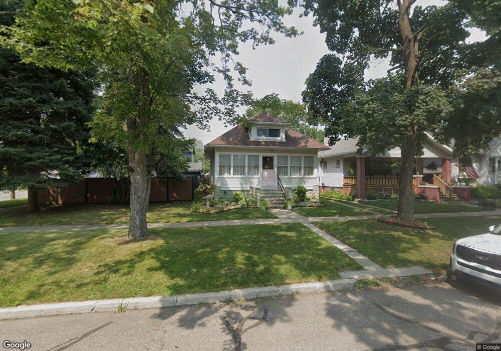
466 Poplar St Unit Bldg-Unit Wyandotte, MI 48192
Estimated Value: $215,000 - $316,000
--
Bed
3
Baths
1,348
Sq Ft
$192/Sq Ft
Est. Value
About This Home
This home is located at 466 Poplar St Unit Bldg-Unit, Wyandotte, MI 48192 and is currently estimated at $259,345, approximately $192 per square foot. 466 Poplar St Unit Bldg-Unit is a home located in Wayne County with nearby schools including James A. Garfield Elementary School, Woodrow Wilson School, and Roosevelt High School.
Ownership History
Date
Name
Owned For
Owner Type
Purchase Details
Closed on
Jan 12, 2018
Sold by
New Genesis Property Solutions
Bought by
Ashlin Raquel and Ashlin Matthew
Current Estimated Value
Purchase Details
Closed on
Oct 19, 2016
Sold by
Wells Fargo Bank Na
Bought by
New Genesis Property Solutions Llc
Purchase Details
Closed on
Nov 12, 2015
Sold by
Duff Joseph L
Bought by
Wells Fargo Bank Na
Purchase Details
Closed on
Jan 18, 2005
Sold by
Mcintosh Jeffrey T
Bought by
Duff Joseph L
Create a Home Valuation Report for This Property
The Home Valuation Report is an in-depth analysis detailing your home's value as well as a comparison with similar homes in the area
Home Values in the Area
Average Home Value in this Area
Purchase History
| Date | Buyer | Sale Price | Title Company |
|---|---|---|---|
| Ashlin Raquel | $175,000 | Reputation First Title Agenc | |
| New Genesis Property Solutions Llc | $42,099 | None Available | |
| Wells Fargo Bank Na | $80,076 | Attorney | |
| Duff Joseph L | $133,300 | Multiple |
Source: Public Records
Tax History Compared to Growth
Tax History
| Year | Tax Paid | Tax Assessment Tax Assessment Total Assessment is a certain percentage of the fair market value that is determined by local assessors to be the total taxable value of land and additions on the property. | Land | Improvement |
|---|---|---|---|---|
| 2025 | $2,757 | $95,200 | $0 | $0 |
| 2024 | $2,757 | $88,400 | $0 | $0 |
| 2023 | $2,629 | $79,400 | $0 | $0 |
| 2022 | $3,045 | $69,300 | $0 | $0 |
| 2021 | $2,984 | $62,300 | $0 | $0 |
| 2020 | $2,943 | $54,900 | $0 | $0 |
| 2019 | $2,902 | $52,900 | $0 | $0 |
| 2018 | $2,018 | $47,100 | $0 | $0 |
| 2017 | $1,801 | $47,100 | $0 | $0 |
| 2016 | $2,442 | $42,800 | $0 | $0 |
| 2015 | $3,747 | $39,700 | $0 | $0 |
| 2013 | $3,630 | $36,300 | $0 | $0 |
| 2012 | $1,679 | $38,000 | $7,800 | $30,200 |
Source: Public Records
Map
Nearby Homes
- 355 Poplar St
- 2619 5th St
- 618 Walnut St
- 519 Mulberry St Unit 33
- 532 Chestnut St
- 250 Chestnut St
- 126 Poplar St
- 254 Cedar St
- 117 Walnut St
- 2120 5th St
- 1136 Superior Blvd
- 2032 3rd St
- 166 Oak St
- 166 Oak St Unit 4
- 682 4th St
- 2116 Biddle Ave
- 2338 9th St
- 2821 Biddle Ave Unit 38
- 2492 Electric St
- 2851 Biddle Ave