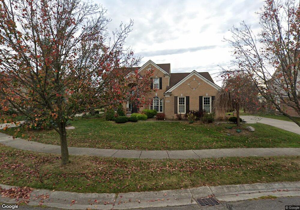
46609 Inverness Rd Canton, MI 48188
Estimated Value: $571,422 - $645,000
--
Bed
3
Baths
2,640
Sq Ft
$234/Sq Ft
Est. Value
About This Home
This home is located at 46609 Inverness Rd, Canton, MI 48188 and is currently estimated at $616,856, approximately $233 per square foot. 46609 Inverness Rd is a home located in Wayne County with nearby schools including Canton High School, Plymouth High School, and Salem High School.
Ownership History
Date
Name
Owned For
Owner Type
Purchase Details
Closed on
Jul 27, 2018
Sold by
Dunne Walter E
Bought by
Hammond Wissan and Naseredeine Amal
Current Estimated Value
Purchase Details
Closed on
Apr 9, 2015
Sold by
Dunne Walter E and Dunne Mary Ann
Bought by
The Walter E Dunne Revocable Trust
Purchase Details
Closed on
Nov 19, 2004
Sold by
Horner Mary L and Pantier Mary L
Bought by
Dunne Walter E
Purchase Details
Closed on
Oct 25, 2002
Sold by
Horner Ralph F
Bought by
Horner Mary L
Purchase Details
Closed on
Jul 16, 2002
Sold by
Horner Ralph F
Bought by
Horner Mary L
Purchase Details
Closed on
Mar 5, 1993
Sold by
Fairway Pines Ltd Ptns
Bought by
Co-Ptns Curtis-Canton
Create a Home Valuation Report for This Property
The Home Valuation Report is an in-depth analysis detailing your home's value as well as a comparison with similar homes in the area
Home Values in the Area
Average Home Value in this Area
Purchase History
| Date | Buyer | Sale Price | Title Company |
|---|---|---|---|
| Hammond Wissan | $403,000 | None Available | |
| The Walter E Dunne Revocable Trust | -- | None Available | |
| Dunne Walter E | $400,000 | Metropolitan Title Company | |
| Horner Mary L | -- | -- | |
| Horner Mary L | -- | -- | |
| Co-Ptns Curtis-Canton | $55,000 | -- |
Source: Public Records
Tax History Compared to Growth
Tax History
| Year | Tax Paid | Tax Assessment Tax Assessment Total Assessment is a certain percentage of the fair market value that is determined by local assessors to be the total taxable value of land and additions on the property. | Land | Improvement |
|---|---|---|---|---|
| 2025 | $3,996 | $268,300 | $0 | $0 |
| 2024 | $3,996 | $231,700 | $0 | $0 |
| 2023 | $3,810 | $229,000 | $0 | $0 |
| 2022 | $8,212 | $203,900 | $0 | $0 |
| 2021 | $7,966 | $203,400 | $0 | $0 |
| 2020 | $7,869 | $196,100 | $0 | $0 |
| 2019 | $7,723 | $188,260 | $0 | $0 |
| 2018 | $2,774 | $177,810 | $0 | $0 |
| 2017 | $6,753 | $176,700 | $0 | $0 |
| 2016 | $6,090 | $178,500 | $0 | $0 |
| 2015 | $15,401 | $157,550 | $0 | $0 |
| 2013 | $14,920 | $161,920 | $0 | $0 |
| 2010 | -- | $134,940 | $68,722 | $66,218 |
Source: Public Records
Map
Nearby Homes
- 241 Country Club Ln
- 51026 Meadowlands
- 316 Queen Anne Dr
- 45400 William Ct
- 1564 Crowndale Ln
- 47078 Bing Dr
- 500 Belvedere Ct N
- 1861 Stonebridge Way
- 45242 Thornhill Rd
- 1752 Thistle Dr
- 1709 Thistle Dr Unit 51
- 46502 Killarney Cir Unit 191
- 2498 Cleveland Way
- 2304 Cleveland Way
- 288 Edington Cir Unit 61
- 45030 Glengarry Rd
- 45801 Henley Dr
- 685 N Beck Rd
- 46449 Killarney Ct Unit Bldg-Unit160
- 1849 Wentworth Ct
- 46635 Inverness Rd
- 46583 Inverness Rd
- 46576 Inverness Rd
- 46657 Inverness Rd
- 46559 Inverness Rd
- 46638 Inverness Rd
- 46547 Inverness Rd
- 46518 Inverness Rd
- 46681 Inverness Rd
- 46670 Inverness Rd
- 46523 Inverness Rd
- 674 Brookmill Ct
- 46692 Inverness Rd
- 46462 Inverness Rd
- 46703 Inverness Rd
- 46475 Inverness Rd
- 655 Brookmill Ct
- 46714 Inverness Rd
- 46451 Inverness Rd
- 652 Brookmill Ct