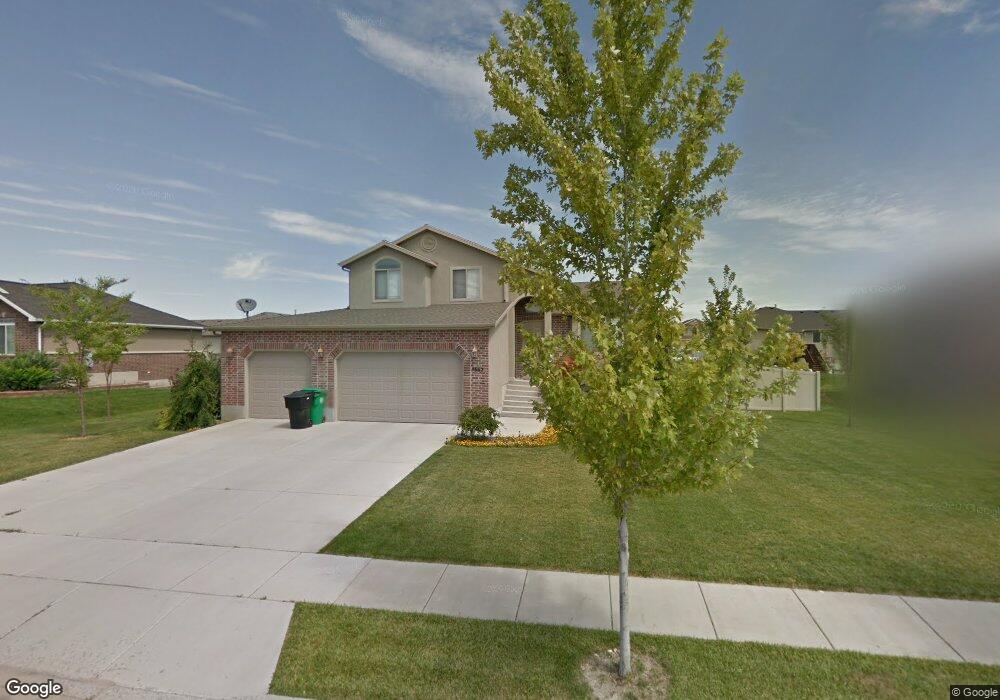
4662 Sage Dr Unit 235 West Point, UT 84015
Estimated Value: $554,340 - $601,000
3
Beds
3
Baths
1,850
Sq Ft
$314/Sq Ft
Est. Value
About This Home
This home is located at 4662 Sage Dr Unit 235, West Point, UT 84015 and is currently estimated at $580,085, approximately $313 per square foot. 4662 Sage Dr Unit 235 is a home located in Davis County with nearby schools including West Point School, West Point Junior High School, and Syracuse High School.
Ownership History
Date
Name
Owned For
Owner Type
Purchase Details
Closed on
Jul 19, 2011
Sold by
Green Jennifer E and Green Richard V
Bought by
Richins Brody and Richins Amber
Current Estimated Value
Home Financials for this Owner
Home Financials are based on the most recent Mortgage that was taken out on this home.
Original Mortgage
$185,250
Outstanding Balance
$127,085
Interest Rate
4.45%
Mortgage Type
New Conventional
Estimated Equity
$453,000
Purchase Details
Closed on
Aug 19, 2005
Sold by
Neuenschwander Seth
Bought by
Green Richard and Green Jennfer E
Home Financials for this Owner
Home Financials are based on the most recent Mortgage that was taken out on this home.
Original Mortgage
$37,800
Interest Rate
5.12%
Mortgage Type
Stand Alone Second
Purchase Details
Closed on
Jan 11, 2005
Sold by
Spartan Paice Llc
Bought by
Susan Beth
Home Financials for this Owner
Home Financials are based on the most recent Mortgage that was taken out on this home.
Original Mortgage
$100,000
Interest Rate
5.8%
Mortgage Type
Purchase Money Mortgage
Create a Home Valuation Report for This Property
The Home Valuation Report is an in-depth analysis detailing your home's value as well as a comparison with similar homes in the area
Home Values in the Area
Average Home Value in this Area
Purchase History
| Date | Buyer | Sale Price | Title Company |
|---|---|---|---|
| Richins Brody | -- | Mountain View Title | |
| Green Richard | -- | First American Title | |
| Susan Beth | -- | None Available |
Source: Public Records
Mortgage History
| Date | Status | Borrower | Loan Amount |
|---|---|---|---|
| Open | Richins Brody | $185,250 | |
| Previous Owner | Green Richard | $37,800 | |
| Previous Owner | Green Richard | $151,200 | |
| Previous Owner | Susan Beth | $100,000 |
Source: Public Records
Tax History Compared to Growth
Tax History
| Year | Tax Paid | Tax Assessment Tax Assessment Total Assessment is a certain percentage of the fair market value that is determined by local assessors to be the total taxable value of land and additions on the property. | Land | Improvement |
|---|---|---|---|---|
| 2025 | $2,892 | $266,200 | $108,280 | $157,920 |
| 2024 | $2,928 | $270,600 | $97,507 | $173,093 |
| 2023 | $2,701 | $459,000 | $120,137 | $338,863 |
| 2022 | $2,902 | $270,050 | $62,103 | $207,947 |
| 2021 | $2,652 | $369,000 | $98,545 | $270,455 |
| 2020 | $2,329 | $319,000 | $82,509 | $236,491 |
| 2019 | $2,260 | $305,000 | $80,132 | $224,868 |
| 2018 | $2,115 | $281,000 | $80,745 | $200,255 |
| 2016 | $1,848 | $128,810 | $31,215 | $97,595 |
| 2015 | $1,857 | $122,705 | $31,215 | $91,490 |
| 2014 | $1,672 | $111,747 | $31,215 | $80,532 |
| 2013 | -- | $114,992 | $31,020 | $83,972 |
Source: Public Records
Map
Nearby Homes
- 4594 W 75 N Unit 405
- 4669 W 75 N
- 128 N 4500 W
- 4366 W 200 N
- 4352 W 300 N
- 477 N 4500 W
- 4325 W 75 N
- 120 N 4325 W
- 4362 West St Unit 106
- 4358 West St Unit 105
- 4719 W 650 N
- 357 N 4000 W
- 356 S 4300 W Unit 611
- 4260 W 350 S
- 364 S 4300 W Unit 610
- 3949 W 250 N
- 3851 W 50 S Unit 425
- 3849 W 50 S Unit 426
- 114 3830 W
- 3847 W 50 S Unit 428
- 4662 Sage Dr
- 4682 Sage Dr
- 4632 Sage Dr Unit 234
- 4682 W 175 N
- 4659 W 250 N
- 4659 Jean Dr Unit 230
- 222 Green Head Ln Unit 229
- 4635 Jean Dr Unit 231
- 190 Green Head Ln Unit 236
- 227 Green Head Ln Unit 228
- 4653 Sage Dr Unit 220
- 4610 Sage Dr Unit 233
- 164 N 4700 W
- 223 N 4600 W
- 4621 Sage Dr Unit 219
- 195 Green Head Ln Unit 227
- 195 Green Head Ln
- 4607 Jean Dr Unit 232
- 169 N 4700 W
- 169 Green Head Ln Unit 226