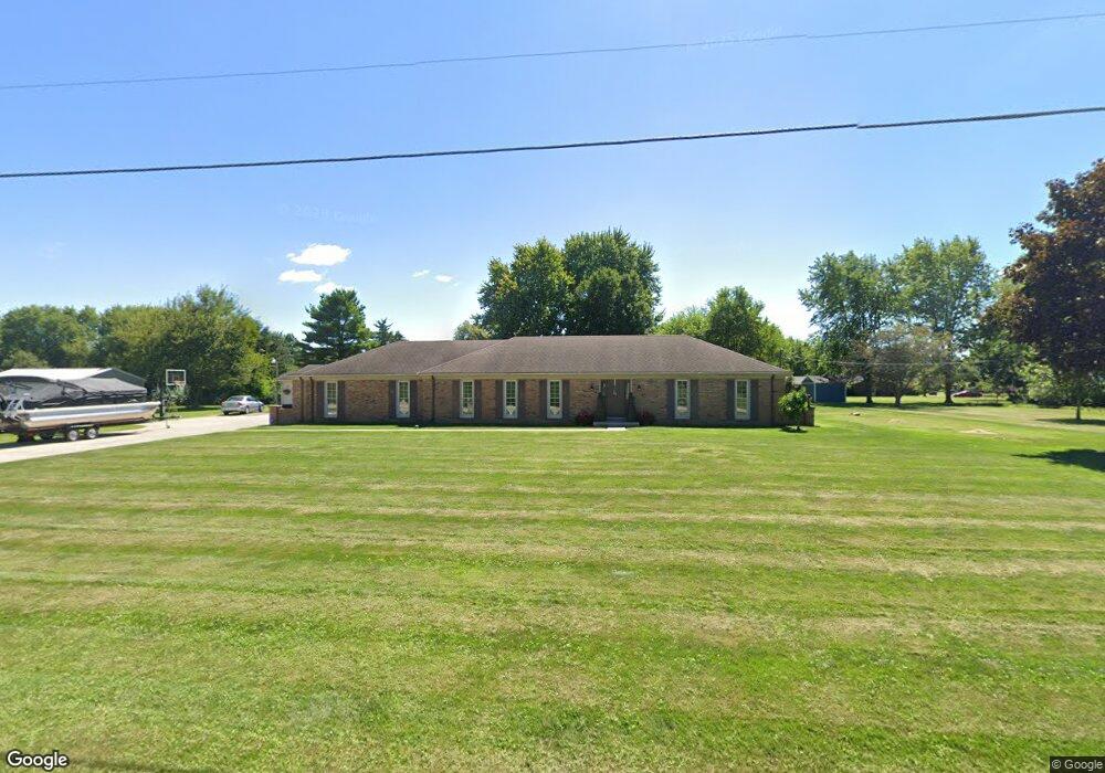
4663 Mumper Rd Springfield, OH 45502
Estimated Value: $315,365 - $381,000
3
Beds
2
Baths
1,798
Sq Ft
$197/Sq Ft
Est. Value
About This Home
This home is located at 4663 Mumper Rd, Springfield, OH 45502 and is currently estimated at $354,591, approximately $197 per square foot. 4663 Mumper Rd is a home located in Clark County with nearby schools including Northridge Elementary School and Kenton Ridge Middle & High School.
Ownership History
Date
Name
Owned For
Owner Type
Purchase Details
Closed on
Sep 30, 2009
Sold by
Ballard Donald W and Ballard Jodi M
Bought by
Comer Donald E
Current Estimated Value
Home Financials for this Owner
Home Financials are based on the most recent Mortgage that was taken out on this home.
Original Mortgage
$148,400
Outstanding Balance
$96,263
Interest Rate
5.19%
Mortgage Type
New Conventional
Estimated Equity
$258,328
Purchase Details
Closed on
Apr 6, 2003
Sold by
Michael Ballard Donald W and Michael Jodi M
Bought by
Ballard Donald W and Ballard Jodi M
Purchase Details
Closed on
Oct 9, 1996
Sold by
Himes Ronald D
Bought by
Michael Donald W Ballard and Michael Jodi M
Home Financials for this Owner
Home Financials are based on the most recent Mortgage that was taken out on this home.
Original Mortgage
$108,000
Interest Rate
8.14%
Mortgage Type
New Conventional
Create a Home Valuation Report for This Property
The Home Valuation Report is an in-depth analysis detailing your home's value as well as a comparison with similar homes in the area
Purchase History
| Date | Buyer | Sale Price | Title Company |
|---|---|---|---|
| Comer Donald E | $185,500 | Attorney | |
| Ballard Donald W | -- | -- | |
| Michael Donald W Ballard | $128,000 | -- |
Source: Public Records
Mortgage History
| Date | Status | Borrower | Loan Amount |
|---|---|---|---|
| Open | Comer Donald E | $148,400 | |
| Previous Owner | Michael Donald W Ballard | $108,000 |
Source: Public Records
Tax History
| Year | Tax Paid | Tax Assessment Tax Assessment Total Assessment is a certain percentage of the fair market value that is determined by local assessors to be the total taxable value of land and additions on the property. | Land | Improvement |
|---|---|---|---|---|
| 2025 | $2,941 | $95,460 | $26,300 | $69,160 |
| 2024 | $2,844 | $67,260 | $19,090 | $48,170 |
| 2023 | $2,844 | $67,260 | $19,090 | $48,170 |
| 2022 | $2,855 | $67,260 | $19,090 | $48,170 |
| 2021 | $3,080 | $61,410 | $15,150 | $46,260 |
| 2020 | $3,083 | $61,410 | $15,150 | $46,260 |
| 2019 | $3,142 | $61,410 | $15,150 | $46,260 |
| 2018 | $2,922 | $54,810 | $15,150 | $39,660 |
| 2017 | $2,505 | $54,800 | $15,152 | $39,648 |
| 2016 | $2,429 | $53,631 | $15,152 | $38,479 |
| 2015 | $2,588 | $53,631 | $15,152 | $38,479 |
| 2014 | $2,588 | $53,631 | $15,152 | $38,479 |
| 2013 | $2,528 | $53,631 | $15,152 | $38,479 |
Source: Public Records
Map
Nearby Homes
- 4607 Plateau Dr S
- 4273 Kay Ave
- 4954 E County Line Rd
- 4293 Yale St
- 5060 Morris Rd
- 1977 Willoughby Ave
- 5309 Virts Rd
- 4500 Bosart Rd
- 1812 Willow Lakes Dr
- 1836 Dunseth Ln
- 9 Middle Urbana Rd
- 5393 Neer Rd
- 4890 Brannan Dr W Unit 4890
- 1470 Oldham Dr Unit 12
- 1398 Elizabeth Ct Unit 66
- 5564 Ridgewood Rd E Unit 7
- 4180 Briarwood Dr
- 1495 Victorian Way
- 4381 Briarwood Dr
- 1521 Erika Dr
- 4695 Mumper Rd
- 6430 Floyd Dr
- 6334 Plateau Dr
- 6326 Plateau Dr
- 6340 Plateau Dr
- 4630 Mumper Rd
- 4737 Mumper Rd
- 4680 Mumper Rd
- 4570 Mumper Rd
- 4571 Mumper Rd
- 6425 Floyd Dr
- 6333 Plateau Dr
- 6407 Floyd Dr
- 6325 Plateau Dr
- 6330 Floyd Dr
- 6343 Floyd Dr
- 4560 Mumper Rd
- 4781 Mumper Rd
- 6320 Plateau Dr
- 6319 Plateau Dr
Your Personal Tour Guide
Ask me questions while you tour the home.