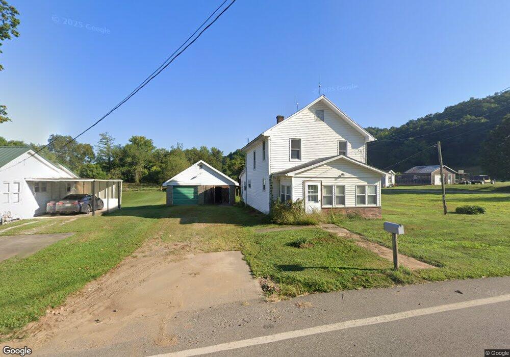
46690 State Route 248 Long Bottom, OH 45743
Estimated Value: $178,000 - $246,277
--
Bed
1
Bath
1,324
Sq Ft
$151/Sq Ft
Est. Value
About This Home
This home is located at 46690 State Route 248, Long Bottom, OH 45743 and is currently estimated at $199,569, approximately $150 per square foot. 46690 State Route 248 is a home located in Meigs County with nearby schools including Eastern Elementary School and Eastern High School.
Ownership History
Date
Name
Owned For
Owner Type
Purchase Details
Closed on
Jan 9, 2020
Sold by
Werry Philip Raymond and Obrien Sherry
Bought by
Werry Philip Brandon
Current Estimated Value
Purchase Details
Closed on
Oct 2, 2002
Bought by
Werry Joyce
Create a Home Valuation Report for This Property
The Home Valuation Report is an in-depth analysis detailing your home's value as well as a comparison with similar homes in the area
Home Values in the Area
Average Home Value in this Area
Purchase History
| Date | Buyer | Sale Price | Title Company |
|---|---|---|---|
| Werry Philip Brandon | $150,000 | None Available | |
| Werry Joyce | -- | -- |
Source: Public Records
Tax History Compared to Growth
Tax History
| Year | Tax Paid | Tax Assessment Tax Assessment Total Assessment is a certain percentage of the fair market value that is determined by local assessors to be the total taxable value of land and additions on the property. | Land | Improvement |
|---|---|---|---|---|
| 2024 | $819 | $24,940 | $4,870 | $20,070 |
| 2023 | $819 | $24,940 | $4,870 | $20,070 |
| 2022 | $826 | $24,940 | $4,870 | $20,070 |
| 2021 | $647 | $18,800 | $4,880 | $13,920 |
| 2020 | $647 | $18,800 | $4,880 | $13,920 |
| 2019 | $342 | $18,800 | $4,880 | $13,920 |
| 2018 | $241 | $15,960 | $3,190 | $12,770 |
| 2017 | $241 | $15,960 | $3,190 | $12,770 |
| 2016 | $247 | $15,960 | $3,190 | $12,770 |
| 2014 | $324 | $18,930 | $3,120 | $15,810 |
| 2013 | $324 | $18,930 | $3,120 | $15,810 |
Source: Public Records
Map
Nearby Homes
- 37227 Bashan Rd
- 37080 Skinner Rd
- 43970 Cook Rd
- 43240 Smith-Goeglein
- 43219 Smith Goeglein Dr
- 35975 Flatwoods Rd
- 34618 Bashan Rd
- 0 Cook
- 0 Mount Olive Rd Unit 20799198
- 40601 E Shade Rd
- 0 Rocksprings Rd
- 39834 State Route 7
- 0 Bigley Ridge Rd
- 37355 Rocksprings Rd
- 47065 Morning Star Rd
- 0 Morning Star Rd
- 0 Wills Hill Rd
- 0 Bigley Run Rd
- 32658 Rose Hill Rd
- 41601 Foxhill Rd
- 46710 State Route 248
- 46670 State Route 248
- 46707 State Route 248
- 46683 State Route 248
- 46661 Ohio 248
- 46661 State Route 248
- 46642 State Route 248
- 46739 State Route 248
- 46657 State Route 248
- 46612 State Route 248
- 46608 State Route 248
- 46599 Ohio 248
- 46599 State Route 248
- 46589 State Route 248
- 36380 New Hope Rd
- 36384 New Hope Rd
- 36460 New Hope Rd
- 248 Sr
- 36494 New Hope Rd
- 36485 New Hope Rd