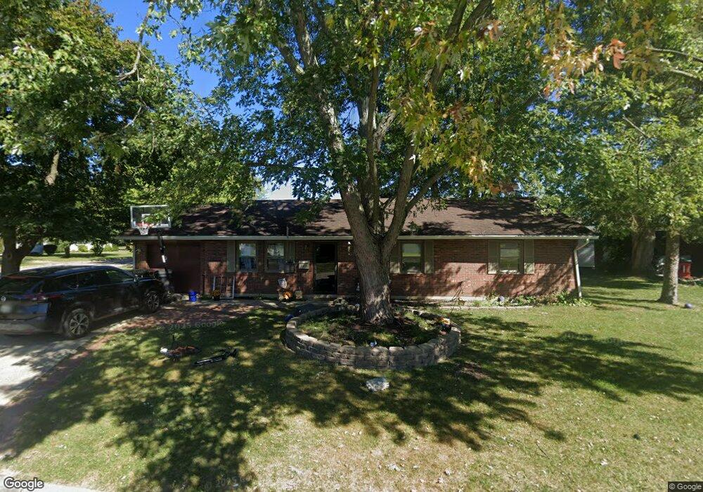
467 Brooke Blvd Wilmington, OH 45177
Estimated Value: $172,000 - $206,000
3
Beds
1
Bath
1,222
Sq Ft
$155/Sq Ft
Est. Value
About This Home
This home is located at 467 Brooke Blvd, Wilmington, OH 45177 and is currently estimated at $189,755, approximately $155 per square foot. 467 Brooke Blvd is a home located in Clinton County with nearby schools including East End Elementary School, Denver Place Elementary School, and Roy E. Holmes Elementary School.
Ownership History
Date
Name
Owned For
Owner Type
Purchase Details
Closed on
Aug 2, 2011
Sold by
Frost James L and Frost Jeff L
Bought by
Vance Rhianna M
Current Estimated Value
Home Financials for this Owner
Home Financials are based on the most recent Mortgage that was taken out on this home.
Original Mortgage
$84,352
Outstanding Balance
$58,594
Interest Rate
4.64%
Estimated Equity
$131,161
Purchase Details
Closed on
Aug 26, 2010
Sold by
Ralph D Fizer Jr Sheriff Of Clinton Cou
Bought by
Frost James L and Frost Jeff L
Purchase Details
Closed on
Mar 24, 1995
Bought by
Mitchell Jack E
Create a Home Valuation Report for This Property
The Home Valuation Report is an in-depth analysis detailing your home's value as well as a comparison with similar homes in the area
Home Values in the Area
Average Home Value in this Area
Purchase History
| Date | Buyer | Sale Price | Title Company |
|---|---|---|---|
| Vance Rhianna M | -- | -- | |
| Frost James L | -- | -- | |
| Mitchell Jack E | -- | -- |
Source: Public Records
Mortgage History
| Date | Status | Borrower | Loan Amount |
|---|---|---|---|
| Open | Vance Rhianna M | $84,352 |
Source: Public Records
Tax History Compared to Growth
Tax History
| Year | Tax Paid | Tax Assessment Tax Assessment Total Assessment is a certain percentage of the fair market value that is determined by local assessors to be the total taxable value of land and additions on the property. | Land | Improvement |
|---|---|---|---|---|
| 2024 | $1,569 | $46,730 | $8,050 | $38,680 |
| 2023 | $1,569 | $46,730 | $8,050 | $38,680 |
| 2022 | $1,403 | $39,320 | $7,280 | $32,040 |
| 2021 | $1,420 | $39,320 | $7,280 | $32,040 |
| 2020 | $1,334 | $39,320 | $7,280 | $32,040 |
| 2019 | $1,291 | $34,730 | $8,280 | $26,450 |
| 2018 | $1,303 | $34,730 | $8,280 | $26,450 |
| 2017 | $1,266 | $34,730 | $8,280 | $26,450 |
| 2016 | $985 | $25,980 | $8,160 | $17,820 |
| 2015 | $970 | $25,980 | $8,160 | $17,820 |
| 2013 | $1,009 | $26,710 | $8,160 | $18,550 |
Source: Public Records
Map
Nearby Homes
- 0 Mccoy Rd Unit 1761017
- 719 Hiatt Ave
- 793 Hiatt Ave
- 0 S St Rt 73 Unit 1827681
- 619 Hiatt Ave
- 215 Leyland Park Dr Unit 1C
- Edmon Plan at Creekview
- Elder Plan at Creekview
- Sullivan Plan at Creekview
- Cabral Plan at Creekview
- Elm Plan at Creekview
- Pine Plan at Creekview
- 813 N Lincoln St
- 26 E Kentucky Ave
- 320 Lorish Ave
- 353 Hiatt Ave
- 165 Lorish Ave
- 0 Prairie Ave Unit 1793216
- 31 Fairland Ave
- 1005 N South St
- 1024 Williams Dr
- 0 Mccoy Rd Unit 16093719
- 0 Denver Rd Unit 1768800
- 0 Mccoy Rd Unit 1761019
- 0 Denver Rd Unit 1732718
- 0 Denver Rd Unit 859776
- 256 New Oglesbee Rd
- 0 Arbor Ridge Dr Unit 1729983
- Lot Lynne Ln
- 479 Brooke Blvd
- 468 Florence Ave
- 478 Florence Ave
- 997 Williams Dr
- 1015 Williams Dr
- 414 Florence Ave
- 492 Florence Ave
- 1025 Williams Dr
- 493 Brooke Blvd
- 470 Brooke Blvd
- 406 Florence Ave