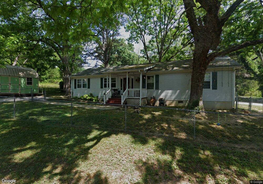
467 Davis Ave Toccoa, GA 30577
Estimated Value: $190,000 - $220,000
3
Beds
2
Baths
1,344
Sq Ft
$152/Sq Ft
Est. Value
About This Home
This home is located at 467 Davis Ave, Toccoa, GA 30577 and is currently estimated at $203,635, approximately $151 per square foot. 467 Davis Ave is a home located in Stephens County with nearby schools including Stephens County High School.
Ownership History
Date
Name
Owned For
Owner Type
Purchase Details
Closed on
May 25, 2018
Sold by
Nolan Kenneth William
Bought by
Blalock Patricia and Blalock Adam F
Current Estimated Value
Home Financials for this Owner
Home Financials are based on the most recent Mortgage that was taken out on this home.
Original Mortgage
$87,878
Outstanding Balance
$75,517
Interest Rate
4.5%
Mortgage Type
New Conventional
Estimated Equity
$128,118
Purchase Details
Closed on
Nov 10, 2011
Sold by
Nolan Carmen Michelle
Bought by
Nolan Kenneth William
Purchase Details
Closed on
Nov 7, 2011
Sold by
Nolan Carmen Michelle
Bought by
Nolan Kenneth William
Purchase Details
Closed on
Jul 1, 1998
Bought by
Nolan Kenneth W and Nolan Carmen M
Purchase Details
Closed on
Nov 1, 1996
Bought by
<Buyer Info Not Present>
Create a Home Valuation Report for This Property
The Home Valuation Report is an in-depth analysis detailing your home's value as well as a comparison with similar homes in the area
Purchase History
| Date | Buyer | Sale Price | Title Company |
|---|---|---|---|
| Blalock Patricia | $87,000 | -- | |
| Nolan Kenneth William | -- | -- | |
| Nolan Kenneth William | -- | -- | |
| Nolan Kenneth W | $62,700 | -- | |
| <Buyer Info Not Present> | $2,500 | -- |
Source: Public Records
Mortgage History
| Date | Status | Borrower | Loan Amount |
|---|---|---|---|
| Open | Blalock Patricia | $87,878 |
Source: Public Records
Tax History
| Year | Tax Paid | Tax Assessment Tax Assessment Total Assessment is a certain percentage of the fair market value that is determined by local assessors to be the total taxable value of land and additions on the property. | Land | Improvement |
|---|---|---|---|---|
| 2025 | $1,958 | $69,645 | $1,046 | $68,599 |
| 2024 | $1,513 | $44,154 | $1,046 | $43,108 |
| 2023 | $1,382 | $40,745 | $1,046 | $39,699 |
| 2022 | $1,075 | $38,102 | $1,046 | $37,056 |
| 2021 | $1,019 | $34,592 | $1,046 | $33,546 |
| 2020 | $1,037 | $34,826 | $1,046 | $33,780 |
| 2019 | $1,040 | $34,826 | $1,046 | $33,780 |
| 2018 | $1,104 | $34,826 | $1,046 | $33,780 |
| 2017 | $1,057 | $34,826 | $1,046 | $33,780 |
| 2016 | $1,041 | $34,825 | $1,045 | $33,780 |
| 2015 | $1,120 | $35,725 | $1,045 | $34,680 |
| 2014 | $1,139 | $35,726 | $1,046 | $34,680 |
| 2013 | -- | $35,725 | $1,045 | $34,680 |
Source: Public Records
Map
Nearby Homes
Your Personal Tour Guide
Ask me questions while you tour the home.