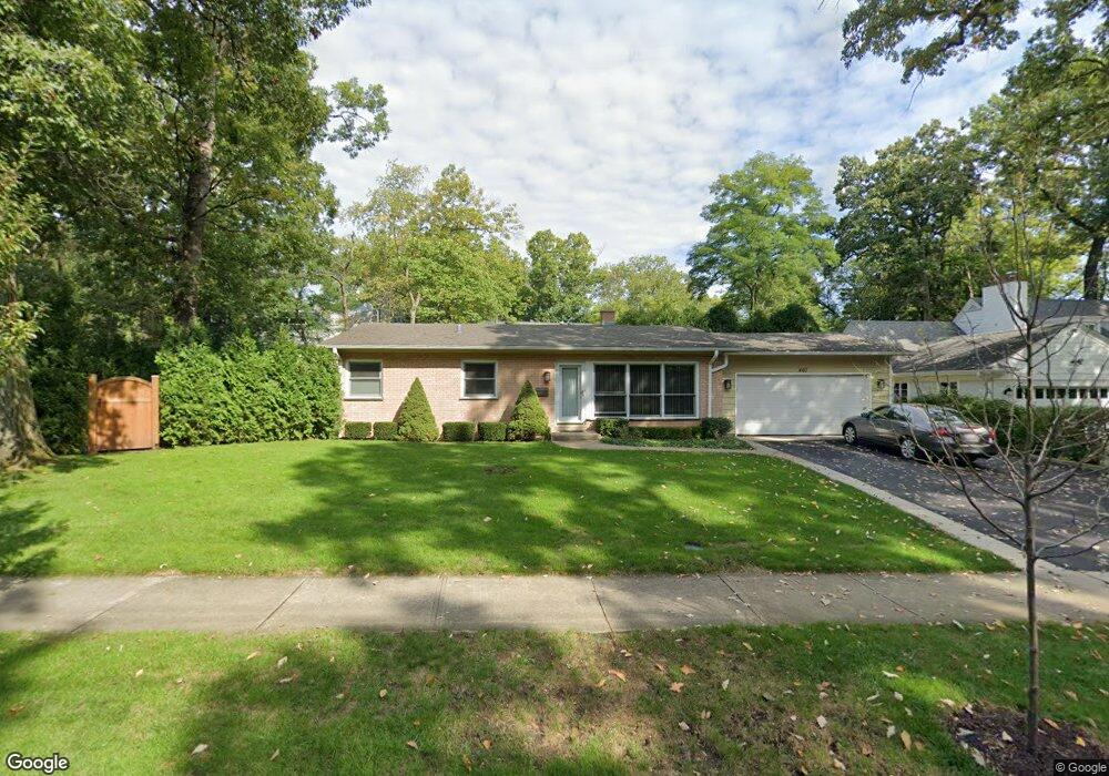
467 Lambert Tree Rd Highland Park, IL 60035
East Highland Park NeighborhoodEstimated Value: $449,000 - $610,000
--
Bed
2
Baths
1,189
Sq Ft
$440/Sq Ft
Est. Value
About This Home
This home is located at 467 Lambert Tree Rd, Highland Park, IL 60035 and is currently estimated at $523,027, approximately $439 per square foot. 467 Lambert Tree Rd is a home located in Lake County with nearby schools including Braeside Elementary School, Edgewood Middle School, and Highland Park High School.
Ownership History
Date
Name
Owned For
Owner Type
Purchase Details
Closed on
Jun 18, 2002
Sold by
Olson Jeffrey A and Olson Irene
Bought by
Olson Jeffrey A and Olson Irene
Current Estimated Value
Home Financials for this Owner
Home Financials are based on the most recent Mortgage that was taken out on this home.
Original Mortgage
$228,000
Outstanding Balance
$87,430
Interest Rate
5.5%
Estimated Equity
$435,597
Purchase Details
Closed on
Mar 26, 1998
Sold by
Olson Irene
Bought by
Olson Jeffrey and Olson Jeffrey A
Purchase Details
Closed on
Jun 1, 1995
Sold by
Gibian Mortimer B and Gibian Eleanor S
Bought by
Olson Irene
Home Financials for this Owner
Home Financials are based on the most recent Mortgage that was taken out on this home.
Original Mortgage
$166,500
Interest Rate
8.26%
Create a Home Valuation Report for This Property
The Home Valuation Report is an in-depth analysis detailing your home's value as well as a comparison with similar homes in the area
Home Values in the Area
Average Home Value in this Area
Purchase History
| Date | Buyer | Sale Price | Title Company |
|---|---|---|---|
| Olson Jeffrey A | -- | Chicago Title Insurance Co | |
| Olson Jeffrey | -- | -- | |
| Olson Irene | $185,000 | Centennial Title Incorporate |
Source: Public Records
Mortgage History
| Date | Status | Borrower | Loan Amount |
|---|---|---|---|
| Open | Olson Jeffrey A | $228,000 | |
| Closed | Olson Irene | $166,500 |
Source: Public Records
Tax History Compared to Growth
Tax History
| Year | Tax Paid | Tax Assessment Tax Assessment Total Assessment is a certain percentage of the fair market value that is determined by local assessors to be the total taxable value of land and additions on the property. | Land | Improvement |
|---|---|---|---|---|
| 2024 | $8,889 | $121,295 | $60,258 | $61,037 |
| 2023 | $9,348 | $109,334 | $54,316 | $55,018 |
| 2022 | $9,348 | $109,803 | $59,669 | $50,134 |
| 2021 | $8,607 | $106,141 | $57,679 | $48,462 |
| 2020 | $8,329 | $106,141 | $57,679 | $48,462 |
| 2019 | $8,050 | $105,644 | $57,409 | $48,235 |
| 2018 | $9,084 | $125,243 | $62,857 | $62,386 |
| 2017 | $8,942 | $124,521 | $62,495 | $62,026 |
| 2016 | $8,609 | $118,546 | $59,496 | $59,050 |
| 2015 | $8,326 | $110,142 | $55,278 | $54,864 |
| 2014 | $7,361 | $95,868 | $49,220 | $46,648 |
| 2012 | $7,169 | $96,427 | $49,507 | $46,920 |
Source: Public Records
Map
Nearby Homes
- 378 Oakland Dr
- 590 Melody Ln
- 298 Leslee Ln
- 325 Lincolnwood Rd
- 625 Sheridan Rd
- 721 Marion Ave
- 732 Bronson Ln
- 600 Broadview Ave
- 847 Marion Ave
- 32 Valley Rd
- 566 Bellevue Place
- 19 Heritage Dr
- 8 Heritage Dr
- 906 Pleasant Ave
- 860 Green Bay Rd
- 55 S Deere Park Dr
- 1200 Green Bay Rd
- 1265 Longmeadow Ln
- 1180 Oak Ridge Dr
- 1330 Sheridan Rd
- 459 Lambert Tree Rd
- 450 Oakland Dr
- 464 Oakland Dr
- 440 Oakland Dr
- 445 Lambert Tree Rd
- 430 Oakland Dr
- 424 Ashland Place
- 416 Ashland Place
- 451 Oakland Dr
- 461 Oakland Dr
- 465 Oakland Dr
- 441 Saint Johns Ave
- 440 Ashland Place
- 431 Oakland Dr
- 410 Oakland Dr
- 453 Saint Johns Ave
- 425 Oakland Dr
- 403 Burton Ave
- 415 Lambert Tree Ave
- 415 Lambert Tree Rd