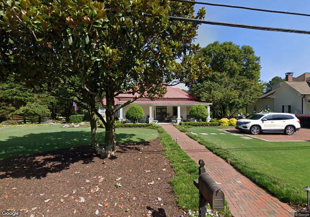
467 Main St Suwanee, GA 30024
Estimated Value: $553,000 - $777,000
2
Beds
1
Bath
2,013
Sq Ft
$352/Sq Ft
Est. Value
About This Home
This home is located at 467 Main St, Suwanee, GA 30024 and is currently estimated at $708,227, approximately $351 per square foot. 467 Main St is a home located in Gwinnett County with nearby schools including Roberts Elementary School, North Gwinnett Middle School, and North Gwinnett High School.
Ownership History
Date
Name
Owned For
Owner Type
Purchase Details
Closed on
Jul 25, 2014
Sold by
Buice Richard D
Bought by
Owen David and Owen Rochelle
Current Estimated Value
Home Financials for this Owner
Home Financials are based on the most recent Mortgage that was taken out on this home.
Original Mortgage
$266,600
Outstanding Balance
$202,705
Interest Rate
4.19%
Mortgage Type
New Conventional
Estimated Equity
$505,522
Purchase Details
Closed on
Nov 28, 2001
Sold by
Buice Richard D
Bought by
Buice Richard D and Buice Beverly
Home Financials for this Owner
Home Financials are based on the most recent Mortgage that was taken out on this home.
Original Mortgage
$68,500
Interest Rate
7.14%
Mortgage Type
New Conventional
Create a Home Valuation Report for This Property
The Home Valuation Report is an in-depth analysis detailing your home's value as well as a comparison with similar homes in the area
Home Values in the Area
Average Home Value in this Area
Purchase History
| Date | Buyer | Sale Price | Title Company |
|---|---|---|---|
| Owen David | $333,250 | -- | |
| Buice Richard D | -- | -- |
Source: Public Records
Mortgage History
| Date | Status | Borrower | Loan Amount |
|---|---|---|---|
| Open | Owen David | $266,600 | |
| Previous Owner | Buice Richard D | $68,500 |
Source: Public Records
Tax History
| Year | Tax Paid | Tax Assessment Tax Assessment Total Assessment is a certain percentage of the fair market value that is determined by local assessors to be the total taxable value of land and additions on the property. | Land | Improvement |
|---|---|---|---|---|
| 2025 | $5,992 | $255,880 | $60,760 | $195,120 |
| 2024 | $6,168 | $255,880 | $60,760 | $195,120 |
| 2023 | $6,168 | $255,880 | $60,760 | $195,120 |
| 2022 | $5,316 | $156,680 | $33,840 | $122,840 |
| 2021 | $5,025 | $156,680 | $33,840 | $122,840 |
| 2020 | $5,064 | $156,680 | $33,840 | $122,840 |
| 2019 | $3,359 | $113,880 | $35,160 | $78,720 |
| 2018 | $3,376 | $113,880 | $35,160 | $78,720 |
| 2016 | $3,127 | $102,442 | $29,886 | $72,556 |
| 2015 | $3,563 | $120,520 | $35,160 | $85,360 |
| 2014 | $953 | $95,840 | $38,440 | $57,400 |
Source: Public Records
Map
Nearby Homes
- 0 Mary Lou St Unit 7445497
- 0 Mary Lou St Unit 10365827
- 557 Cypher Dr
- 3656 Chicago St
- 3930 Charleston Market St Unit 221
- 3941 Savannah Square St
- 3971 Savannah Square St
- 3843 Suwanee Green Pkwy
- 220 Suwanee Ave
- 228 Suwanee Ave
- 224 Suwanee Ave
- 216 Suwanee Ave
- 212 Suwanee Ave
- 3779 Lawrenceville Suwanee
- 821 Scales Rd
- 704 Urban Grange Way
- 255 Sims Park Place
- 0 Mohawk Trail Unit 7688155
- 0 Mohawk Trail Unit 10652266
- 722 Urban Grange Way
- 451 Main St
- 441 Main St
- 437 Main St
- 481 Main St
- 491 Main St
- 431 Main St
- 501 Main St
- 511 Main St
- 425 Buford Hwy Unit 103 & 104
- 479 Hwy 23
- 517 Main St
- 260 Wildcat Ridge Dr
- 250 Wildcat Ridge Dr
- 625 Lambert Cove Trail
- 4300 Westbrook Rd Unit B
- 4300 Westbrook Rd Unit D
- 4300 Westbrook Rd Unit F
- 4300 Westbrook Rd Unit E
- 4300 Westbrook Rd Unit C
- 220 Wildcat Ridge Dr
Your Personal Tour Guide
Ask me questions while you tour the home.