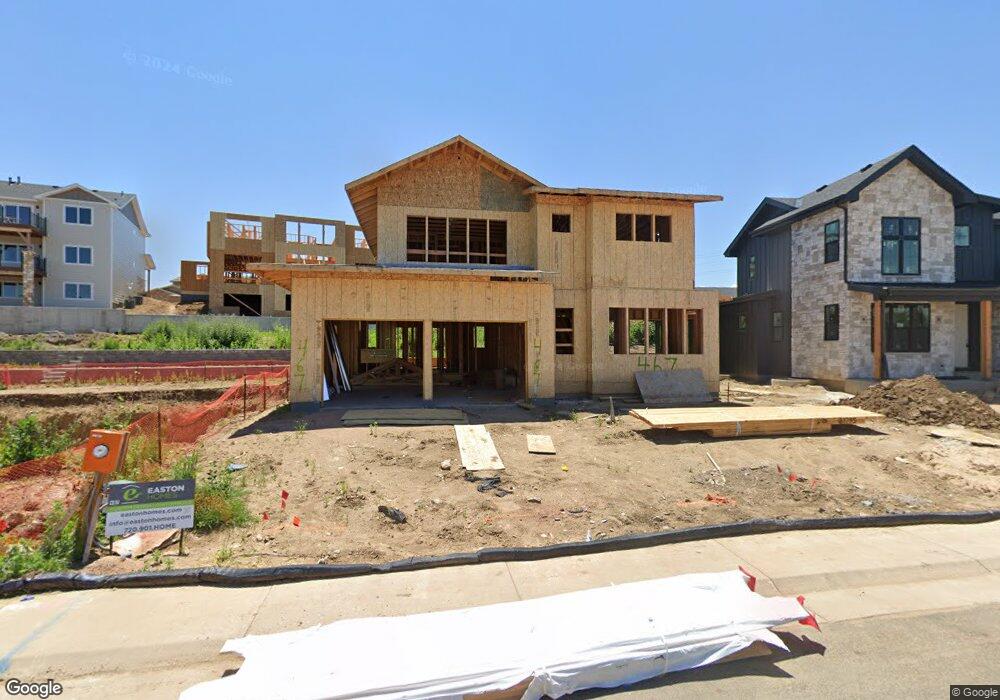
467 Muirfield Cir Louisville, CO 80027
Estimated Value: $634,000 - $1,467,000
3
Beds
8
Baths
2,256
Sq Ft
$428/Sq Ft
Est. Value
About This Home
This home is located at 467 Muirfield Cir, Louisville, CO 80027 and is currently estimated at $965,104, approximately $427 per square foot. 467 Muirfield Cir is a home located in Boulder County with nearby schools including Monarch K-8 School, Monarch High School, and The Goddard School - Louisville.
Ownership History
Date
Name
Owned For
Owner Type
Purchase Details
Closed on
Oct 2, 1991
Bought by
Jaeger Frederick Jacob
Current Estimated Value
Purchase Details
Closed on
Oct 10, 1990
Bought by
Jaeger Frederick Jacob
Purchase Details
Closed on
Apr 25, 1990
Bought by
Jaeger Frederick Jacob
Purchase Details
Closed on
Apr 13, 1990
Bought by
Jaeger Frederick Jacob
Create a Home Valuation Report for This Property
The Home Valuation Report is an in-depth analysis detailing your home's value as well as a comparison with similar homes in the area
Home Values in the Area
Average Home Value in this Area
Purchase History
| Date | Buyer | Sale Price | Title Company |
|---|---|---|---|
| Jaeger Frederick Jacob | $169,900 | -- | |
| Jaeger Frederick Jacob | $130,000 | -- | |
| Jaeger Frederick Jacob | $202,500 | -- | |
| Jaeger Frederick Jacob | -- | -- |
Source: Public Records
Tax History Compared to Growth
Tax History
| Year | Tax Paid | Tax Assessment Tax Assessment Total Assessment is a certain percentage of the fair market value that is determined by local assessors to be the total taxable value of land and additions on the property. | Land | Improvement |
|---|---|---|---|---|
| 2025 | $1,786 | $84,562 | $29,231 | $55,331 |
| 2024 | $1,786 | $84,562 | $29,231 | $55,331 |
| 2023 | $1,755 | $26,566 | $30,251 | -- |
| 2022 | $1,112 | $11,551 | $11,551 | $0 |
| 2021 | $3,871 | $48,942 | $23,767 | $25,175 |
| 2020 | $3,439 | $43,894 | $20,735 | $23,159 |
| 2019 | $3,390 | $43,894 | $20,735 | $23,159 |
| 2018 | $3,040 | $41,227 | $13,320 | $27,907 |
| 2017 | $2,979 | $45,579 | $14,726 | $30,853 |
| 2016 | $2,724 | $38,916 | $14,726 | $24,190 |
| 2015 | $3,245 | $34,761 | $6,925 | $27,836 |
| 2014 | $2,972 | $34,761 | $6,925 | $27,836 |
Source: Public Records
Map
Nearby Homes
- 461 Muirfield Cir
- 941 Saint Andrews Ln
- 941 Saint Andrews Ln Unit 96
- 945 Saint Andrews Ln
- 945 Saint Andrews Ln Unit 98
- 494 Muirfield Cir
- 953 Saint Andrews Ln
- 497 Muirfield Cir
- 499 Muirfield Cir
- 1030 Turnberry Cir
- 481 Muirfield Ct
- 1002 Turnberry Cir
- 977 Saint Andrews Ln
- 716 Club Cir
- 830 Josephine Way
- 860 Josephine Way
- 2528 Emiline Way
- 2351 Superior Dr
- 2341 Superior Dr
- 2331 Superior Dr
- 469 Muirfield Cir
- 465 Muirfield Cir
- 950 Saint Andrews Ln
- 948 Saint Andrews Ln
- 471 Muirfield Cir
- 463 Muirfield Cir
- 952 Saint Andrews Ln
- 946 Saint Andrews Ln
- 466 Muirfield Cir
- 473 Muirfield Cir
- 474 Muirfield Cir
- 954 Saint Andrews Ln
- 464 Muirfield Cir
- 956 Saint Andrews Ln
- 462 Muirfield Cir
- 477 Muirfield Ct
- 496 Muirfield Cir
- 942 Saint Andrews Ln
- 947 Saint Andrews Ln
- 949 Saint Andrews Ln