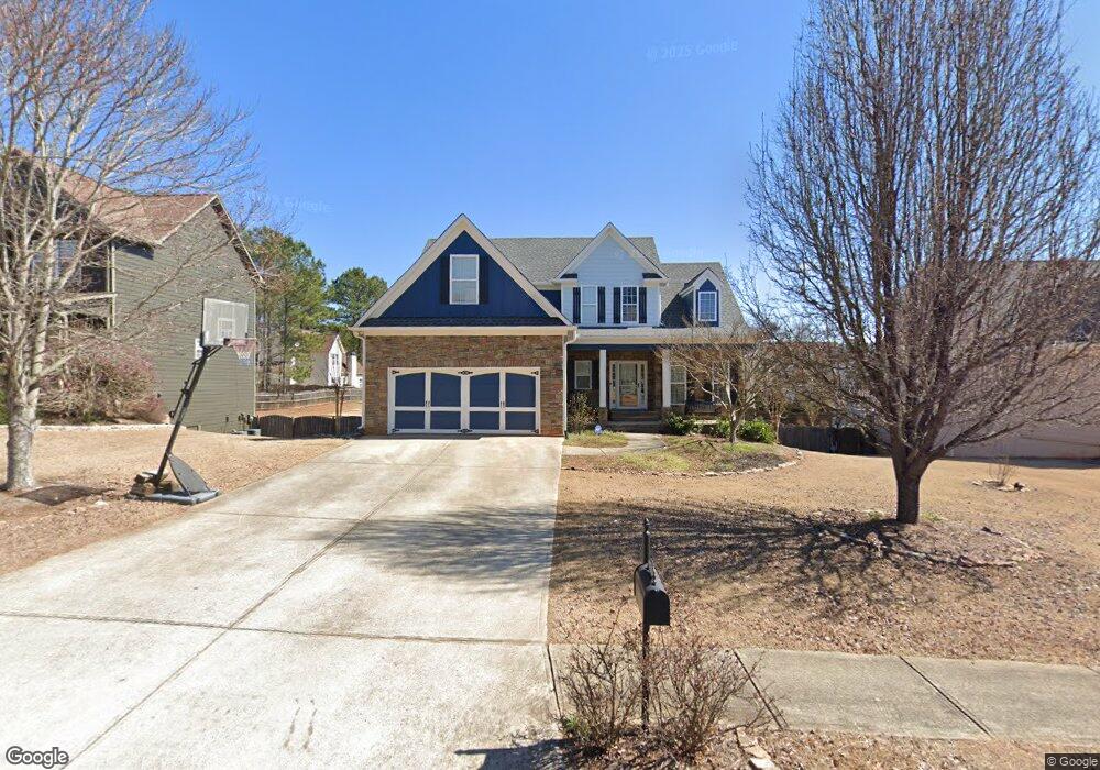
4671 Mason Ct Douglasville, GA 30135
Bill Arp NeighborhoodEstimated Value: $332,564 - $379,000
--
Bed
3
Baths
2,314
Sq Ft
$158/Sq Ft
Est. Value
About This Home
This home is located at 4671 Mason Ct, Douglasville, GA 30135 and is currently estimated at $365,891, approximately $158 per square foot. 4671 Mason Ct is a home located in Douglas County with nearby schools including Bill Arp Elementary School, Yeager Middle School, and Alexander High School.
Ownership History
Date
Name
Owned For
Owner Type
Purchase Details
Closed on
Jun 6, 2005
Sold by
Mason Ridge Builders Inc
Bought by
Amandolia Brandy N
Current Estimated Value
Home Financials for this Owner
Home Financials are based on the most recent Mortgage that was taken out on this home.
Original Mortgage
$166,300
Outstanding Balance
$86,427
Interest Rate
5.69%
Mortgage Type
New Conventional
Estimated Equity
$279,464
Create a Home Valuation Report for This Property
The Home Valuation Report is an in-depth analysis detailing your home's value as well as a comparison with similar homes in the area
Home Values in the Area
Average Home Value in this Area
Purchase History
| Date | Buyer | Sale Price | Title Company |
|---|---|---|---|
| Amandolia Brandy N | $207,900 | -- |
Source: Public Records
Mortgage History
| Date | Status | Borrower | Loan Amount |
|---|---|---|---|
| Open | Amandolia Brandy N | $166,300 |
Source: Public Records
Tax History Compared to Growth
Tax History
| Year | Tax Paid | Tax Assessment Tax Assessment Total Assessment is a certain percentage of the fair market value that is determined by local assessors to be the total taxable value of land and additions on the property. | Land | Improvement |
|---|---|---|---|---|
| 2024 | $3,477 | $129,320 | $21,600 | $107,720 |
| 2023 | $3,477 | $117,000 | $13,600 | $103,400 |
| 2022 | $3,346 | $117,000 | $13,600 | $103,400 |
| 2021 | $2,855 | $92,240 | $12,360 | $79,880 |
| 2020 | $2,897 | $92,240 | $12,360 | $79,880 |
| 2019 | $2,665 | $89,240 | $12,360 | $76,880 |
| 2018 | $2,631 | $86,960 | $12,360 | $74,600 |
| 2017 | $2,427 | $78,040 | $12,360 | $65,680 |
| 2016 | $1,911 | $60,800 | $10,040 | $50,760 |
| 2015 | $1,704 | $56,880 | $10,040 | $46,840 |
| 2014 | $1,704 | $52,400 | $10,040 | $42,360 |
| 2013 | -- | $52,920 | $10,200 | $42,720 |
Source: Public Records
Map
Nearby Homes
- 0 Dorsett Shoals Rd Unit 20170850
- 0 Dorsett Shoals Rd Unit 7336228
- 6797 Greenoak Dr
- 6851 Alexander Pkwy
- 6883 Lakeshore Dr
- 6755 Alexander Pkwy
- 6867 Laurelwood Dr
- 4450 Poplar Ct Unit 3
- 4430 Poplar Ct
- 3949 Georgia 5
- 7131 Banks Mill Rd
- 6560 Chickasaw Dr
- 0 Big a Rd Unit 20169908
- 7215 Colony Ln
- 6590 Manor Creek Dr
- 7212 Milam Rd
- 6441 Michell Way
- 5181 Kilroy Ln
- 4675 Mason Ct
- 4661 Mason Ct
- 0 Mason Ct Unit 8160328
- 0 Mason Ct
- 4681 Mason Ct
- 6807 Mason Creek Rd
- 6807 Mason Creek Rd
- 4771 Pauline Rd
- 6820 Spring Valley Ct
- 4781 Pauline Rd
- 6797 Mason Creek Rd
- 4651 Mason Ct
- 4651 Mason Ct
- 4791 Pauline Rd
- 6813 Spring Valley Ct
- 4691 Mason Ct
- 4761 Pauline Rd
- 4660 Mason Ct
- 4660 Mason Ct
- 6830 Spring Valley Ct