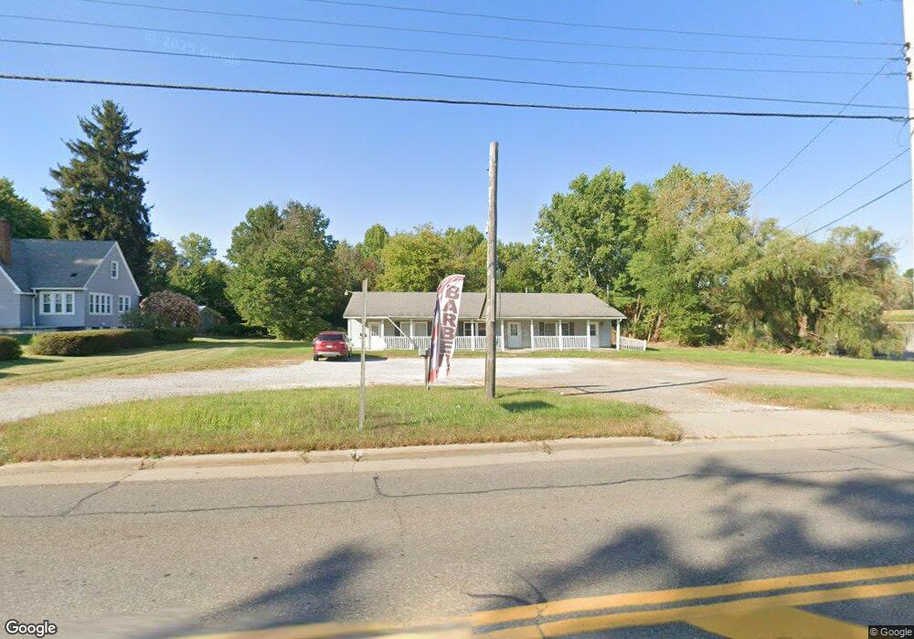
4673 State Route 82 Unit A & C Mantua, OH 44255
Estimated Value: $235,015
50
Beds
--
Bath
2,040
Sq Ft
$115/Sq Ft
Est. Value
About This Home
This home is located at 4673 State Route 82 Unit A & C, Mantua, OH 44255 and is currently estimated at $235,015, approximately $115 per square foot. 4673 State Route 82 Unit A & C is a home located in Portage County with nearby schools including Crestwood Primary School, Crestwood Intermediate School, and Crestwood Middle School.
Ownership History
Date
Name
Owned For
Owner Type
Purchase Details
Closed on
Sep 20, 2023
Sold by
Haycorp 99 Llc
Bought by
Mantua Petroleum Llc
Current Estimated Value
Home Financials for this Owner
Home Financials are based on the most recent Mortgage that was taken out on this home.
Original Mortgage
$200,000
Outstanding Balance
$195,758
Interest Rate
6.96%
Mortgage Type
Seller Take Back
Estimated Equity
$39,257
Purchase Details
Closed on
Nov 29, 2021
Sold by
Deskins Patsy J and The Pasty J Deskins Trust
Bought by
Haycorp 99 Llc
Purchase Details
Closed on
Dec 13, 2011
Sold by
Deskins Charles E and Deskins Patsy J
Bought by
Deskins Patsy J and Deskins Charles E
Create a Home Valuation Report for This Property
The Home Valuation Report is an in-depth analysis detailing your home's value as well as a comparison with similar homes in the area
Home Values in the Area
Average Home Value in this Area
Purchase History
| Date | Buyer | Sale Price | Title Company |
|---|---|---|---|
| Mantua Petroleum Llc | $200,000 | None Listed On Document | |
| Haycorp 99 Llc | $175,000 | None Available | |
| Deskins Patsy J | $875 | Diamond Title Co |
Source: Public Records
Mortgage History
| Date | Status | Borrower | Loan Amount |
|---|---|---|---|
| Open | Mantua Petroleum Llc | $200,000 |
Source: Public Records
Tax History Compared to Growth
Tax History
| Year | Tax Paid | Tax Assessment Tax Assessment Total Assessment is a certain percentage of the fair market value that is determined by local assessors to be the total taxable value of land and additions on the property. | Land | Improvement |
|---|---|---|---|---|
| 2024 | $3,370 | $63,740 | $37,000 | $26,740 |
| 2023 | $2,683 | $46,270 | $24,500 | $21,770 |
| 2022 | $2,489 | $46,270 | $24,500 | $21,770 |
| 2021 | $2,537 | $46,270 | $24,500 | $21,770 |
| 2020 | $2,583 | $46,270 | $24,500 | $21,770 |
| 2019 | $2,967 | $46,270 | $24,500 | $21,770 |
| 2018 | $3,012 | $47,010 | $18,520 | $28,490 |
| 2017 | $3,012 | $47,010 | $18,520 | $28,490 |
| 2016 | $3,018 | $47,010 | $18,520 | $28,490 |
| 2015 | $3,012 | $47,010 | $18,520 | $28,490 |
| 2014 | $3,025 | $47,010 | $18,520 | $28,490 |
| 2013 | $3,000 | $47,010 | $18,520 | $28,490 |
Source: Public Records
Map
Nearby Homes
- 11470 Bowen Rd
- 4791 Pioneer Trail
- 4620 Pioneer Trail
- 11131 State Route 44
- 4364 Pioneer Trail
- 0 Ambler Ln Unit 5142203
- 12167 Mantua Center Rd
- 0 Infirmary Rd
- 10685 Limeridge Rd
- 3444 Winchell Rd
- 12298 Chamberlain Rd
- 12845 Vincent Dr
- 11166 Loris Ave
- SR 82 Ohio 82
- 290 Townline Rd
- 200 Greentree Cir
- 6846 Wakefield Rd
- 483 Townline Rd
- 18420 May Ct
- 0 Garfield Rd
- 4673 State Route 82
- 4655 State Route 82
- 4674 Ohio 82
- 4650 Ohio 82
- 4650 State Route 82
- 4696 State Route 82
- 11697 Ohio 44
- 4673 Ohio 82
- 4601 State Route 82
- 11697 State Route 44
- 11 State Route 44
- 11766 State Route 44
- 11744 State Route 44
- 4757 State Route 82
- 4718 Ohio 82
- 11627 State Route 44
- 4764 Ohio 82
- 4764 State Route 82
- State Route 44
- 4769 State Route 82