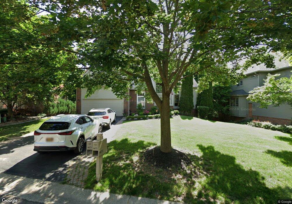
4673 Woodbine Cir Unit 34 West Bloomfield, MI 48323
Estimated Value: $613,759 - $711,000
4
Beds
3
Baths
3,002
Sq Ft
$227/Sq Ft
Est. Value
About This Home
This home is located at 4673 Woodbine Cir Unit 34, West Bloomfield, MI 48323 and is currently estimated at $681,190, approximately $226 per square foot. 4673 Woodbine Cir Unit 34 is a home located in Oakland County with nearby schools including Walled Lake Central High School, The Susan And Rabbi Harold Loss Ecc, and Brookfield Academy - West Bloomfield.
Ownership History
Date
Name
Owned For
Owner Type
Purchase Details
Closed on
Mar 7, 2008
Sold by
Bond Martin and Bond Marlene
Bought by
Marrogy Andrew
Current Estimated Value
Purchase Details
Closed on
Feb 24, 2000
Sold by
Matthews John E
Bought by
Bond Martin J
Purchase Details
Closed on
Jun 10, 1996
Sold by
Ivanhoe Huntley Torray R
Bought by
Matthews John E
Home Financials for this Owner
Home Financials are based on the most recent Mortgage that was taken out on this home.
Original Mortgage
$260,000
Interest Rate
8.05%
Purchase Details
Closed on
Feb 6, 1996
Sold by
Fugle Cockerell Do Pc Pe
Bought by
Matthews John E
Create a Home Valuation Report for This Property
The Home Valuation Report is an in-depth analysis detailing your home's value as well as a comparison with similar homes in the area
Home Values in the Area
Average Home Value in this Area
Purchase History
| Date | Buyer | Sale Price | Title Company |
|---|---|---|---|
| Marrogy Andrew | $334,750 | None Available | |
| Bond Martin J | $420,000 | -- | |
| Matthews John E | -- | -- | |
| Matthews John E | $57,750 | -- |
Source: Public Records
Mortgage History
| Date | Status | Borrower | Loan Amount |
|---|---|---|---|
| Previous Owner | Matthews John E | $260,000 |
Source: Public Records
Tax History Compared to Growth
Tax History
| Year | Tax Paid | Tax Assessment Tax Assessment Total Assessment is a certain percentage of the fair market value that is determined by local assessors to be the total taxable value of land and additions on the property. | Land | Improvement |
|---|---|---|---|---|
| 2024 | $3,678 | $243,980 | $0 | $0 |
| 2022 | $3,468 | $203,750 | $23,750 | $180,000 |
| 2021 | $5,988 | $199,980 | $0 | $0 |
| 2020 | $3,427 | $197,590 | $23,750 | $173,840 |
| 2018 | $5,558 | $176,040 | $25,000 | $151,040 |
| 2015 | -- | $170,510 | $0 | $0 |
| 2014 | -- | $160,080 | $0 | $0 |
| 2011 | -- | $144,500 | $0 | $0 |
Source: Public Records
Map
Nearby Homes
- 6140 Pontiac Trail
- 000 Pontiac Trail
- 6100 Pontiac Trail
- 7545/7585 Pontiac Trail
- 7585/7548 Pontiac Trail
- 5994 Glen Eagles Dr
- 4540 Rolling Pine Ct
- 6433 Walnut Lake Rd
- 4442 Borland St
- 5160 Greenbriar Dr
- 6675 Langtoft St
- 6980 Hambro St
- 0000 Langtoft
- 5435 Tequesta Dr
- 4066 Green Lake Rd
- 5676 Hillcrest Cir E
- 5608 Hillcrest Cir W Unit 80
- 6606 Leytonstone Blvd
- 5616 Hillcrest Cir W
- VL Leytonstone Blvd
- 4677 Woodbine Cir
- 4665 Woodbine Cir
- 4659 Woodbine Cir
- 4683 Woodbine Cir Unit 32
- 4668 Woodbine Cir
- 4674 Woodbine Cir
- 4680 Woodbine Cir
- 4662 Woodbine Cir Unit 48
- 4653 Woodbine Cir
- 4689 Woodbine Cir
- 4686 Woodbine Cir Unit 45
- 4656 Woodbine Cir
- 4645 Woodbine Cir
- 4693 Woodbine Cir Unit 30
- 6095 Pontiac Trail
- 4650 Woodbine Cir
- 4637 Woodbine Cir
- 4695 Woodbine Cir Unit 29
- 4710 Woodbine Cir
- 4631 Woodbine Cir Unit 40