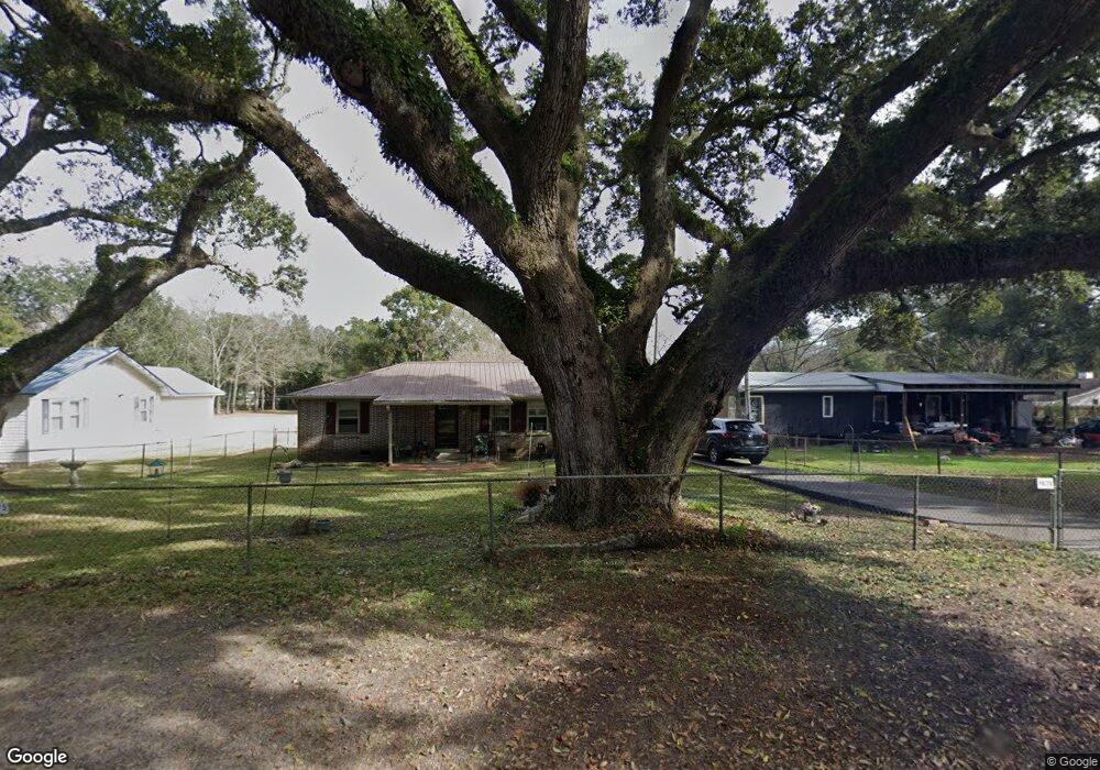
4675 Calhoun Rd Mobile, AL 36619
Nevius NeighborhoodEstimated Value: $92,942 - $154,000
3
Beds
1
Bath
1,200
Sq Ft
$99/Sq Ft
Est. Value
About This Home
This home is located at 4675 Calhoun Rd, Mobile, AL 36619 and is currently estimated at $118,236, approximately $98 per square foot. 4675 Calhoun Rd is a home with nearby schools including WC Griggs Elementary School, Burns Middle School, and Theodore High School.
Ownership History
Date
Name
Owned For
Owner Type
Purchase Details
Closed on
May 7, 2012
Sold by
Stafford Justin E
Bought by
Phh Mortgage Corporation
Current Estimated Value
Purchase Details
Closed on
Sep 23, 2009
Sold by
Robertson Jackie and Tillman Laurie
Bought by
Stafford Justin E
Purchase Details
Closed on
May 28, 2009
Sold by
U S Bank National Association
Bought by
Robertson Jackie
Purchase Details
Closed on
Jul 29, 2008
Sold by
Redding Patrick and Redding Linda Carol
Bought by
U S Bank Na
Create a Home Valuation Report for This Property
The Home Valuation Report is an in-depth analysis detailing your home's value as well as a comparison with similar homes in the area
Home Values in the Area
Average Home Value in this Area
Purchase History
| Date | Buyer | Sale Price | Title Company |
|---|---|---|---|
| Phh Mortgage Corporation | $82,051 | None Available | |
| Stafford Justin E | -- | Ct | |
| Robertson Jackie | $32,900 | None Available | |
| U S Bank Na | $59,500 | None Available |
Source: Public Records
Tax History
| Year | Tax Paid | Tax Assessment Tax Assessment Total Assessment is a certain percentage of the fair market value that is determined by local assessors to be the total taxable value of land and additions on the property. | Land | Improvement |
|---|---|---|---|---|
| 2025 | -- | $6,990 | $1,280 | $5,710 |
| 2024 | -- | $6,500 | $1,200 | $5,300 |
| 2023 | $0 | $6,780 | $1,200 | $5,580 |
| 2022 | $0 | $5,670 | $1,200 | $4,470 |
| 2021 | $191 | $5,510 | $1,200 | $4,310 |
| 2020 | $191 | $5,510 | $1,200 | $4,310 |
| 2019 | $191 | $5,390 | $1,200 | $4,190 |
| 2018 | $0 | $5,320 | $0 | $0 |
| 2017 | $191 | $5,320 | $0 | $0 |
| 2016 | $197 | $5,440 | $0 | $0 |
| 2013 | $228 | $5,920 | $0 | $0 |
Source: Public Records
Map
Nearby Homes
- 4630 General Rd
- 5674 Nevius Rd
- 4800 Bush Ln
- 4314 Lumsden Battery Cir W
- 5480 Inn Rd
- 4244 Lumsden Battery Cir W
- 5023 Freeway Ln
- 6116 General Lee Ave
- 5015 Santos Dr W
- 5185 Santos Dr W
- 0 Higgins Rd Unit 153 371518
- 0 Higgins Rd Unit 7497709
- 0 Higgins Rd Unit 5 384060
- 0 Higgins Rd Unit 7634227
- 5544 Candia Ct
- 5084 Fairland Dr
- 5551 Springer Ct
- 5089 Guinevere Dr
- 5171 Fairland Dr
- 0 Stone Mill Ct Unit 7715820
- 4689 Calhoun Rd
- 4663 Calhoun Rd
- 4655 Calhoun Rd
- 4711 Calhoun Rd
- 4674 Calhoun Rd
- 5672 Andrews Rd
- 4680 Calhoun Rd
- 5672 Andrew Rd
- 5666 Andrews Rd
- 4666 Calhoun Rd
- 5666 Andrew Rd
- 5662 Andrew Rd
- 4645 Calhoun Rd
- 5738 Andrews Rd
- 4735 Calhoun Rd
- 4642 Calhoun Rd
- 4637 Calhoun Rd
- 5638 Andrews Rd
- 5683 Andrews Rd
- 5671 Andrews Rd
Your Personal Tour Guide
Ask me questions while you tour the home.