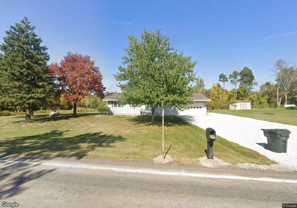
4676 State Route 181 Crestline, OH 44827
Estimated Value: $182,000 - $254,000
About This Home
This home is located at 4676 State Route 181, Crestline, OH 44827 and is currently estimated at $224,276, approximately $190 per square foot. 4676 State Route 181 is a home located in Richland County with nearby schools including Stingel Elementary School, Ontario Middle School, and Ontario High School.
Ownership History
We collect this data history from publicly available records. To have your information removed, we recommend requesting removal directly through your county’s website.
Purchase Details
Home Financials for this Owner
Home Financials are based on the most recent Mortgage that was taken out on this home.Purchase Details
Home Financials for this Owner
Home Financials are based on the most recent Mortgage that was taken out on this home.Purchase Details
Home Financials for this Owner
Home Financials are based on the most recent Mortgage that was taken out on this home.Home Values in the Area
Average Home Value in this Area
Purchase History
We collect this data history from publicly available records. To have your information removed, we recommend requesting removal directly through your county’s website.
| Date | Buyer | Sale Price | Title Company |
|---|---|---|---|
| $245,000 | Crown Search Services | ||
| -- | None Available | ||
| $107,000 | -- |
Mortgage History
We collect this data history from publicly available records. To have your information removed, we recommend requesting removal directly through your county’s website.
| Date | Status | Borrower | Loan Amount |
|---|---|---|---|
| Open | $195,000 | ||
| Previous Owner | $3,000 | ||
| Previous Owner | $93,600 | ||
| Previous Owner | $101,650 |
Tax History
We collect this data history from publicly available records. To have your information removed, we recommend requesting removal directly through your county’s website.
| Year | Tax Paid | Tax Assessment Tax Assessment Total Assessment is a certain percentage of the fair market value that is determined by local assessors to be the total taxable value of land and additions on the property. | Land | Improvement |
|---|---|---|---|---|
| 2025 | $2,112 | $43,360 | $8,200 | $35,160 |
| 2024 | $2,112 | $43,360 | $8,200 | $35,160 |
| 2023 | $2,161 | $43,360 | $8,200 | $35,160 |
| 2022 | $2,000 | $34,540 | $7,460 | $27,080 |
| 2021 | $2,004 | $34,540 | $7,460 | $27,080 |
| 2020 | $2,139 | $34,540 | $7,460 | $27,080 |
| 2019 | $2,003 | $29,270 | $6,320 | $22,950 |
| 2018 | $1,700 | $29,270 | $6,320 | $22,950 |
| 2017 | $1,673 | $29,270 | $6,320 | $22,950 |
| 2016 | $1,689 | $29,360 | $6,130 | $23,230 |
| 2015 | $1,687 | $29,360 | $6,130 | $23,230 |
| 2014 | $1,690 | $29,360 | $6,130 | $23,230 |
| 2012 | $792 | $30,260 | $6,320 | $23,940 |
Map
- 3710 Shangri la Ave E
- 0 Rudy Rd
- 3560 Park Ave W
- 1053 State Route 181
- 636 Cloverdale Ave
- 319 Etler Dr
- 763 County Line Rd
- 855 Bowers Rd
- 3308 Park Ave W
- 515 S Seltzer St
- 93 Maynard Ave
- 3260 Oakstone Dr
- 1411 Burnison Rd
- 206 N Pierce St
- 0 State Route 61
- 504 S Thoman St
- 1051 Bibich Ct
- 1555 Burnison Rd
- 15 Park Circle Dr
- 406 Patterson St
- 4666 State Route 181
- 4685 State Route 181
- 4664 State Route 181
- 4734 Ohio 181
- 4734 State Route 181
- 4662 State Route 181
- 4660 State Route 181
- 4737 State Route 181
- 4655 State Route 181
- 4655 Ohio 181
- 4639 State Route 181
- 4743 State Route 181
- 4629 State Route 181
- 645 Eckstein Rd
- 701 Eckstein Rd
- 4809 State Route 181
- 4841 State Route 181
- 676 Eckstein Rd
- 4565 State Route 181
- 749 Eckstein Rd
Ask me questions while you tour the home.