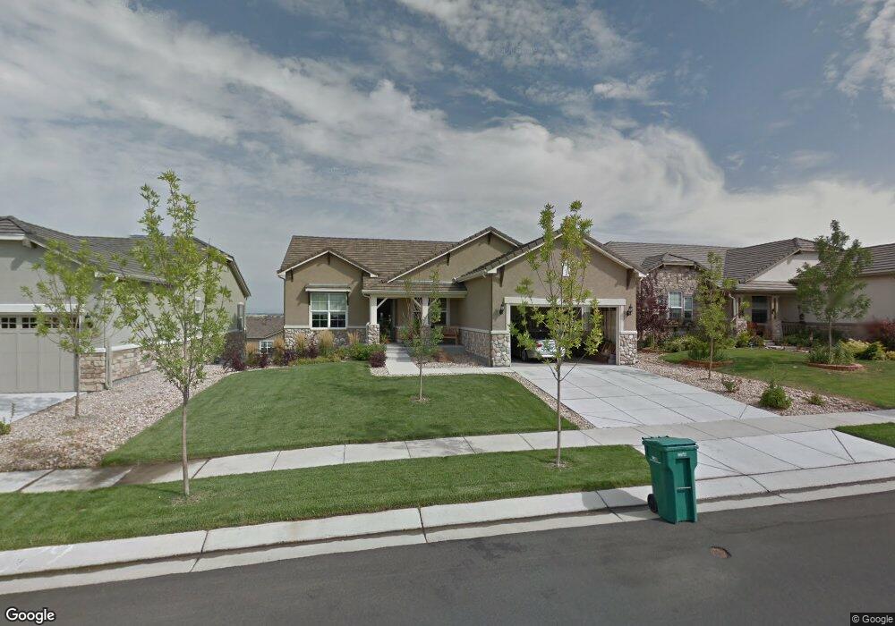
4679 Belford Cir Broomfield, CO 80023
Anthem NeighborhoodEstimated Value: $898,376 - $1,148,000
2
Beds
3
Baths
1,955
Sq Ft
$532/Sq Ft
Est. Value
About This Home
This home is located at 4679 Belford Cir, Broomfield, CO 80023 and is currently estimated at $1,039,594, approximately $531 per square foot. 4679 Belford Cir is a home located in Broomfield County with nearby schools including Thunder Vista P-8, Legacy High School, and Prospect Ridge Academy.
Ownership History
Date
Name
Owned For
Owner Type
Purchase Details
Closed on
Jul 19, 2023
Sold by
Edmondson Ruth
Bought by
Ruth Harker Edmondson Revocable Trust
Current Estimated Value
Purchase Details
Closed on
Sep 14, 2010
Sold by
Pulte Home Corporation
Bought by
Edmondson Robert W and Edmondson Ruth
Home Financials for this Owner
Home Financials are based on the most recent Mortgage that was taken out on this home.
Original Mortgage
$300,000
Interest Rate
4.51%
Mortgage Type
New Conventional
Create a Home Valuation Report for This Property
The Home Valuation Report is an in-depth analysis detailing your home's value as well as a comparison with similar homes in the area
Home Values in the Area
Average Home Value in this Area
Purchase History
| Date | Buyer | Sale Price | Title Company |
|---|---|---|---|
| Ruth Harker Edmondson Revocable Trust | -- | None Listed On Document | |
| Edmondson Robert W | $446,290 | None Available |
Source: Public Records
Mortgage History
| Date | Status | Borrower | Loan Amount |
|---|---|---|---|
| Previous Owner | Edmondson Robert W | $300,000 |
Source: Public Records
Tax History Compared to Growth
Tax History
| Year | Tax Paid | Tax Assessment Tax Assessment Total Assessment is a certain percentage of the fair market value that is determined by local assessors to be the total taxable value of land and additions on the property. | Land | Improvement |
|---|---|---|---|---|
| 2025 | $6,709 | $60,810 | $14,610 | $46,200 |
| 2024 | $6,709 | $59,970 | $13,130 | $46,840 |
| 2023 | $6,656 | $67,130 | $14,460 | $52,670 |
| 2022 | $5,521 | $46,890 | $10,480 | $36,410 |
| 2021 | $5,696 | $48,240 | $10,780 | $37,460 |
| 2020 | $6,356 | $45,250 | $10,040 | $35,210 |
| 2019 | $6,381 | $45,570 | $10,110 | $35,460 |
| 2018 | $6,346 | $43,040 | $7,920 | $35,120 |
| 2017 | $5,937 | $47,580 | $8,760 | $38,820 |
| 2016 | $5,906 | $40,660 | $8,760 | $31,900 |
| 2015 | $6,150 | $33,310 | $8,760 | $24,550 |
| 2014 | $5,353 | $33,310 | $8,760 | $24,550 |
Source: Public Records
Map
Nearby Homes
- 4680 Belford Cir
- 16075 Meeker Way
- 4636 Belford Cir
- 15975 Quandary Loop
- 16505 Antero Cir
- 16526 Chesapeake Dr
- 16615 Ellingwood Dr
- 16320 Graham Peak Way
- 3741 Harvard Place
- 16626 Las Brisas Dr
- 16345 Spanish Peak Way
- 16273 Ute Peak Way
- 15739 Columbus Mountain Dr
- 15875 Wild Horse Dr
- 16392 Spanish Peak Way
- 4263 Corte Bella Dr
- 16611 Plateau Ln
- 3457 Parkside Center Dr
- 16371 Jones Mountain Way
- 3285 Yale Dr
- 4677 Belford Cir
- 4681 Belford Cir
- 4675 Belford Cir
- 4683 Belford Cir
- 4600 Belford Cir
- 4516 Silver Mountain Loop
- 4514 Silver Mountain Loop
- 4673 Belford Cir
- 4685 Belford Cir
- 4602 Belford Cir
- 4512 Silver Mountain Loop
- 16105 Cameron Way
- 4684 Belford Cir
- 4671 Belford Cir
- 4604 Belford Cir
- 4687 Belford Cir
- 4603 Belford Cir
- 4510 Silver Mountain Loop
- 4520 Silver Mountain Loop
- 16095 Cameron Way