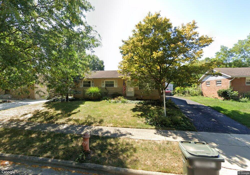
4679 Julian Dr Columbus, OH 43227
Leawood NeighborhoodEstimated Value: $199,000 - $280,000
3
Beds
2
Baths
1,304
Sq Ft
$173/Sq Ft
Est. Value
About This Home
This home is located at 4679 Julian Dr, Columbus, OH 43227 and is currently estimated at $225,061, approximately $172 per square foot. 4679 Julian Dr is a home located in Franklin County with nearby schools including Shady Lane Elementary School, Sherwood Middle School, and Walnut Ridge High School.
Ownership History
Date
Name
Owned For
Owner Type
Purchase Details
Closed on
Sep 11, 2020
Sold by
Stewart Eric D
Bought by
Stewiser Inc
Current Estimated Value
Purchase Details
Closed on
Jul 12, 2020
Sold by
Stewart Eric D
Bought by
Stewiser Inc
Purchase Details
Closed on
Mar 19, 2007
Sold by
Homesales Inc
Bought by
Stewart Eric D
Home Financials for this Owner
Home Financials are based on the most recent Mortgage that was taken out on this home.
Original Mortgage
$65,200
Interest Rate
5.92%
Mortgage Type
Purchase Money Mortgage
Purchase Details
Closed on
Dec 5, 2006
Sold by
Kersell Marsha F and Jp Morgan Chase Bank Na
Bought by
Homesales Inc and Homesale Inc Of Delaware
Purchase Details
Closed on
Mar 31, 1998
Sold by
Hud
Bought by
Milam Steven R and Milam Nancy L
Purchase Details
Closed on
Jul 16, 1997
Sold by
Cotton Loralynn
Bought by
Cotton Tyrone
Create a Home Valuation Report for This Property
The Home Valuation Report is an in-depth analysis detailing your home's value as well as a comparison with similar homes in the area
Home Values in the Area
Average Home Value in this Area
Purchase History
| Date | Buyer | Sale Price | Title Company |
|---|---|---|---|
| Stewiser Inc | -- | None Listed On Document | |
| Stewiser Inc | -- | None Available | |
| Stewart Eric D | $81,500 | Attorney | |
| Homesales Inc | $72,000 | None Available | |
| Milam Steven R | -- | -- | |
| Cotton Tyrone | -- | -- |
Source: Public Records
Mortgage History
| Date | Status | Borrower | Loan Amount |
|---|---|---|---|
| Previous Owner | Stewart Eric D | $65,200 |
Source: Public Records
Tax History
| Year | Tax Paid | Tax Assessment Tax Assessment Total Assessment is a certain percentage of the fair market value that is determined by local assessors to be the total taxable value of land and additions on the property. | Land | Improvement |
|---|---|---|---|---|
| 2025 | $2,796 | $61,010 | $14,070 | $46,940 |
| 2024 | $2,796 | $61,010 | $14,070 | $46,940 |
| 2023 | $2,761 | $61,005 | $14,070 | $46,935 |
| 2022 | $2,056 | $38,680 | $6,410 | $32,270 |
| 2021 | $2,209 | $38,680 | $6,410 | $32,270 |
| 2020 | $2,062 | $38,680 | $6,410 | $32,270 |
| 2019 | $1,931 | $31,050 | $5,150 | $25,900 |
| 2018 | $1,820 | $31,050 | $5,150 | $25,900 |
| 2017 | $1,930 | $31,050 | $5,150 | $25,900 |
| 2016 | $1,881 | $27,690 | $5,740 | $21,950 |
| 2015 | $1,713 | $27,690 | $5,740 | $21,950 |
| 2014 | $1,717 | $27,690 | $5,740 | $21,950 |
| 2013 | $997 | $32,585 | $6,755 | $25,830 |
Source: Public Records
Map
Nearby Homes
- 4649 Dundee Ave
- 1691 Shady Lane Rd
- 4589 Belfast Dr
- 1612 Simpson Dr
- 1607 Simpson Dr
- 4677 E Livingston Ave
- 4475 Ellery Dr
- 1571 Baxter Dr
- 1607 Baxter Dr
- 1752 S Hamilton Rd
- 1377 Marble Dr
- 4859 Folger Dr
- 1654 Wilton Dr
- 4467 Grimsby Rd
- 1646 Clyde Place
- 1470 Efner Dr
- 1945 Riverdale Rd
- 1356 Harlow Rd
- 1281 Maetzel Dr
- 1216 Marble Dr