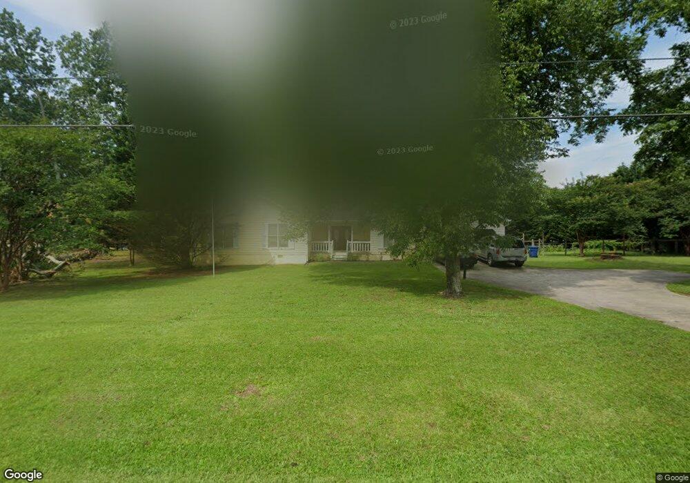
468 Miles Patrick Rd Winder, GA 30680
Estimated Value: $298,000 - $330,000
3
Beds
3
Baths
1,634
Sq Ft
$192/Sq Ft
Est. Value
About This Home
This home is located at 468 Miles Patrick Rd, Winder, GA 30680 and is currently estimated at $314,402, approximately $192 per square foot. 468 Miles Patrick Rd is a home located in Barrow County with nearby schools including County Line Elementary School, Russell Middle School, and Winder-Barrow High School.
Ownership History
Date
Name
Owned For
Owner Type
Purchase Details
Closed on
Jun 14, 1994
Sold by
Shubert James R and Shubert Tracey D
Bought by
Turner Anthony R
Current Estimated Value
Home Financials for this Owner
Home Financials are based on the most recent Mortgage that was taken out on this home.
Original Mortgage
$82,750
Interest Rate
8.52%
Mortgage Type
FHA
Create a Home Valuation Report for This Property
The Home Valuation Report is an in-depth analysis detailing your home's value as well as a comparison with similar homes in the area
Home Values in the Area
Average Home Value in this Area
Purchase History
| Date | Buyer | Sale Price | Title Company |
|---|---|---|---|
| Turner Anthony R | $82,500 | -- |
Source: Public Records
Mortgage History
| Date | Status | Borrower | Loan Amount |
|---|---|---|---|
| Closed | Turner Anthony R | $82,750 |
Source: Public Records
Tax History Compared to Growth
Tax History
| Year | Tax Paid | Tax Assessment Tax Assessment Total Assessment is a certain percentage of the fair market value that is determined by local assessors to be the total taxable value of land and additions on the property. | Land | Improvement |
|---|---|---|---|---|
| 2024 | $2,361 | $86,308 | $20,000 | $66,308 |
| 2023 | $1,878 | $86,308 | $20,000 | $66,308 |
| 2022 | $2,251 | $68,602 | $16,400 | $52,202 |
| 2021 | $1,842 | $54,798 | $12,000 | $42,798 |
| 2020 | $1,804 | $54,798 | $12,000 | $42,798 |
| 2019 | $1,776 | $53,230 | $12,000 | $41,230 |
| 2018 | $1,562 | $46,961 | $12,000 | $34,961 |
| 2017 | $1,108 | $37,127 | $12,000 | $25,127 |
| 2016 | $1,136 | $37,484 | $12,000 | $25,484 |
| 2015 | $1,161 | $38,198 | $12,000 | $26,198 |
| 2014 | $945 | $32,436 | $5,880 | $26,556 |
| 2013 | -- | $31,274 | $5,880 | $25,394 |
Source: Public Records
Map
Nearby Homes
- 27 Creekside Dr
- 401 N 5th Ave
- 0 E Northcrest Dr Unit 10648147
- 746 Baskins Cir
- 469 Plantation Dr
- 412 Regan Dr
- 980 Lake Rockwell Way
- 326 Miles Patrick Rd
- 318 Ryan Rd
- 436 Northcrest Dr
- 172 Settle St
- 381 W Candler St
- 926 Live Oak Ct Unit 2
- 197 Buena Vista St
- 615 Wellington Dr
- 713 Mallard Dr
- 303 Rocky Point Ct
- 5 Olevia St
- 535 Valley View Dr
- 0 Miles Patrick Rd Unit 7468165
- 0 Miles Patrick Rd Unit 7468162
- 0 Miles Patrick Rd Unit 7468160
- 0 Miles Patrick Rd Unit 7468158
- 0 Miles Patrick Rd Unit 2.23 ACRES 20021879
- 0 Miles Patrick Rd Unit 7479506
- 0 Miles Patrick Rd Unit 7278859
- 0 Miles Patrick Rd Unit 7251734
- 0 Miles Patrick Rd Unit 7241267
- 0 Miles Patrick Rd Unit 7040864
- 0 Miles Patrick Rd Unit 8551841
- 0 Miles Patrick Rd Unit 8188201
- 0 Miles Patrick Rd Unit 8092704
- 0 Miles Patrick Rd Unit 8035399
- 0 Miles Patrick Rd Unit 8843780
- 0 Miles Patrick Rd Unit 3152876
- 0 Miles Patrick Rd Unit 8571838
- 476 Miles Patrick Rd
- 542 Valley View Dr