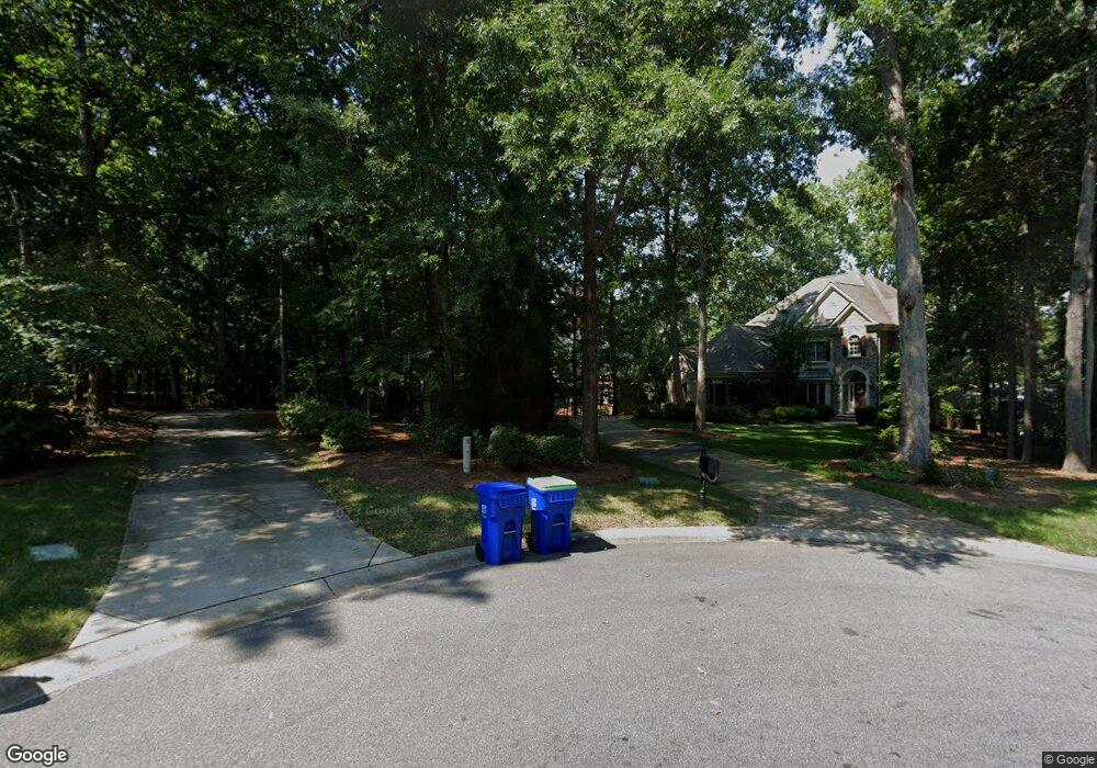
4685 Eagle Pointe Ct Denver, NC 28037
Estimated Value: $1,787,000 - $2,153,000
5
Beds
4
Baths
3,620
Sq Ft
$531/Sq Ft
Est. Value
About This Home
This home is located at 4685 Eagle Pointe Ct, Denver, NC 28037 and is currently estimated at $1,922,787, approximately $531 per square foot. 4685 Eagle Pointe Ct is a home located in Lincoln County with nearby schools including Rock Springs Elementary School, North Lincoln Middle School, and North Lincoln High School.
Ownership History
Date
Name
Owned For
Owner Type
Purchase Details
Closed on
Jan 14, 2015
Sold by
Perry Thomas C and Perry Vera A
Bought by
Strock Bradley R
Current Estimated Value
Purchase Details
Closed on
Sep 29, 2005
Sold by
Jordan Randy L and Jordan Romonda L
Bought by
Storck Bradley R and Storck Vicky N
Home Financials for this Owner
Home Financials are based on the most recent Mortgage that was taken out on this home.
Original Mortgage
$612,000
Interest Rate
5.62%
Mortgage Type
Assumption
Purchase Details
Closed on
Apr 2, 2001
Bought by
Jordan Randy L and Jordan Romonda L
Purchase Details
Closed on
May 1, 2000
Bought by
Shea Homes Llc
Create a Home Valuation Report for This Property
The Home Valuation Report is an in-depth analysis detailing your home's value as well as a comparison with similar homes in the area
Home Values in the Area
Average Home Value in this Area
Purchase History
| Date | Buyer | Sale Price | Title Company |
|---|---|---|---|
| Strock Bradley R | $40,000 | None Available | |
| Storck Bradley R | -- | None Available | |
| Strock Bradley R | $765,000 | None Available | |
| Jordan Randy L | $583,000 | -- | |
| Shea Homes Llc | $147,000 | -- |
Source: Public Records
Mortgage History
| Date | Status | Borrower | Loan Amount |
|---|---|---|---|
| Previous Owner | Strock Bradley R | $612,000 |
Source: Public Records
Tax History
| Year | Tax Paid | Tax Assessment Tax Assessment Total Assessment is a certain percentage of the fair market value that is determined by local assessors to be the total taxable value of land and additions on the property. | Land | Improvement |
|---|---|---|---|---|
| 2025 | $9,576 | $1,559,628 | $465,879 | $1,093,749 |
| 2024 | $9,525 | $1,559,628 | $465,879 | $1,093,749 |
| 2023 | $9,520 | $1,559,628 | $465,879 | $1,093,749 |
| 2022 | $7,492 | $995,581 | $350,409 | $645,172 |
| 2021 | $7,423 | $995,581 | $350,409 | $645,172 |
| 2020 | $7,108 | $995,581 | $350,409 | $645,172 |
| 2019 | $6,888 | $964,696 | $350,409 | $614,287 |
| 2018 | $6,292 | $842,449 | $335,920 | $506,529 |
| 2017 | $6,116 | $842,449 | $335,920 | $506,529 |
| 2016 | $6,095 | $842,449 | $335,920 | $506,529 |
| 2015 | $6,420 | $842,449 | $335,920 | $506,529 |
| 2014 | $6,009 | $814,297 | $360,892 | $453,405 |
Source: Public Records
Map
Nearby Homes
- 00 Hawkes Bay Ct Unit 121
- 4526 Island Waters Dr
- 4423 Augusta Ridge Ct
- 7901 Mcconnell Rd
- 4218 Ash Hollow Ln
- 8026 Silver Jade Dr
- 8022 Silver Jade Ln
- 7722 Juniper Ln
- 44 Cottonwood Dr
- 5056 Bridge Way
- #19 Juniper Ln
- 7656 Juniper Ln Unit 15
- 7909 Bay Pointe Dr
- 7653 Juniper Ln
- 8065 Bay Pointe Dr
- 7464 Albemarle Dr
- 512 Stonemarker Rd
- 4018 Halyard Dr
- 7962 Westcape Dr Unit 1016
- 4237 Little Fork Cove Rd
- 4687 Eagle Pointe Ct
- 4634 Hawkes Bay Ct
- 4675 Eagle Pointe Ct
- 4632 Hawkes Bay Ct
- 4686 Eagle Pointe Ct
- 4636 Hawkes Bay Ct
- 4665 Eagle Pointe Ct
- 4624 Hawkes Bay Ct
- Lot 121 Hawkes Bay Ct
- 4678 Eagle Pointe Ct
- 411 Artesian Cove
- 441 Artesian Cove
- 4684 Eagle Pointe Ct
- 4612 Hawkes Bay Ct
- 4637 Hawkes Bay Ct
- 4655 Eagle Pointe Ct
- 4668 Eagle Pointe Ct
- 4658 Eagle Pointe Ct
- LOT121 Hawkes Bay Ct
- 4631 Hawkes Bay Ct
Your Personal Tour Guide
Ask me questions while you tour the home.