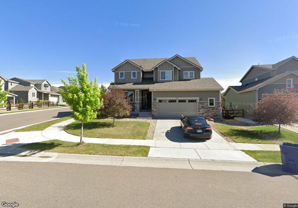
4689 Colorado River Dr Firestone, CO 80504
Estimated Value: $688,711 - $790,000
5
Beds
4
Baths
2,813
Sq Ft
$259/Sq Ft
Est. Value
About This Home
This home is located at 4689 Colorado River Dr, Firestone, CO 80504 and is currently estimated at $727,428, approximately $258 per square foot. 4689 Colorado River Dr is a home with nearby schools including Mead Elementary School, Mead Middle School, and Mead High School.
Ownership History
Date
Name
Owned For
Owner Type
Purchase Details
Closed on
Jul 21, 2019
Sold by
Greff Mallory and Hanson Kevin Scott
Bought by
Greff Mallory Kristen and Greff Shane Anthony
Current Estimated Value
Home Financials for this Owner
Home Financials are based on the most recent Mortgage that was taken out on this home.
Original Mortgage
$75,007
Outstanding Balance
$65,713
Interest Rate
3.82%
Mortgage Type
New Conventional
Estimated Equity
$661,715
Purchase Details
Closed on
Aug 20, 2018
Sold by
Calallantic Group Inc
Bought by
Greff Mallory and Hanson Kevin Scott
Home Financials for this Owner
Home Financials are based on the most recent Mortgage that was taken out on this home.
Original Mortgage
$383,484
Outstanding Balance
$333,040
Interest Rate
4.5%
Mortgage Type
New Conventional
Estimated Equity
$394,388
Create a Home Valuation Report for This Property
The Home Valuation Report is an in-depth analysis detailing your home's value as well as a comparison with similar homes in the area
Home Values in the Area
Average Home Value in this Area
Purchase History
| Date | Buyer | Sale Price | Title Company |
|---|---|---|---|
| Greff Mallory Kristen | -- | Wfg National Title | |
| Greff Mallory | $479,355 | Servicelink |
Source: Public Records
Mortgage History
| Date | Status | Borrower | Loan Amount |
|---|---|---|---|
| Open | Greff Mallory Kristen | $75,007 | |
| Open | Greff Mallory | $383,484 |
Source: Public Records
Tax History Compared to Growth
Tax History
| Year | Tax Paid | Tax Assessment Tax Assessment Total Assessment is a certain percentage of the fair market value that is determined by local assessors to be the total taxable value of land and additions on the property. | Land | Improvement |
|---|---|---|---|---|
| 2025 | $7,734 | $43,550 | $9,810 | $33,740 |
| 2024 | $7,734 | $43,550 | $9,810 | $33,740 |
| 2023 | $6,872 | $41,450 | $6,770 | $34,680 |
| 2022 | $6,231 | $33,800 | $6,600 | $27,200 |
| 2021 | $6,136 | $34,780 | $6,790 | $27,990 |
| 2020 | $6,055 | $34,480 | $6,290 | $28,190 |
| 2019 | $6,064 | $34,480 | $6,290 | $28,190 |
| 2018 | $867 | $5,050 | $5,050 | $0 |
| 2017 | $822 | $4,900 | $4,900 | $0 |
| 2016 | $7 | $10 | $10 | $0 |
Source: Public Records
Map
Nearby Homes
- 4679 Lakeside Dr
- 12491 Shore View Dr
- 12623 Canoe St
- 12759 Eagle River Rd
- 4581 Shore View Ct
- 4410 Garnet Way
- 12797 Clearview St
- CHATHAM Plan at Lakeside Canyon
- HOLCOMBE Plan at Lakeside Canyon
- HENLEY Plan at Lakeside Canyon
- BRIDGEPORT Plan at Lakeside Canyon
- BELLAMY Plan at Lakeside Canyon
- PENDLETON Plan at Lakeside Canyon
- 12862 Crane River Dr
- 4861 St Vrain Rd
- 12901 Crane River Dr
- 13628 Topaz St
- 12944 Grasslands St
- 13810 Quartz St
- 13806 Quartz St
- 4701 Colorado River Dr
- 12620 Sandstone Ct
- 12630 Sandstone Ct
- 4715 Colorado River Dr
- 4669 Colorado River Dr
- 4657 Colorado River Dr
- 4678 Colorado River Dr
- 4692 Colorado River Dr
- 12613 Stone Creek Ct
- 12640 Sandstone Ct
- 12621 Sandstone Ct
- 12603 Stone Creek Ct
- 4729 Colorado River Dr
- 4666 Colorado River Dr
- 4708 Colorado River Dr
- 12631 Sandstone Ct
- 12623 Stone Creek Ct
- 4654 Colorado River Dr
- 12652 Sandstone Ct
- 4716 Colorado River Dr