Estimated Value: $409,000 - $429,000
3
Beds
2
Baths
2,546
Sq Ft
$164/Sq Ft
Est. Value
About This Home
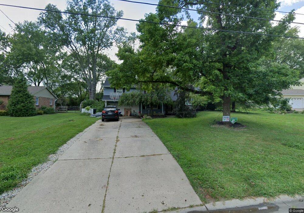
This home is located at 469 Cloverwood Dr, Mason, OH 45040 and is currently estimated at $416,781, approximately $163 per square foot. 469 Cloverwood Dr is a home located in Warren County with nearby schools including Mason Intermediate Elementary School, Mason Middle School, and William Mason High School.
Ownership History
Date
Name
Owned For
Owner Type
Purchase Details
Closed on
Nov 5, 2001
Sold by
Looker Katherine
Bought by
Cox Andrew W and Cox Katherine E
Current Estimated Value
Home Financials for this Owner
Home Financials are based on the most recent Mortgage that was taken out on this home.
Original Mortgage
$64,000
Interest Rate
6.8%
Mortgage Type
New Conventional
Create a Home Valuation Report for This Property
The Home Valuation Report is an in-depth analysis detailing your home's value as well as a comparison with similar homes in the area
Home Values in the Area
Average Home Value in this Area
Purchase History
| Date | Buyer | Sale Price | Title Company |
|---|---|---|---|
| Cox Andrew W | $120,000 | -- |
Source: Public Records
Mortgage History
| Date | Status | Borrower | Loan Amount |
|---|---|---|---|
| Closed | Cox Andrew W | $64,000 |
Source: Public Records
Tax History Compared to Growth
Tax History
| Year | Tax Paid | Tax Assessment Tax Assessment Total Assessment is a certain percentage of the fair market value that is determined by local assessors to be the total taxable value of land and additions on the property. | Land | Improvement |
|---|---|---|---|---|
| 2024 | $4,323 | $106,520 | $24,500 | $82,020 |
| 2023 | $4,214 | $87,724 | $15,067 | $72,656 |
| 2022 | $4,160 | $87,724 | $15,068 | $72,657 |
| 2021 | $3,941 | $87,724 | $15,068 | $72,657 |
| 2020 | $3,737 | $71,320 | $12,250 | $59,070 |
| 2019 | $3,435 | $71,320 | $12,250 | $59,070 |
| 2018 | $3,447 | $71,320 | $12,250 | $59,070 |
| 2017 | $3,242 | $62,615 | $11,267 | $51,349 |
| 2016 | $3,339 | $62,615 | $11,267 | $51,349 |
| 2015 | $3,346 | $62,615 | $11,267 | $51,349 |
| 2014 | $3,218 | $56,150 | $10,240 | $45,910 |
| 2013 | $3,225 | $67,170 | $12,250 | $54,920 |
Source: Public Records
Map
Nearby Homes
- 6303 Greenwood Ct
- 6292 Greenwood Ct
- 6334 Greenwood Ct
- 6298 Greenwood Ct
- 6328 Greenwood Ct
- 6279 Greenwood Ct
- 6346 Coverage Ct
- 6350 Coverage Ct
- 6342 Coverage Ct
- 6338 Coverage Ct
- 6267 Greenwood Ct
- 5799 Fairway Dr
- 4109 Old Manchester Ct
- 325 Kings Mills Rd
- 3900 St Andrews Ct
- 226 Kings Mills Rd
- 6365 Fieldstone Dr
- 618 Bunker Ln
- 4154 Fieldsedge Dr
- 4762 Flagstone Dr
- 463 Cloverwood Dr
- 475 Cloverwood Dr
- 457 Cloverwood Dr
- 470 Cloverwood Dr
- 481 Cloverwood Dr
- 464 Cloverwood Dr
- 487 David Ln
- 451 Cloverwood Dr
- 480 Cloverwood Dr
- 456 Cloverwood Dr
- 445 Cloverwood Dr
- 500 David Ln
- 448 Cloverwood Dr
- 459 David Ln
- 490 David Ln
- 476 David Ln
- 494 David Ln
- 447 David Ln
- 439 Arbor Ct
- 444 Cloverwood Dr