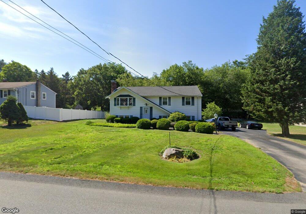
469 King St Raynham, MA 02767
Estimated Value: $554,544 - $571,000
3
Beds
2
Baths
1,802
Sq Ft
$313/Sq Ft
Est. Value
About This Home
This home is located at 469 King St, Raynham, MA 02767 and is currently estimated at $564,636, approximately $313 per square foot. 469 King St is a home located in Bristol County with nearby schools including Merrill Elementary School, LaLiberte Elementary School, and Williams Intermediate School.
Create a Home Valuation Report for This Property
The Home Valuation Report is an in-depth analysis detailing your home's value as well as a comparison with similar homes in the area
Home Values in the Area
Average Home Value in this Area
Tax History
| Year | Tax Paid | Tax Assessment Tax Assessment Total Assessment is a certain percentage of the fair market value that is determined by local assessors to be the total taxable value of land and additions on the property. | Land | Improvement |
|---|---|---|---|---|
| 2025 | $5,795 | $478,900 | $188,800 | $290,100 |
| 2024 | $5,948 | $478,900 | $188,800 | $290,100 |
| 2023 | $5,496 | $404,100 | $169,900 | $234,200 |
| 2022 | $5,481 | $369,600 | $160,400 | $209,200 |
| 2021 | $5,180 | $352,600 | $151,000 | $201,600 |
| 2020 | $4,885 | $339,000 | $143,500 | $195,500 |
| 2019 | $4,555 | $320,100 | $124,600 | $195,500 |
| 2018 | $4,241 | $284,600 | $118,900 | $165,700 |
| 2017 | $3,986 | $265,200 | $113,300 | $151,900 |
| 2016 | $3,916 | $261,400 | $109,500 | $151,900 |
| 2015 | $3,679 | $241,400 | $109,800 | $131,600 |
Source: Public Records
Map
Nearby Homes
- 30 Edward Rd
- 53 Queens Cir
- 21 Sully Rd
- 26 Nottingham Dr
- 935 King St
- 201 Buck Knoll Rd
- 33 White St
- 75 Warren St W Unit 16
- 224 Whippoorwill Dr
- 152 Forgeriver
- 0 Cape Highway Route 44 Unit 73474847
- 5 Parcels Cape Highway Route 44
- 162 Bayberry Rd
- 115 Forge River Pkwy
- 208 S Main St
- 84 Diniz Dr
- 4-B High Ridge Dr
- 35 Spruce St
- 30 Spruce St
- 2 Maplewood Ln Unit 21-1
Your Personal Tour Guide
Ask me questions while you tour the home.