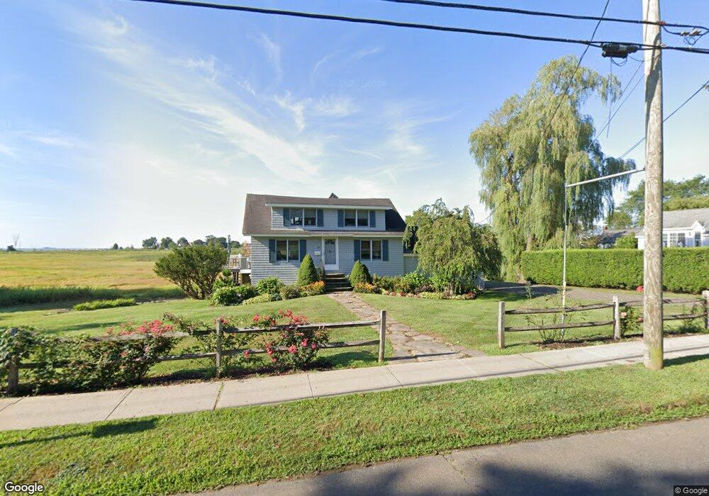
469 Old Whitfield St Guilford, CT 06437
Estimated Value: $656,000 - $922,000
4
Beds
2
Baths
1,918
Sq Ft
$402/Sq Ft
Est. Value
About This Home
This home is located at 469 Old Whitfield St, Guilford, CT 06437 and is currently estimated at $771,230, approximately $402 per square foot. 469 Old Whitfield St is a home located in New Haven County with nearby schools including E.C. Adams Middle School, A. Baldwin Middle School, and Guilford High School.
Ownership History
Date
Name
Owned For
Owner Type
Purchase Details
Closed on
Nov 4, 2016
Sold by
Arnold Nancy R
Bought by
Nancy Arnold Lt
Current Estimated Value
Purchase Details
Closed on
Jan 12, 1979
Bought by
Arnold Nancy R
Create a Home Valuation Report for This Property
The Home Valuation Report is an in-depth analysis detailing your home's value as well as a comparison with similar homes in the area
Home Values in the Area
Average Home Value in this Area
Purchase History
| Date | Buyer | Sale Price | Title Company |
|---|---|---|---|
| Nancy Arnold Lt | -- | -- | |
| Arnold Nancy R | -- | -- |
Source: Public Records
Mortgage History
| Date | Status | Borrower | Loan Amount |
|---|---|---|---|
| Previous Owner | Arnold Nancy R | $30,000 | |
| Previous Owner | Arnold Nancy R | $6,000 |
Source: Public Records
Tax History Compared to Growth
Tax History
| Year | Tax Paid | Tax Assessment Tax Assessment Total Assessment is a certain percentage of the fair market value that is determined by local assessors to be the total taxable value of land and additions on the property. | Land | Improvement |
|---|---|---|---|---|
| 2025 | $10,777 | $389,760 | $254,800 | $134,960 |
| 2024 | $10,360 | $389,760 | $254,800 | $134,960 |
| 2023 | $10,087 | $389,760 | $254,800 | $134,960 |
| 2022 | $10,129 | $304,630 | $222,040 | $82,590 |
| 2021 | $9,937 | $304,630 | $222,040 | $82,590 |
| 2020 | $9,843 | $304,630 | $222,040 | $82,590 |
| 2019 | $9,757 | $304,630 | $222,040 | $82,590 |
| 2018 | $9,529 | $304,630 | $222,040 | $82,590 |
| 2017 | $9,344 | $318,240 | $229,320 | $88,920 |
| 2016 | $9,124 | $318,240 | $229,320 | $88,920 |
| 2015 | $8,987 | $318,240 | $229,320 | $88,920 |
| 2014 | $8,726 | $318,240 | $229,320 | $88,920 |
Source: Public Records
Map
Nearby Homes
- 505 Old Whitfield St
- 52 Seaside Ave
- 379 Whitfield St Unit CN946
- 12 Paddock Ln
- 174 Whitfield St
- 66 High St Unit 17
- 66 High St Unit 40
- 66 High St Unit 38
- 66 High St Unit 36
- 64 Boston St
- 29 Circle Beach Rd
- 51 Pearl St
- 104 Sperry Dr
- 42 Horseshoe Rd
- 65 Water St
- 134 Water St
- 15 Highland Terrace
- 82 State St
- 201 Mulberry Point Rd
- 1054 Boston Post Rd
- 455 Old Whitfield St
- 00 Old Whitfield St
- 455 Whitfield St
- 485 Old Whitfield St
- 485 Whitfield St
- 0 Seaside Ave Unit N10217602
- 0 Seaside Ave
- 22 Seaside Ave
- 484 Old Whitfield St
- 484 Old Whitfield St
- 472 Old Whitfield St
- 456 Old Whitfield St
- 1 Seaside Ave
- 440 Old Whitfield St
- 18 Seaview Terrace
- 19 Seaside Ave
- 496 Old Whitfield St
- 34 Seaside Ave
- 22 Seaview Terrace
- 27 Seaside Ave