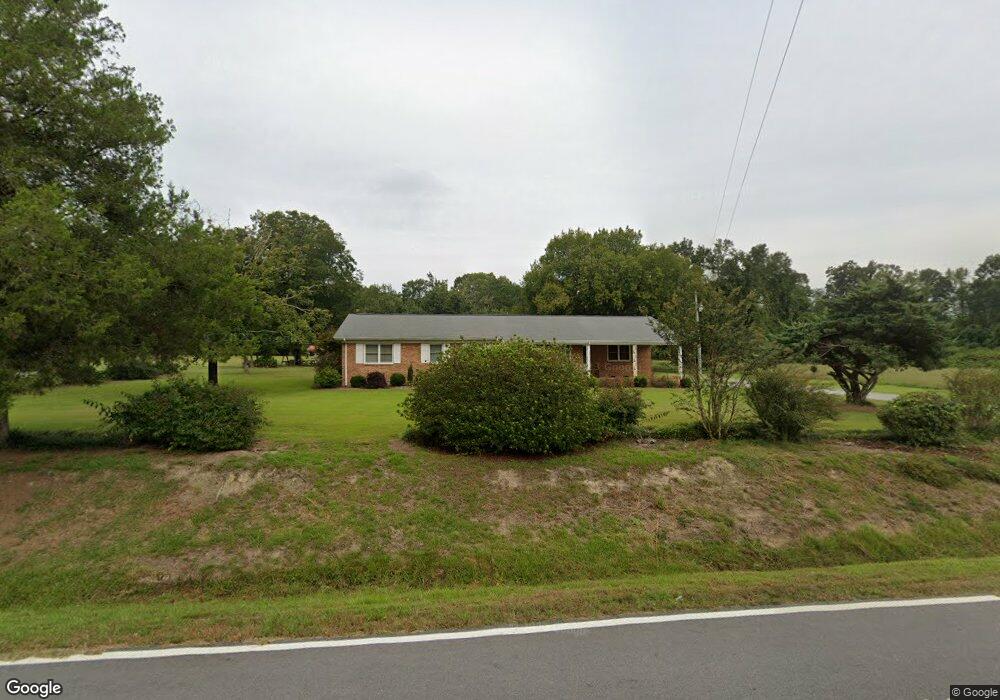
4690 Bear Creek Rd La Grange, NC 28551
Estimated Value: $263,000 - $320,000
3
Beds
2
Baths
1,999
Sq Ft
$146/Sq Ft
Est. Value
About This Home
This home is located at 4690 Bear Creek Rd, La Grange, NC 28551 and is currently estimated at $291,876, approximately $146 per square foot. 4690 Bear Creek Rd is a home located in Lenoir County with nearby schools including La Grange Elementary School, E.B. Frink Middle School, and North Lenoir High School.
Ownership History
Date
Name
Owned For
Owner Type
Purchase Details
Closed on
Jun 9, 2017
Sold by
Rhodes Joni Yvonne and Rhodes Brent
Bought by
Rhodes Joni Yvonne and Rhodes Brent
Current Estimated Value
Home Financials for this Owner
Home Financials are based on the most recent Mortgage that was taken out on this home.
Original Mortgage
$70,000
Interest Rate
4.02%
Mortgage Type
New Conventional
Create a Home Valuation Report for This Property
The Home Valuation Report is an in-depth analysis detailing your home's value as well as a comparison with similar homes in the area
Home Values in the Area
Average Home Value in this Area
Purchase History
| Date | Buyer | Sale Price | Title Company |
|---|---|---|---|
| Rhodes Joni Yvonne | $70,000 | None Available |
Source: Public Records
Mortgage History
| Date | Status | Borrower | Loan Amount |
|---|---|---|---|
| Closed | Rhodes Joni Yvonne | $70,000 |
Source: Public Records
Tax History Compared to Growth
Tax History
| Year | Tax Paid | Tax Assessment Tax Assessment Total Assessment is a certain percentage of the fair market value that is determined by local assessors to be the total taxable value of land and additions on the property. | Land | Improvement |
|---|---|---|---|---|
| 2025 | $2,196 | $287,269 | $23,684 | $263,585 |
| 2024 | $1,338 | $134,917 | $19,440 | $115,477 |
| 2023 | $1,284 | $134,917 | $19,440 | $115,477 |
| 2022 | $1,284 | $134,917 | $19,440 | $115,477 |
| 2021 | $1,284 | $134,917 | $19,440 | $115,477 |
| 2020 | $1,284 | $134,917 | $19,440 | $115,477 |
| 2019 | $1,284 | $134,917 | $19,440 | $115,477 |
| 2018 | $1,264 | $134,917 | $19,440 | $115,477 |
| 2017 | $1,265 | $134,917 | $19,440 | $115,477 |
| 2014 | $1,307 | $139,808 | $19,440 | $120,368 |
| 2013 | -- | $139,808 | $19,440 | $120,368 |
| 2011 | -- | $139,808 | $19,440 | $120,368 |
Source: Public Records
Map
Nearby Homes
- 5517 Bulltown Rd
- 5301 Barber Rd
- 6272 Highway 70 E
- 4725 Packhouse Rd
- 3619 S Caswell St
- 0 Sunset Ridge Dr Unit Lot 21 CAR4282820
- 0 Sunset Ridge Dr Unit Lot11 CAR4282833
- 805 Madison Ann Dr
- 614 S Caswell St
- 210 Wood St
- 201 Wood St
- 202 Wood St
- 208 Wood St
- 217 Wood St
- 204 Wood St
- 205 Wood St
- 206 Wood St
- Hayden Plan at Blair Ridge
- Freeport Plan at Blair Ridge
- Cali Plan at Blair Ridge
- 4716 Bear Creek Rd
- 4677 Bear Creek Rd
- 4734 Bear Creek Rd
- 4682 Bulltown Rd
- 4725 Bulltown Rd
- 4720 Bulltown Rd
- 1525 Ben F Herring Rd
- 1484 Ben F Herring Rd
- 1510 Ben F Herring Rd
- 4755 Bulltown Rd
- 4517 Bear Creek Rd
- 4881 Bear Creek Rd
- 4497 Bear Creek Rd
- 1862 Jenny Lind Rd
- 1861 Jenny Lind Rd
- 2062 Jenny Lind Rd
- 4459 Bear Creek Rd
- 1794 Jenny Lind Rd
- 1428 Ben F Herring Rd
- 1933 Jenny Lind Rd