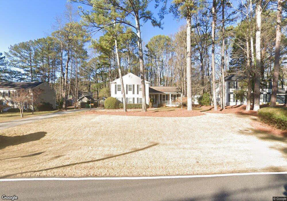
4690 Jones Bridge Cir Unit 7 Norcross, GA 30092
Estimated Value: $551,000 - $565,000
3
Beds
3
Baths
1,624
Sq Ft
$345/Sq Ft
Est. Value
About This Home
This home is located at 4690 Jones Bridge Cir Unit 7, Norcross, GA 30092 and is currently estimated at $560,183, approximately $344 per square foot. 4690 Jones Bridge Cir Unit 7 is a home located in Gwinnett County with nearby schools including Simpson Elementary School, Pinckneyville Middle School, and Norcross High School.
Ownership History
Date
Name
Owned For
Owner Type
Purchase Details
Closed on
Feb 16, 2015
Sold by
Kendrick Clifford
Bought by
Kendrick Helen M Irrevocable T
Current Estimated Value
Purchase Details
Closed on
Nov 22, 2004
Sold by
Meyhoefer Douglas and Meyhoefer Melissa
Bought by
Kendrick Clifford and Kendrick Helen
Purchase Details
Closed on
Apr 23, 1996
Sold by
Rusell Earl S Sharon L
Bought by
Heyhoefer Douglas R
Create a Home Valuation Report for This Property
The Home Valuation Report is an in-depth analysis detailing your home's value as well as a comparison with similar homes in the area
Home Values in the Area
Average Home Value in this Area
Purchase History
| Date | Buyer | Sale Price | Title Company |
|---|---|---|---|
| Kendrick Helen M Irrevocable T | -- | -- | |
| Kendrick Clifford | $239,900 | -- | |
| Heyhoefer Douglas R | $146,500 | -- |
Source: Public Records
Mortgage History
| Date | Status | Borrower | Loan Amount |
|---|---|---|---|
| Closed | Heyhoefer Douglas R | $0 |
Source: Public Records
Tax History Compared to Growth
Tax History
| Year | Tax Paid | Tax Assessment Tax Assessment Total Assessment is a certain percentage of the fair market value that is determined by local assessors to be the total taxable value of land and additions on the property. | Land | Improvement |
|---|---|---|---|---|
| 2025 | $2,816 | $232,880 | $38,000 | $194,880 |
| 2024 | $6,676 | $192,600 | $40,000 | $152,600 |
| 2023 | $6,676 | $181,760 | $36,400 | $145,360 |
| 2022 | $1,221 | $162,280 | $32,800 | $129,480 |
| 2021 | $1,211 | $143,520 | $26,240 | $117,280 |
| 2020 | $1,211 | $139,480 | $26,000 | $113,480 |
| 2019 | $1,119 | $139,480 | $26,000 | $113,480 |
| 2018 | $1,115 | $122,840 | $24,000 | $98,840 |
| 2016 | $1,074 | $97,840 | $24,000 | $73,840 |
| 2015 | $1,099 | $97,840 | $24,000 | $73,840 |
| 2014 | -- | $94,880 | $24,000 | $70,880 |
Source: Public Records
Map
Nearby Homes
- 5221 W Jones Bridge Rd
- 5397 Valley Mist Ct
- 5465 Fort Fisher Way
- 5465 Fort Fisher Way
- 4531 Outer Bank Dr
- 5809 Alvaton Ct
- 5885 Match Point
- 5649 Whitesburg Ct
- 5961 Ranger Ct
- 5665 Creekside Ct
- 5305 Linnadine Way
- 3999 the Dales Ln NW
- 4053 Spalding Hollow NW
- 3659 Allenhurst Dr
- 5970 Rachel Ridge Unit 2
- 5786 Broxton Cir
- The Adams Plan at Waterside - Condos
- 4457 Watervale Way Unit 292
- 4477 Watervale Way Unit 286
- 5047 Shirley Oaks Dr Unit 313
- 4700R Jones Bridge Cir
- 4700 Jones Bridge Cir
- 4680 Jones Bridge Cir
- 4700 Jones Bridge Cir
- 4295 Shawn Ct
- 4284 Patrick Trace Unit 6
- 4274 Patrick Trace Unit 7
- 4691 Jones Bridge Cir Unit 8
- 4260 Walden Ct
- 4264 Patrick Trace
- 4681 Jones Bridge Cir
- 4284 Shawn Ct
- 4294 Patrick Trace
- 4294 Shawn Ct
- 4250 Walden Ct
- 4711 Jones Bridge Cir Unit 8
- 4711 Jones Bridge Cir
- 4671 Jones Bridge Cir Unit 8
- 4315 Shawn Ct
- 4261 Mary Walk Unit 8