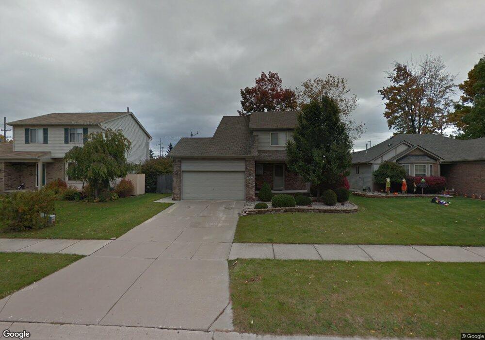
46924 Oak Pointe Dr Macomb, MI 48042
Estimated Value: $331,000 - $355,000
Studio
2
Baths
1,626
Sq Ft
$211/Sq Ft
Est. Value
About This Home
This home is located at 46924 Oak Pointe Dr, Macomb, MI 48042 and is currently estimated at $343,680, approximately $211 per square foot. 46924 Oak Pointe Dr is a home located in Macomb County with nearby schools including Atwood Elementary School, L'Anse Creuse Middle School - North, and L'Anse Creuse High School - North.
Ownership History
Date
Name
Owned For
Owner Type
Purchase Details
Closed on
Jun 14, 2002
Sold by
Droelle Dean A and Droelle Lorice
Bought by
Bauer James
Current Estimated Value
Home Financials for this Owner
Home Financials are based on the most recent Mortgage that was taken out on this home.
Original Mortgage
$150,450
Interest Rate
6.49%
Mortgage Type
Purchase Money Mortgage
Create a Home Valuation Report for This Property
The Home Valuation Report is an in-depth analysis detailing your home's value as well as a comparison with similar homes in the area
Home Values in the Area
Average Home Value in this Area
Purchase History
| Date | Buyer | Sale Price | Title Company |
|---|---|---|---|
| Bauer James | $177,000 | Clinton Valley Title Company |
Source: Public Records
Mortgage History
| Date | Status | Borrower | Loan Amount |
|---|---|---|---|
| Previous Owner | Bauer James | $150,450 |
Source: Public Records
Tax History
| Year | Tax Paid | Tax Assessment Tax Assessment Total Assessment is a certain percentage of the fair market value that is determined by local assessors to be the total taxable value of land and additions on the property. | Land | Improvement |
|---|---|---|---|---|
| 2025 | $2,128 | $151,700 | $0 | $0 |
| 2024 | $21 | $140,700 | $0 | $0 |
| 2023 | $1,962 | $132,400 | $0 | $0 |
| 2022 | $2,738 | $115,300 | $0 | $0 |
| 2021 | $4,023 | $111,100 | $0 | $0 |
| 2020 | $3,169 | $106,800 | $0 | $0 |
| 2019 | $5,415 | $99,200 | $0 | $0 |
| 2018 | $5,296 | $97,700 | $0 | $0 |
| 2017 | $6,045 | $85,920 | $25,000 | $60,920 |
| 2016 | $4,807 | $85,920 | $0 | $0 |
| 2015 | $4,543 | $80,410 | $0 | $0 |
| 2014 | $4,543 | $70,620 | $16,000 | $54,620 |
| 2013 | $2,749 | $70,620 | $0 | $0 |
Source: Public Records
Map
Nearby Homes
- 24374 21 Mile Rd
- 0 Gratiot Ave
- 6009 Gratiot Ave
- 45945 N Gratiot Ave
- 47140 Hunters Chase Dr
- 23944 Harrellson St
- 45729 N Gratiot Ave
- 47338 Hunters Chase Dr
- 25591 Lord Dr
- 23206 21 Mile Rd
- 23199 Hidden Creek Dr
- 47848 Sonnett Dr
- 23610 Lynnhurst St
- 25865 Eastridge Ct
- 45937 Duke Dr
- 25983 New Forest Ct
- 47846 North Ave
- 26122 Joanne Smith Ln Unit 143
- 26196 Captains Landing
- 23346 Spring Creek Dr
- 46902 Oak Pointe Dr
- 46946 Oak Pointe Dr
- 46880 Oak Pointe Dr
- 46858 Oak Pointe Dr
- 46935 Oak Pointe Dr
- 46899 Oak Pointe Dr
- 46951 Oak Pointe Dr
- 46873 Oak Pointe Dr
- 46836 Oak Pointe Dr
- 24380 21 Mile Rd
- 24379 Mikado Ct
- 46814 Oak Pointe Dr
- 46825 Oak Pointe Dr
- 46792 Oak Pointe Dr
- 24357 Mikado Ct
- 46809 Oak Pointe Dr
- 24356 21 Mile Rd
- 46770 Oak Pointe Dr
- 46781 Oak Pointe Dr
- 24386 Mikado Ct
Your Personal Tour Guide
Ask me questions while you tour the home.