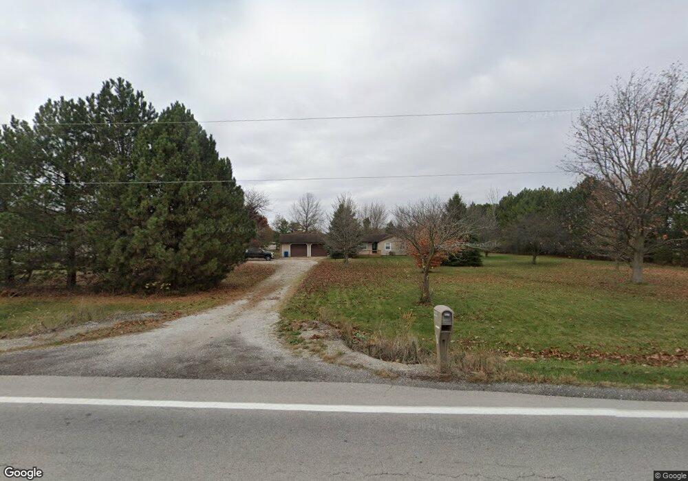
4699 State Route 4 Bellevue, OH 44811
Estimated Value: $180,000 - $233,000
3
Beds
2
Baths
1,266
Sq Ft
$164/Sq Ft
Est. Value
About This Home
This home is located at 4699 State Route 4, Bellevue, OH 44811 and is currently estimated at $207,011, approximately $163 per square foot. 4699 State Route 4 is a home located in Huron County with nearby schools including Bellevue Elementary School, Bellevue Middle School, and Bellevue High School.
Ownership History
Date
Name
Owned For
Owner Type
Purchase Details
Closed on
Oct 20, 2017
Sold by
Taggart Brad E and Taggart Tulana Renae
Bought by
Mccullough Brett M
Current Estimated Value
Home Financials for this Owner
Home Financials are based on the most recent Mortgage that was taken out on this home.
Original Mortgage
$113,400
Outstanding Balance
$94,619
Interest Rate
3.78%
Mortgage Type
New Conventional
Estimated Equity
$112,392
Purchase Details
Closed on
Apr 24, 1995
Bought by
Taggart Brad E
Create a Home Valuation Report for This Property
The Home Valuation Report is an in-depth analysis detailing your home's value as well as a comparison with similar homes in the area
Home Values in the Area
Average Home Value in this Area
Purchase History
| Date | Buyer | Sale Price | Title Company |
|---|---|---|---|
| Mccullough Brett M | $162,000 | First American Title | |
| Taggart Brad E | -- | -- |
Source: Public Records
Mortgage History
| Date | Status | Borrower | Loan Amount |
|---|---|---|---|
| Open | Mccullough Brett M | $113,400 |
Source: Public Records
Tax History Compared to Growth
Tax History
| Year | Tax Paid | Tax Assessment Tax Assessment Total Assessment is a certain percentage of the fair market value that is determined by local assessors to be the total taxable value of land and additions on the property. | Land | Improvement |
|---|---|---|---|---|
| 2024 | $2,222 | $53,120 | $11,870 | $41,250 |
| 2023 | $2,222 | $40,710 | $8,600 | $32,110 |
| 2022 | $1,823 | $40,710 | $8,600 | $32,110 |
| 2021 | $1,837 | $40,710 | $8,600 | $32,110 |
| 2020 | $1,721 | $36,320 | $8,400 | $27,920 |
| 2019 | $1,694 | $36,320 | $8,400 | $27,920 |
| 2018 | $1,672 | $36,320 | $8,400 | $27,920 |
| 2017 | $1,632 | $37,180 | $8,250 | $28,930 |
| 2016 | $1,583 | $37,180 | $8,250 | $28,930 |
| 2015 | $1,627 | $37,190 | $8,250 | $28,940 |
| 2014 | $1,735 | $38,300 | $9,140 | $29,160 |
| 2013 | $1,732 | $38,300 | $9,140 | $29,160 |
Source: Public Records
Map
Nearby Homes
- 3050 E Main St
- 817 E Main St
- 140 Hobson St
- 140 Harkness St
- 501 E Center St
- 808 Castalia St
- 206 Southwest St
- 819 Castalia St
- 124 Sunset Dr
- 111 Park Ave
- 130 Huffman St
- 219 Huffman St
- 129 Hamilton St
- 126 Greenwood Heights
- 408 W Main St
- 154 Ashford Ave
- 155 Ashford Ave
- 231 Lawrence St
- 720 Kilbourne St
- 230 Highland Ave Unit 106
- 4699 Ohio 4
- 4665 State Route 4
- 4719 State Route 4
- 4730 State Route 4
- 4731 State Route 4
- 4766 State Route 4
- 4541 State Route 4
- 4657 Beckstein Rd
- 4724 Beckstein Rd
- 4770 Beckstein Rd
- 4818 Beckstein Rd
- 4852 Beckstein Rd
- 3010 E Main St
- 4890 Beckstein Rd
- 3000 E Main St
- 4422 Section Line Road 30
- 5625 State Route 113
- 5360 Us Highway 20 E
- 4954 State Route 4
- 5679 State Route 113