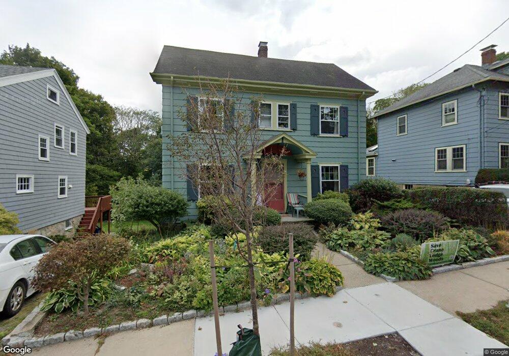
47 Arborough Rd Roslindale, MA 02131
Roslindale NeighborhoodEstimated Value: $846,000 - $1,077,000
3
Beds
1
Bath
1,900
Sq Ft
$504/Sq Ft
Est. Value
About This Home
This home is located at 47 Arborough Rd, Roslindale, MA 02131 and is currently estimated at $957,413, approximately $503 per square foot. 47 Arborough Rd is a home located in Suffolk County with nearby schools including Brooke Charter School Roslindale, Sacred Heart STEM School, and Holy Name Parish School.
Ownership History
Date
Name
Owned For
Owner Type
Purchase Details
Closed on
Jul 15, 2025
Sold by
Elizabeth Zoob Lt and Zoob
Bought by
Tumposky Zoob Ft and Tumposky
Current Estimated Value
Purchase Details
Closed on
Jun 9, 2015
Sold by
Tumposky Robert and Zoob Elizabeth
Bought by
Elizabeth Zoob Lt
Create a Home Valuation Report for This Property
The Home Valuation Report is an in-depth analysis detailing your home's value as well as a comparison with similar homes in the area
Home Values in the Area
Average Home Value in this Area
Purchase History
| Date | Buyer | Sale Price | Title Company |
|---|---|---|---|
| Tumposky Zoob Ft | -- | -- | |
| Tumposky Zoob Ft | -- | -- | |
| Elizabeth Zoob Lt | -- | -- | |
| Elizabeth Zoob Lt | -- | -- |
Source: Public Records
Tax History Compared to Growth
Tax History
| Year | Tax Paid | Tax Assessment Tax Assessment Total Assessment is a certain percentage of the fair market value that is determined by local assessors to be the total taxable value of land and additions on the property. | Land | Improvement |
|---|---|---|---|---|
| 2025 | $8,997 | $776,900 | $257,700 | $519,200 |
| 2024 | $8,367 | $767,600 | $263,300 | $504,300 |
| 2023 | $8,244 | $767,600 | $263,300 | $504,300 |
| 2022 | $7,457 | $685,400 | $235,100 | $450,300 |
| 2021 | $7,197 | $674,500 | $235,100 | $439,400 |
| 2020 | $7,030 | $665,700 | $225,700 | $440,000 |
| 2019 | $6,496 | $616,300 | $187,900 | $428,400 |
| 2018 | $5,983 | $570,900 | $187,900 | $383,000 |
| 2017 | $6,046 | $570,900 | $187,900 | $383,000 |
| 2016 | $6,097 | $554,300 | $187,900 | $366,400 |
| 2015 | $5,471 | $451,800 | $141,900 | $309,900 |
| 2014 | -- | $410,800 | $141,900 | $268,900 |
Source: Public Records
Map
Nearby Homes
- 20 Taft Hill Park Unit 5
- 46 Cotton St Unit 46
- 620 South St
- 21 Bexley Rd
- 108 Florence St Unit 1
- 108 Florence St Unit 3
- 108 Florence St Unit 2
- 15 S Fairview St Unit 3
- 22 Walter St Unit 2
- 18 Robert St Unit 14
- 18 Robert St Unit 4
- 173 Brookway Rd
- 27 Sheffield Rd Unit 3
- 2 Weld Hill St Unit 301
- 2 Weld Hill St Unit PH2
- 2 Weld Hill St Unit 302
- 187 Florence St Unit 2L
- 46 Belgrade Ave Unit 2
- 39 Harrison St Unit B
- 74 Selwyn St Unit 2
- 51 Arborough Rd
- 43 Arborough Rd
- 55 Arborough Rd
- 55 Arborough Rd Unit 1
- 39 Arborough Rd
- 48 Arborough Rd
- 57 Arborough Rd
- 35 Arborough Rd
- 44 Arborough Rd
- 52 Arborough Rd
- 56 Arborough Rd
- 40 Arborough Rd
- 29 Arborough Rd
- 36 Arborough Rd
- 60 Arborough Rd
- 32 Arborough Rd
- 55 Fairview St
- 53 Fairview St
- 57 Fairview St
- 51 Fairview St