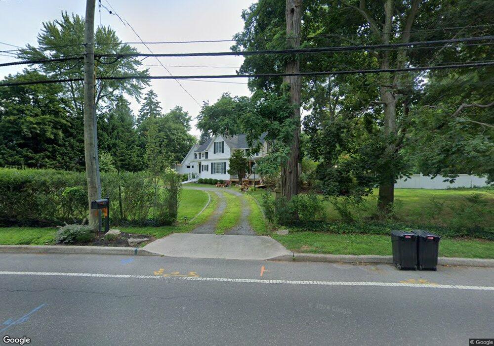
47 Bennetts Rd East Setauket, NY 11733
Estimated Value: $614,000 - $958,000
3
Beds
1
Bath
1,642
Sq Ft
$459/Sq Ft
Est. Value
About This Home
This home is located at 47 Bennetts Rd, East Setauket, NY 11733 and is currently estimated at $752,920, approximately $458 per square foot. 47 Bennetts Rd is a home located in Suffolk County with nearby schools including Minnesauke Elementary School, Paul J Gelinas Junior High School, and Ward Melville Senior High School.
Ownership History
Date
Name
Owned For
Owner Type
Purchase Details
Closed on
Sep 15, 2021
Sold by
Kanestrin Robert
Bought by
Bond Jonathan
Current Estimated Value
Home Financials for this Owner
Home Financials are based on the most recent Mortgage that was taken out on this home.
Original Mortgage
$400,000
Interest Rate
3.09%
Mortgage Type
Negative Amortization
Purchase Details
Closed on
Aug 28, 2003
Sold by
Kanestrin Robert C and Kanestrin Lori J
Bought by
Kanestrin Lori J
Purchase Details
Closed on
May 4, 1999
Sold by
Delia Pat and Delia Emma
Bought by
Kanestrin Robert C and Kanestrin Lori J
Home Financials for this Owner
Home Financials are based on the most recent Mortgage that was taken out on this home.
Original Mortgage
$130,000
Interest Rate
6.92%
Mortgage Type
Unknown
Create a Home Valuation Report for This Property
The Home Valuation Report is an in-depth analysis detailing your home's value as well as a comparison with similar homes in the area
Home Values in the Area
Average Home Value in this Area
Purchase History
| Date | Buyer | Sale Price | Title Company |
|---|---|---|---|
| Bond Jonathan | $475,000 | None Available | |
| Bond Jonathan | $475,000 | None Available | |
| Kanestrin Lori J | -- | Fidelity National Title Ins | |
| Kanestrin Lori J | -- | Fidelity National Title Ins | |
| Kanestrin Robert C | $200,000 | First American Title Ins Co | |
| Kanestrin Robert C | $200,000 | First American Title Ins Co |
Source: Public Records
Mortgage History
| Date | Status | Borrower | Loan Amount |
|---|---|---|---|
| Previous Owner | Bond Jonathan | $400,000 | |
| Previous Owner | Kanestrin Robert C | $130,000 |
Source: Public Records
Tax History Compared to Growth
Tax History
| Year | Tax Paid | Tax Assessment Tax Assessment Total Assessment is a certain percentage of the fair market value that is determined by local assessors to be the total taxable value of land and additions on the property. | Land | Improvement |
|---|---|---|---|---|
| 2024 | $11,682 | $2,750 | $400 | $2,350 |
| 2023 | $11,682 | $2,750 | $400 | $2,350 |
| 2022 | $9,465 | $2,750 | $400 | $2,350 |
| 2021 | $9,465 | $2,750 | $400 | $2,350 |
| 2020 | $9,785 | $2,750 | $400 | $2,350 |
| 2019 | $9,785 | $0 | $0 | $0 |
| 2018 | $9,275 | $2,750 | $400 | $2,350 |
| 2017 | $9,275 | $2,750 | $400 | $2,350 |
| 2016 | $9,145 | $2,750 | $400 | $2,350 |
| 2015 | -- | $2,750 | $400 | $2,350 |
| 2014 | -- | $2,750 | $400 | $2,350 |
Source: Public Records
Map
Nearby Homes
- 121 Lower Sheep Pasture Rd
- 28 Buckingham Meadow Rd
- 155 Lower Sheep Pasture Rd
- 67 Ridgeway Ave
- 63 Ridgeway Ave
- 3 Somerset Ct
- 16 Abbey Ln Unit 116
- 20 Huyler Rd
- 14 Brewster Hill Rd
- 26 Brewster Hill Rd
- 18 Huyler Ct
- 5 Stony Wood Rd
- 19 Fox Rd
- 11 Quaker Path
- 169 Old Town Rd
- 63-LOT1 N Country Rd
- 27 Upper Sheep Pasture Rd
- 30 Yorktown Rd
- 28 Christian Ave
- 7 Garden Dr