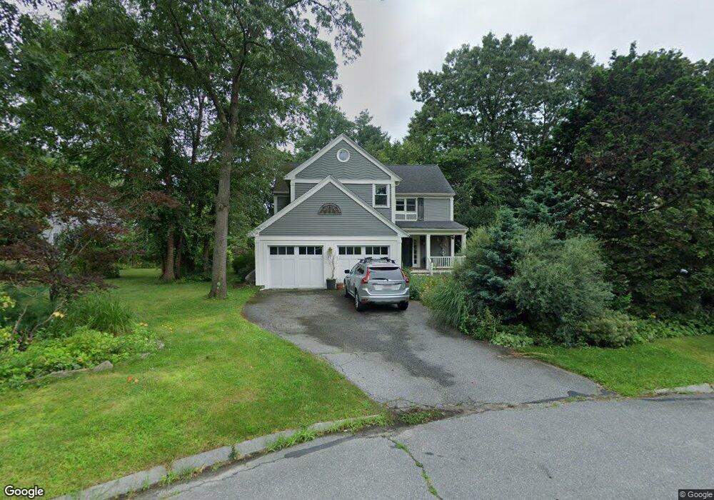
47 Bridgecourt Ln Concord, MA 01742
Estimated Value: $1,318,000 - $1,654,000
4
Beds
3
Baths
2,427
Sq Ft
$624/Sq Ft
Est. Value
About This Home
This home is located at 47 Bridgecourt Ln, Concord, MA 01742 and is currently estimated at $1,515,601, approximately $624 per square foot. 47 Bridgecourt Ln is a home located in Middlesex County with nearby schools including Willard School, Concord Middle School, and Concord Carlisle High School.
Ownership History
Date
Name
Owned For
Owner Type
Purchase Details
Closed on
Sep 14, 2001
Sold by
Kaemmer J David and Kaemmer Althea S
Bought by
Gaehde Nicholas C and Hubbard Pamela A
Current Estimated Value
Home Financials for this Owner
Home Financials are based on the most recent Mortgage that was taken out on this home.
Original Mortgage
$275,000
Interest Rate
6.99%
Mortgage Type
Purchase Money Mortgage
Purchase Details
Closed on
Feb 20, 1992
Sold by
Altair Assoc Inc
Bought by
Kaemmer J David and Kaemmer Althea S
Create a Home Valuation Report for This Property
The Home Valuation Report is an in-depth analysis detailing your home's value as well as a comparison with similar homes in the area
Home Values in the Area
Average Home Value in this Area
Purchase History
| Date | Buyer | Sale Price | Title Company |
|---|---|---|---|
| Gaehde Nicholas C | $730,000 | -- | |
| Kaemmer J David | $362,068 | -- |
Source: Public Records
Mortgage History
| Date | Status | Borrower | Loan Amount |
|---|---|---|---|
| Open | Kaemmer J David | $300,000 | |
| Closed | Gaehde Nicholas C | $275,000 | |
| Previous Owner | Kaemmer J David | $50,000 | |
| Previous Owner | Kaemmer J David | $128,000 |
Source: Public Records
Tax History Compared to Growth
Tax History
| Year | Tax Paid | Tax Assessment Tax Assessment Total Assessment is a certain percentage of the fair market value that is determined by local assessors to be the total taxable value of land and additions on the property. | Land | Improvement |
|---|---|---|---|---|
| 2025 | $161 | $1,215,800 | $551,700 | $664,100 |
| 2024 | $15,963 | $1,215,800 | $551,700 | $664,100 |
| 2023 | $14,789 | $1,141,100 | $501,500 | $639,600 |
| 2022 | $13,802 | $935,100 | $401,200 | $533,900 |
| 2021 | $13,435 | $912,700 | $401,200 | $511,500 |
| 2020 | $13,033 | $915,900 | $401,200 | $514,700 |
| 2019 | $12,280 | $865,400 | $389,600 | $475,800 |
| 2018 | $12,082 | $845,500 | $371,000 | $474,500 |
| 2017 | $11,577 | $822,800 | $353,400 | $469,400 |
| 2016 | $11,421 | $820,500 | $353,400 | $467,100 |
| 2015 | $10,783 | $754,600 | $327,200 | $427,400 |
Source: Public Records
Map
Nearby Homes
- 1053 Main St
- 12 S Meadow Ridge Unit 12
- 12 S Meadow Ridge
- 24 Concord Greene Unit 7
- 16 Concord Greene Unit 5
- 29 Concord Greene Unit 3
- 114 Upland Rd
- 111 Central St
- 102 Highland St
- 70 McCallar Ln
- 54 Maple St
- 37 Wolf Pine Way
- 602 Main St
- 79-81 Assabet Ave
- 497 Old Road to 9 Acre Corner
- 1687 Main St
- 46 Wood St
- 88 Wright Rd
- 10 Wright Rd
- 27 Water St
- 50 Bridgecourt Ln
- 41 Bridgecourt Ln
- 318 Old Marlboro Rd
- 111 Cottage St
- 103 Cottage St
- 304 Old Marlboro Rd
- 77 Crest St
- 121 Cottage St
- 31 Bridgecourt Ln
- 55 Crest St
- 67 Crest St
- 296 Old Marlboro Rd
- 332 Old Marlboro Rd
- 26 Bridgecourt Ln
- 49 Crest St
- 129 Cottage St
- 288 Old Marlboro Rd
- 283 Old Marlboro Rd
- 43 Crest St
- 45 Crest St Unit 1st Fl