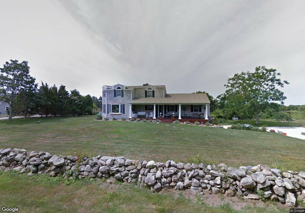
47 Butts Rock Rd Little Compton, RI 02837
Estimated Value: $1,296,417 - $2,073,000
3
Beds
3
Baths
2,622
Sq Ft
$602/Sq Ft
Est. Value
About This Home
This home is located at 47 Butts Rock Rd, Little Compton, RI 02837 and is currently estimated at $1,579,604, approximately $602 per square foot. 47 Butts Rock Rd is a home located in Newport County with nearby schools including Wilbur & McMahon School.
Ownership History
Date
Name
Owned For
Owner Type
Purchase Details
Closed on
Jan 31, 2019
Sold by
Duquenoy Gordon C
Bought by
Duquenoy 2019 Lt
Current Estimated Value
Purchase Details
Closed on
Oct 15, 2010
Sold by
Zarach Steven M
Bought by
Duquenoy Gordon and Duquenoy Lisa
Create a Home Valuation Report for This Property
The Home Valuation Report is an in-depth analysis detailing your home's value as well as a comparison with similar homes in the area
Home Values in the Area
Average Home Value in this Area
Purchase History
| Date | Buyer | Sale Price | Title Company |
|---|---|---|---|
| Duquenoy 2019 Lt | -- | -- | |
| Duquenoy Gordon | $600,000 | -- |
Source: Public Records
Mortgage History
| Date | Status | Borrower | Loan Amount |
|---|---|---|---|
| Previous Owner | Duquenoy Gordon | $50,000 | |
| Previous Owner | Duquenoy Gordon | $192,000 | |
| Previous Owner | Duquenoy Gordon | $473,000 | |
| Previous Owner | Duquenoy Gordon | $50,000 |
Source: Public Records
Tax History Compared to Growth
Tax History
| Year | Tax Paid | Tax Assessment Tax Assessment Total Assessment is a certain percentage of the fair market value that is determined by local assessors to be the total taxable value of land and additions on the property. | Land | Improvement |
|---|---|---|---|---|
| 2025 | $4,792 | $1,000,500 | $504,500 | $496,000 |
| 2024 | $4,104 | $807,900 | $438,800 | $369,100 |
| 2023 | $4,007 | $807,900 | $438,800 | $369,100 |
| 2022 | $3,808 | $777,100 | $438,800 | $338,300 |
| 2021 | $4,432 | $733,800 | $410,200 | $323,600 |
| 2020 | $4,395 | $733,800 | $410,200 | $323,600 |
| 2019 | $4,351 | $733,800 | $410,200 | $323,600 |
| 2018 | $4,345 | $729,100 | $410,200 | $318,900 |
| 2016 | $4,134 | $729,100 | $410,200 | $318,900 |
| 2015 | $4,095 | $712,100 | $346,900 | $365,200 |
| 2014 | $4,016 | $712,100 | $346,900 | $365,200 |
Source: Public Records
Map
Nearby Homes
- 18 Old Barn Rd
- 128 Maple Ave
- 141 S Of Commons Rd
- 304 Brayton Point Rd
- 189 Brayton Point Rd
- 536 W Main Rd
- 255 John Dyer Rd
- 19 Seabury Ln
- 0 Willow Ave
- 505 Long Hwy
- 441 W Main Rd
- 245 John Dyer Rd
- 180 W Main Rd
- 17 Ferolbink Way
- 155 W Main Rd
- 116 Amy Hart Path
- 83 Long Hwy
- 1881 Main Rd
- 0 Reed Rd (Ss)
- 6 June Way
- 47 Butts Rock Rd Unit 1
- 83 Butts Rock Rd
- 51 Butts Rock Rd
- 48 Butts Rock Rd
- 48 Rogers Ln
- 56 Rogers Ln
- 0 Rogers Ln
- 43 Butts Rock Rd
- 44 Butts Rock Rd
- 60 Butts Rock Rd
- 62 Rogers Ln
- 39 Butts Rock Rd
- 45 Side Rd
- 10 Beach Dr
- 38 Butts Rock Rd
- 66 Rogers Ln
- 45 Indian Rd
- 49 Indian Rd
- 41 Indian Rd
- 64 Butts Rock Rd