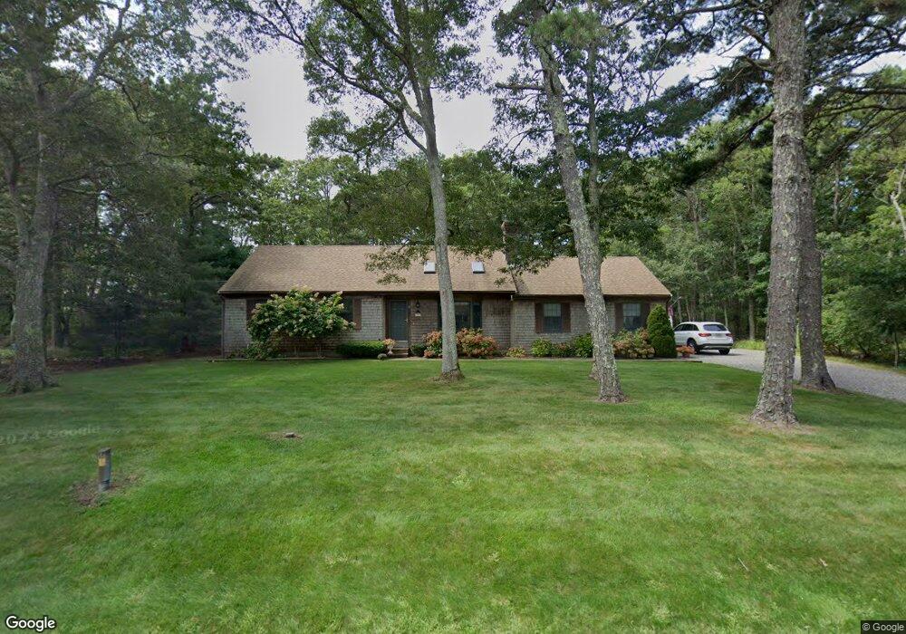
47 Captain Walsh Rd Dennis, MA 02638
East Dennis NeighborhoodEstimated Value: $741,000 - $811,000
3
Beds
2
Baths
1,670
Sq Ft
$461/Sq Ft
Est. Value
About This Home
This home is located at 47 Captain Walsh Rd, Dennis, MA 02638 and is currently estimated at $769,583, approximately $460 per square foot. 47 Captain Walsh Rd is a home located in Barnstable County with nearby schools including Dennis-Yarmouth Regional High School.
Ownership History
Date
Name
Owned For
Owner Type
Purchase Details
Closed on
Jan 22, 2020
Sold by
Gaeta Richard A and Gaeta Ellen M
Bought by
Gaeta Nt
Current Estimated Value
Purchase Details
Closed on
May 15, 1985
Bought by
Gaeta Richard A and Gaeta Ellen M
Create a Home Valuation Report for This Property
The Home Valuation Report is an in-depth analysis detailing your home's value as well as a comparison with similar homes in the area
Home Values in the Area
Average Home Value in this Area
Purchase History
| Date | Buyer | Sale Price | Title Company |
|---|---|---|---|
| Gaeta Nt | -- | None Available | |
| Gaeta Richard A | $28,000 | -- |
Source: Public Records
Mortgage History
| Date | Status | Borrower | Loan Amount |
|---|---|---|---|
| Previous Owner | Gaeta Richard A | $115,000 | |
| Previous Owner | Gaeta Richard A | $110,000 | |
| Previous Owner | Gaeta Richard A | $100,000 | |
| Previous Owner | Gaeta Richard A | $68,000 |
Source: Public Records
Tax History Compared to Growth
Tax History
| Year | Tax Paid | Tax Assessment Tax Assessment Total Assessment is a certain percentage of the fair market value that is determined by local assessors to be the total taxable value of land and additions on the property. | Land | Improvement |
|---|---|---|---|---|
| 2025 | $3,209 | $741,200 | $163,500 | $577,700 |
| 2024 | $3,148 | $717,000 | $157,200 | $559,800 |
| 2023 | $2,807 | $601,000 | $142,900 | $458,100 |
| 2022 | $2,718 | $485,300 | $143,100 | $342,200 |
| 2021 | $2,575 | $427,100 | $140,200 | $286,900 |
| 2020 | $2,785 | $456,600 | $140,200 | $316,400 |
| 2019 | $2,587 | $419,300 | $137,500 | $281,800 |
| 2018 | $2,371 | $374,000 | $117,800 | $256,200 |
| 2017 | $2,251 | $366,000 | $117,800 | $248,200 |
| 2016 | $2,220 | $340,000 | $130,900 | $209,100 |
| 2015 | $2,176 | $340,000 | $130,900 | $209,100 |
| 2014 | $1,784 | $281,000 | $130,900 | $150,100 |
Source: Public Records
Map
Nearby Homes
- 32 Captain Walsh Dr
- 31 Acorn Rd
- 43 Barque Cir
- 15 Trudy Cir
- 1146 Massachusetts 134 Unit 4C
- 6 Match Point
- 15 Captain Jud Rd
- 154 Whittier Dr
- 102 Prince Way
- 15 Sallys Way
- 10 Devonshire Ln
- 42 Agnes Rd
- 35 Crown Grant Dr
- 56 S Yarmouth Rd
- 4 Ebb Rd
- 6 Thomas Ct
- 15 Signal Hill Dr
- 46 Jays Dr
- 268 Main St
- 46 Jays Dr
- 33 Capt Walsh Rd
- 53 Captain Walsh Rd
- 51 Captain Walsh Rd
- 51 Captain Walsh Dr
- 32 Blackberry Ln
- 54 Captain Walsh Dr
- 38 Blackberry Ln
- 38 Blackberry Ln Unit 38-40
- 38 Blackberry Ln Unit 1
- 60 Captain Walsh Dr
- 54 Captain Walsh Rd
- 26 Blackberry Ln
- 46 Captain Walsh Dr
- 46 Captain Walsh Rd
- 60 Captain Walsh Rd
- 59 Captain Walsh Rd
- 59 Captain Walsh Dr
- 20 Blackberry Ln
- 33 Captain Walsh Rd
- 66 Captain Walsh Rd