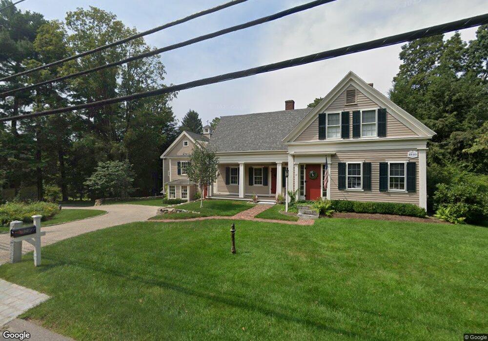
47 Concord Rd Sudbury, MA 01776
Estimated Value: $1,379,000 - $1,862,000
4
Beds
3
Baths
2,233
Sq Ft
$741/Sq Ft
Est. Value
About This Home
This home is located at 47 Concord Rd, Sudbury, MA 01776 and is currently estimated at $1,655,655, approximately $741 per square foot. 47 Concord Rd is a home located in Middlesex County with nearby schools including Israel Loring Elementary School, Ephraim Curtis Middle School, and Lincoln-Sudbury Regional High School.
Ownership History
Date
Name
Owned For
Owner Type
Purchase Details
Closed on
May 27, 2010
Sold by
Akers John and Akers Loretta G
Bought by
Noble John Griffith and Noble Jessica S
Current Estimated Value
Home Financials for this Owner
Home Financials are based on the most recent Mortgage that was taken out on this home.
Original Mortgage
$532,915
Outstanding Balance
$362,031
Interest Rate
5.25%
Mortgage Type
FHA
Estimated Equity
$1,293,624
Create a Home Valuation Report for This Property
The Home Valuation Report is an in-depth analysis detailing your home's value as well as a comparison with similar homes in the area
Home Values in the Area
Average Home Value in this Area
Purchase History
| Date | Buyer | Sale Price | Title Company |
|---|---|---|---|
| Noble John Griffith | $586,000 | -- |
Source: Public Records
Mortgage History
| Date | Status | Borrower | Loan Amount |
|---|---|---|---|
| Open | Noble John Griffith | $532,915 |
Source: Public Records
Tax History Compared to Growth
Tax History
| Year | Tax Paid | Tax Assessment Tax Assessment Total Assessment is a certain percentage of the fair market value that is determined by local assessors to be the total taxable value of land and additions on the property. | Land | Improvement |
|---|---|---|---|---|
| 2025 | $20,716 | $1,415,000 | $409,200 | $1,005,800 |
| 2024 | $19,944 | $1,365,100 | $397,300 | $967,800 |
| 2023 | $17,538 | $1,112,100 | $361,100 | $751,000 |
| 2022 | $15,380 | $852,100 | $331,400 | $520,700 |
| 2021 | $16,631 | $883,200 | $331,400 | $551,800 |
| 2020 | $16,295 | $883,200 | $331,400 | $551,800 |
| 2019 | $15,818 | $883,200 | $331,400 | $551,800 |
| 2018 | $15,043 | $839,000 | $335,200 | $503,800 |
| 2017 | $13,365 | $753,400 | $323,700 | $429,700 |
| 2016 | $11,097 | $623,400 | $311,400 | $312,000 |
| 2015 | $9,191 | $522,200 | $296,700 | $225,500 |
| 2014 | $9,147 | $507,300 | $286,300 | $221,000 |
Source: Public Records
Map
Nearby Homes
- 36 Concord Rd
- 23 Massasoit Ave
- 1011 Boston Post Rd
- 94 Goodmans Hill Rd
- 270 Old Lancaster Rd
- 216 Landham Rd
- 89 Bridle Path
- 24 Woodland Rd
- 128 Nobscot Rd
- 7 Adams Rd
- 6 Old County Rd Unit 16
- 84 Hopestill Brown Rd
- 0 Robbins Rd
- 0 Wagonwheel Rd
- 12 Hickory Rd
- 30 Rolling Ln
- 54 Stone Rd
- 63 Landham Rd
- 30 Nobscot Rd Unit 14
- 32 Eaton Rd W
- 99999999 Confident
- 44 Concord Rd
- 53 Concord Rd
- 53 Concord Rd Unit n/a
- 41 Concord Rd
- 52 Concord Rd
- 40 Concord Rd
- 58 Concord Rd
- 61 Concord Rd
- 35 Concord Rd
- 4 Confidence Way Unit 4
- 4 Confidence Way Unit n/a
- 4 Confidence Way
- 32 Concord Rd Unit 32
- 62 Concord Rd
- 67 Concord Rd
- 99 Confidential
- 25 Franklin Place
- 68 Concord Rd
- 34 Church St