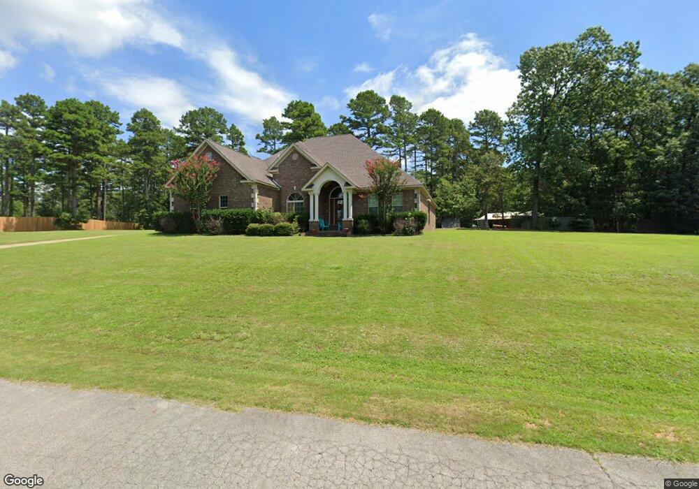
47 County Road 7820 Jonesboro, AR 72405
Estimated Value: $392,000 - $431,000
--
Bed
--
Bath
2,684
Sq Ft
$154/Sq Ft
Est. Value
About This Home
This home is located at 47 County Road 7820, Jonesboro, AR 72405 and is currently estimated at $412,947, approximately $153 per square foot. 47 County Road 7820 is a home with nearby schools including Brookland Elementary School, Brookland Middle School, and Brookland Junior High School.
Ownership History
Date
Name
Owned For
Owner Type
Purchase Details
Closed on
Jun 9, 2009
Sold by
T & A Enterprises Of Jonesboro Inc
Bought by
Smith Roberto O and Smith Jennifer L
Current Estimated Value
Home Financials for this Owner
Home Financials are based on the most recent Mortgage that was taken out on this home.
Original Mortgage
$32,000
Interest Rate
4.83%
Mortgage Type
Future Advance Clause Open End Mortgage
Purchase Details
Closed on
Mar 20, 2002
Bought by
Beaty
Purchase Details
Closed on
Apr 23, 1999
Bought by
Mcnatt
Create a Home Valuation Report for This Property
The Home Valuation Report is an in-depth analysis detailing your home's value as well as a comparison with similar homes in the area
Home Values in the Area
Average Home Value in this Area
Purchase History
| Date | Buyer | Sale Price | Title Company |
|---|---|---|---|
| Smith Roberto O | $32,000 | None Available | |
| Beaty | $100,000 | -- | |
| Mcnatt | $72,000 | -- |
Source: Public Records
Mortgage History
| Date | Status | Borrower | Loan Amount |
|---|---|---|---|
| Closed | Smith Roberto O | $32,000 |
Source: Public Records
Tax History Compared to Growth
Tax History
| Year | Tax Paid | Tax Assessment Tax Assessment Total Assessment is a certain percentage of the fair market value that is determined by local assessors to be the total taxable value of land and additions on the property. | Land | Improvement |
|---|---|---|---|---|
| 2025 | $2,902 | $62,441 | $6,800 | $55,641 |
| 2024 | $2,902 | $62,441 | $6,800 | $55,641 |
| 2023 | $2,339 | $62,441 | $6,800 | $55,641 |
| 2022 | $2,267 | $62,441 | $6,800 | $55,641 |
| 2021 | $2,223 | $53,570 | $6,000 | $47,570 |
| 2020 | $2,223 | $53,570 | $6,000 | $47,570 |
| 2019 | $2,223 | $53,570 | $6,000 | $47,570 |
| 2018 | $2,226 | $53,570 | $6,000 | $47,570 |
| 2017 | $2,112 | $53,570 | $6,000 | $47,570 |
| 2016 | $1,999 | $48,270 | $7,000 | $41,270 |
| 2015 | $1,999 | $48,270 | $7,000 | $41,270 |
| 2014 | $1,999 | $48,270 | $7,000 | $41,270 |
Source: Public Records
Map
Nearby Homes
- 83 County Road 7820
- 24 County Road 7820
- 6253 Arkansas 351
- 6253 Highway 351
- 41 Cr 7710
- 229 County Road 7820
- 229 Cr 7820
- 230 County Road 7710
- 487 County Road 7593
- 137 County Road 765
- 240 County Road 765
- 2164 Cr 762
- 2164 County Road 762
- 5936 745
- 5936 S 745
- 4794 Highway 351
- 2833 County Road 759
- 4086 Craighead 780 Rd
- 11 Arkansas 351
- 2618 Arkansas 351
- 6380 Highway 351
- 24 Cr 7820
- 17 County Road 7820
- 16 County Road 7820
- 70 County Road 7820
- 0 County Road 7820
- Lot 16 County Road 7820
- 93 County Road 782
- 604 County Road 782
- 112 County Road 7820
- 48 County Road 782
- 628 County Road 782
- lot 12 Cr 782
- 283 County Road 782
- Lot 23 County Road 782
- 6482 Highway 351
- 100 County Road 782
- 566 County Road 782
- 593 County Road 782
- 167 County Road 7820